
Canudos is a municipality in the northeast region of Bahia, Brazil. The original town, since flooded by the Cocorobó Dam, was the scene of violent clashes between peasants and republican police in the 1890s.

Ipiaú is a city in Bahia, Brazil. It is located at around 14°8′13″S39°44′2″W.
Santaluz is a municipality in the Brazilian state of Bahia. Its estimated population in 2020 is 37,531.
Serra Preta is a city located in the eastern state of Bahia, Brazil. The population in this arid region is 14,699. Serra Preta is about 150 miles northwest from Bahia's capital, Salvador, and 600 miles north of Rio de Janeiro.
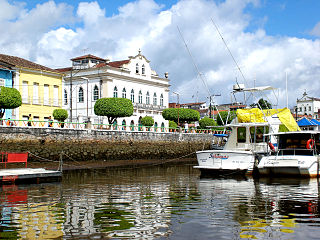
Valença is a Brazilian city in the state of Bahia and has an estimated population of 97,233. It is visited by tourists because it is the main access to the island of Ilha de Tinharé, famous for the town of Morro de São Paulo.

Serrinha is a city in the state of Bahia, in eastern Brazil.
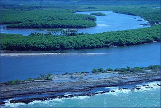
The João de Tiba River is a river of Bahia state in eastern Brazil.
The Mucuri River is a river of Bahia and Minas Gerais states in eastern Brazil.
Potiraguá is a municipality in the state of Bahia in the North-East region of Brazil.

Uauá [pronounce: uaua] is a municipality in the state of Bahia in the North-East region of Brazil.
Barro Preto is a municipality in the state of Bahia in the North-East region of Brazil.
Itapé, Bahia is a municipality in the state of Bahia in the North-East region of Brazil.
Itapebi is a municipality in the state of Bahia in the North-East region of Brazil.
Jussari is a municipality in the state of Bahia in the North-East region of Brazil.

Itaju do Colônia is a municipality in the state of Bahia in the North-East region of Brazil.

Itamaraju is a municipality in the state of Bahia in the North-East region of Brazil. "Itamaraju" is a word from the Tupi language meaning "rock of the trees of Jucuruçu" from the terms itá (rock), mara (woods), and ju.
Mascote is a municipality in the state of Bahia in the North-East region of Brazil.
Nova Viçosa is a municipality in the state of Bahia in the North-East region of Brazil. It was "discovered" in 1720 and became a municipality in 1962. The municipality contains part of the Cassurubá Extractive Reserve, a 100,768 hectares sustainable use conservation unit that protects an area of mangroves, river and sea where shellfish are harvested.

The Subprefecture of Jaçanã-Tremembé is one of 32 subprefectures of the city of São Paulo, Brazil. It comprises two districts: Jaçanã and Tremembé. It's the northernmost subprefecture and largely covered by parts of the Atlantic Forest.
Cherry Box is an unincorporated community in northwestern Shelby County, Missouri, United States. The community is on Missouri Route B 3.5 miles northwest of Leonard. The North Fork of the Salt River flows past two miles to the west of the community.