
Botswana, officially the Republic of Botswana, is a landlocked country in Southern Africa. Botswana is topographically flat, with approximately 70 percent of its territory part of the Kalahari Desert. It is bordered by South Africa to the south and southeast, Namibia to the west and north, Zambia to the north and Zimbabwe to the northeast. With a population of slightly over 2.4 million people and a comparable land area to France, Botswana is one of the most sparsely populated countries in the world. It is essentially the nation-state of the Tswana people, who constitute nearly 80 percent of the population.

Gaborone is the capital and largest city of Botswana with a population of 246,325 based on the 2022 census, about 10% of the total population of Botswana. Its agglomeration is home to 534,842 inhabitants at the 2022 census.

The Bechuanaland Protectorate was a protectorate established on 31 March 1885 in Southern Africa by the United Kingdom. It became the Republic of Botswana on 30 September 1966.
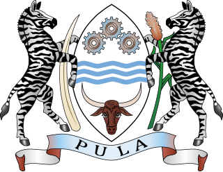
The coat of arms of Botswana was adopted on 25 January 1966. The centre shield is supported by two zebras. The shape of the shield is that of traditional shields found in Southern Africa. On the top portion of the shield are three cogwheels that represent industry.
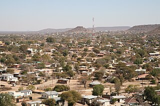
Serowe is an urban village in Botswana's Central District. A trade and commercial centre, it is Botswana's third largest village. Serowe has played an important role in Botswana's history, as capital for the Bamangwato people in the early 20th century and as birthplace of several of Botswana's presidents. More recently it has undergone significant development as the town and as Botswana continues to grow.
Mochudi is one of the larger villages in Botswana with a population of 50,321 people in 2022. It is situated in the Bakgatla tribal region, in Kgatleng District, about 37 km (23 mi) northeast of Gaborone. The village lies several kilometres from the main Gaborone–Francistown road, and can be accessed through a short turn at Pilane. Mochudi was settled by the Tswana people in 1871. The main attraction in Mochudi is the Phuthadikobo Museum which is perched at the top of a hill and holds a rich history of Bakgatla tribe and Batswana in general.

Central is the largest of Botswana's districts in terms of area and population. It encompasses the traditional homeland of the Bamangwato people. Some of the most politically connected Batswana have come from the Central District, including former President Sir Seretse Khama, former President Festus Mogae, and former President Lt. General Seretse Ian Khama. The district borders the Botswanan districts of Chobe in the north, North-West in the northwest, Ghanzi in the west, Kweneng in southwest, Kgatleng in the south and North-East in the northeast, as well as Zimbabwe also in the northeast and South Africa in the southeast.
The Parliament of Botswana consists of the President and the National Assembly. In contrast to other parliamentary systems, the Parliament elects the President directly for a set five-year term of office. A president can only serve 2 full terms. The President is both Head of state and of government in Botswana's parliamentary republican system. Parliament of Botswana is the supreme legislative authority. The President of Botswana is Mokgweetsi Masisi, who assumed the Presidency on 1 April 2018. In October 2019, the 2019 general election was held which saw the return of the Botswana Democratic Party to the power with a majority of 19 seats in the 65 seat National Assembly.

Kanye is a village in southern Botswana, located 83 kilometres (52 mi) south-west of the capital, Gaborone. It is the administrative centre of the Southern District, and had a population of 48,028 as of the 2022 Population and Housing Census. This is an increase compared to the 45,196 of the 2011 census, making it the ninth-largest village in the country. Kanye is the traditional capital of the Ngwaketse tribe, who first settled in the area in the 1790s. The village is the longest continuously-occupied tribal capital in the country.
Masunga /ˈmɑːsuŋɡʌ/ is a Bakalanga settlement in the North-East District of Botswana. The village is the Headquarters of the North East District. The nearest city is Francistown which is about 120 km (75 mi) away. The Chief of the region is Kgosi Thabo Maruje Masunga III, who took over from his uncle Christopher Masunga.
The Bamangwato is one of the eight "principal" Tswana chieftaincies of Botswana. The modern Bamangwato formed in the Central Serowe,Palapye & Mahalapye District, with its main town and capital at Serowe. The paramount chief, a hereditary position, occupies one of the fifteen places in Ntlo ya Dikgosi, the national House of Chiefs.
Shoshong is a town in Botswana, formerly the chief settlement of the eastern Bamangwato.

The Kalahari Basin, also known as the Kalahari Depression, Okavango Basin or the Makgadikgadi Basin, is an endorheic basin and large lowland area covering approximately 725,293 km2 (280,037 sq mi) — mostly within Botswana and Namibia, but also parts of Angola, South Africa, Zambia, and Zimbabwe. The outstanding physical feature in the basin, and occupying the centre, is the large Kalahari Desert.
Mapoka is a small village in the North-East District of Botswana. Its neighboring villages are Nlapkhwane, Moroka, and Masukwane. The 2001 population and housing census put its population at 1,540.
Mochudi Centre Chiefs Sporting Club are a professional football club based in Mochudi, Botswana, who play in the Botswana Premier League after acquiring the license from Masitaoka. Thus, the Centre Chiefs are back on the highest level following their relegation from the Premier League in 2019. Centre Chiefs have won the Botswana Premier League, the highest level of Botswana football, four times. The team originates from Mochudi, a large village on the outskirts of Gaborone.

The Botswana National Olympic Committee is the National Olympic Committee representing Botswana. It is also the body responsible for Botswana's representation at the Commonwealth Games.
Visitors to Botswana require a visa unless they come from one of the visa exempt countries.
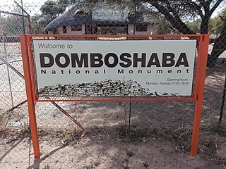
Domboshaba ruins is a cultural and heritage site in Botswana originally occupied towards the end of the Great Zimbabwe period. The site is a respected place for the people living in the region and it is believed that the chief lived on the top of the hill together with his helpers or assistants.
The High Court of Botswana is a superior court of law in Botswana. It is based in Gaborone with branches in Lobatse, Francistown, and Maun. It operates above the Magistrates' Courts of Botswana, but below the Appeal Court. The High Court is headed by the Chief Justice of Botswana.

The Manyana Rock Paintings are a collection of rock art and caves located at the Kolobeng hills, neighbouring Manyana, Southern District, Botswana. It is believed that the artworks were made by the Khoikhoi or the San people between 1100 AD and 1700 AD. The paintings are found on five cliff areas around the rocky hill. Today, the site is fenced and protected as a National Monument.