This article relies largely or entirely on a single source .(October 2021) |
Major Powell was a 3-ton, twin-screw-driven steamboat built and launched in 1891 on the Green River at Green River, Utah, in August 1891.
This article relies largely or entirely on a single source .(October 2021) |
Major Powell was a 3-ton, twin-screw-driven steamboat built and launched in 1891 on the Green River at Green River, Utah, in August 1891.
Major Powell's owner was the Green Grand & Colorado River Navigation Company headed by B. S. Ross. The company was formed to run a line of excursion steamers down the Green River to its conjunction with the Colorado River and four miles down the Colorado as far as the first cataract [ clarification needed ] at the head of Cataract Canyon, to a hotel to be built for tourists. The Major Powell was 35 feet long and 8 feet abeam, with a 26 inch draft. It had an open deck covered by a canvas canopy. Its two 6 horsepower steam engines were coal-fired, each driving one of the twin screws.
At first a failure on its first trial run after its launch due to the screws being struck by rocks in the fast moving and shallow water, the screws were afterward protected by iron guards, which enabled its success in its first voyage under the command of a local rancher Arthur Wheeler. Leaving April 15, 1882 the Major Powell descended to the Colorado River on the Green River, through Labyrinth Canyon and Stillwater Canyon and then down to the first cataract below the confluence with the Green River. Under-powered it barely made headway against the current of the Green River on its return journey on this first voyage and ran low on coal, forcing the crew to tie it up at Wheeler's ranch, 22 miles below Green River on the river and travel over land to announce their success at that town on July 3, 1892. [1] : 106, 109–110
A second voyage down river was made, after the Major Powell was converted to using wood for fuel. This voyage took a month to complete, however it took only 4 days of that time to make the round trip on the river between Wheeler's ranch and the first cataract of the Colorado. Much of the rest of the time was spent obtaining the cottonwood logs to fire the engine. However despite these two successes, the Major Powell was dismantled in 1894 for its machinery, its hull left, to be washed away in the next flood. [1] : 110

A steamship, often referred to as a steamer, is a type of steam-powered vessel, typically ocean-faring and seaworthy, that is propelled by one or more steam engines that typically move (turn) propellers or paddlewheels. The first steamships came into practical usage during the early 1800s; however, there were exceptions that came before. Steamships usually use the prefix designations of "PS" for paddle steamer or "SS" for screw steamer. As paddle steamers became less common, "SS" is assumed by many to stand for "steamship". Ships powered by internal combustion engines use a prefix such as "MV" for motor vessel, so it is not correct to use "SS" for most modern vessels.

A steamboat is a boat that is propelled primarily by steam power, typically driving propellers or paddlewheels. Steamboats sometimes use the prefix designation SS, S.S. or S/S or PS ; however, these designations are most often used for steamships.

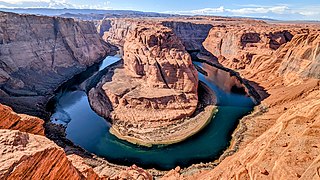
The Colorado River is one of the principal rivers in the Southwestern United States and in northern Mexico. The 1,450-mile-long (2,330 km) river drains an expansive, arid watershed that encompasses parts of seven U.S. states and two Mexican states. The name Colorado derives from the Spanish language for "colored reddish" due to its heavy silt load. Starting in the central Rocky Mountains of Colorado, it flows generally southwest across the Colorado Plateau and through the Grand Canyon before reaching Lake Mead on the Arizona–Nevada border, where it turns south toward the international border. After entering Mexico, the Colorado approaches the mostly dry Colorado River Delta at the tip of the Gulf of California between Baja California and Sonora.

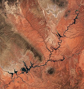
Lake Powell is an artificial reservoir on the Colorado River in Utah and Arizona, United States. It is a major vacation destination visited by approximately two million people every year. It is the second largest artificial reservoir by maximum water capacity in the United States behind Lake Mead, storing 24,322,000 acre-feet (3.0001×10¹⁰ m3) of water when full. However, Lake Mead has fallen below Lake Powell in size several times during the 21st century in terms of volume of water, depth and surface area.

The Little Colorado River is a tributary of the Colorado River in the U.S. state of Arizona, providing the principal drainage from the Painted Desert region. Together with its major tributary, the Puerco River, it drains an area of about 26,500 square miles (69,000 km2) in eastern Arizona and western New Mexico. Although it stretches almost 340 miles (550 km), only the headwaters and the lowermost reaches flow year-round. Between St. Johns and Cameron, most of the river is a wide, braided wash, only containing water after heavy snowmelt or flash flooding.

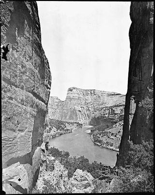
The Green River, located in the western United States, is the chief tributary of the Colorado River. The watershed of the river, known as the Green River Basin, covers parts of the U.S. states of Wyoming, Utah, and Colorado. The Green River is 730 miles (1,170 km) long, beginning in the Wind River Mountains of Wyoming and flowing through Wyoming and Utah for most of its course, except for a short segment of 40 miles (64 km) in western Colorado. Much of the route traverses the arid Colorado Plateau, where the river has carved some of the most spectacular canyons in the United States. The Green is slightly smaller than Colorado when the two rivers merge but typically carries a larger load of silt. The average yearly mean flow of the river at Green River, Utah is 6,121 cubic feet (173.3 m3) per second.

The Yampa River flows 250 miles (400 km) through northwestern Colorado in the United States. Rising in the Rocky Mountains, it is a tributary of the Green River and a major part of the Colorado River system. The Yampa is one of the few free-flowing rivers in the western United States, with only a few small dams and diversions.

The known human history of the Grand Canyon area stretches back 10,500 years, when the first evidence of human presence in the area is found. Native Americans have inhabited the Grand Canyon and the area now covered by Grand Canyon National Park for at least the last 4,000 of those years. Ancestral Pueblo peoples, first as the Basketmaker culture and later as the more familiar Pueblo people, developed from the Desert Culture as they became less nomadic and more dependent on agriculture. A similar culture, the Cochimi also lived in the canyon area. Drought in the late 13th century likely caused both groups to move on. Other people followed, including the Paiute, Cerbat, and the Navajo, only to be later forced onto reservations by the United States Government.

New Orleans was the first steamboat on the western waters of the United States. Owned by Robert Fulton and Robert R. Livingston, and built by Nicholas Roosevelt, its 1811–1812 voyage from Pittsburgh, Pennsylvania, to New Orleans, Louisiana, on the Ohio and Mississippi rivers ushered in the era of commercial steamboat navigation on the western and mid-western continental rivers.

Cataract Canyon is a 46-mile-long (74 km) canyon of the Colorado River located within Canyonlands National Park and Glen Canyon National Recreation Area in southern Utah. It begins at Colorado's confluence with the Green River, and its downstream terminus is the confluence with the Dirty Devil River. The lower half of the canyon is submerged beneath Lake Powell when the lake is at its normal high water elevation of 3,700 feet (1,100 m).

The Hite Crossing Bridge is an arch bridge that carries Utah State Route 95 across the Colorado River northwest of Blanding, Utah, United States. The bridge informally marks the upstream limit of Lake Powell and the end of Cataract Canyon of the Colorado River, but when the lake is at normal water elevation, the water can back up over 30 miles (48 km) upstream into Cataract Canyon. The bridge is the only automobile bridge spanning the Colorado River between the Glen Canyon Bridge, 185 miles (298 km) downstream near the Glen Canyon Dam and the U.S. Route 191 bridge 110 miles (180 km) upstream near Moab. The bridge is near Hite Marina on Lake Powell, and a small airstrip is immediately adjacent to the north side of the bridge.

The Colorado River is a major river of the western United States and northwest Mexico in North America. Its headwaters are in the Rocky Mountains where La Poudre Pass Lake is its source. Located in north central Colorado it flows southwest through the Colorado Plateau country of western Colorado, southeastern Utah and northwestern Arizona where it flows through the Grand Canyon. It turns south near Las Vegas, Nevada, forming the Arizona–Nevada border in Lake Mead and the Arizona–California border a few miles below Davis Dam between Laughlin, Nevada and Needles, California before entering Mexico in the Colorado Desert. Most of its waters are diverted into the Imperial Valley of Southern California. In Mexico its course forms the boundary between Sonora and Baja California before entering the Gulf of California. This article describes most of the major features along the river.

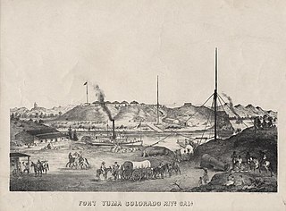
Steamboats on the Colorado River operated from the river mouth at the Colorado River Delta on the Gulf of California in Mexico, up to the Virgin River on the Lower Colorado River Valley in the Southwestern United States from 1852 until 1909, when the construction of the Laguna Dam was completed. The shallow draft paddle steamers were found to be the most economical way to ship goods between the Pacific Ocean ports and settlements and mines along the lower river, putting in at landings in Sonora state, Baja California Territory, California state, Arizona Territory, New Mexico Territory, and Nevada state. They remained the primary means of transportation of freight until the advent of the more economical railroads began cutting away at their business from 1878 when the first line entered Arizona Territory.
Cocopah, was a stern-wheel paddle-steamer, the fifth steamboat on the Colorado River, first put on the river in August 1859.
General Jesup was a side-wheel paddle-steamer, named for General Thomas Jesup then Quartermaster General of the United States Army, and was the second steamboat launched on the Colorado River, in 1854.
Mohave was the first stern-wheel steamboat of that name running on the Colorado River between 1864 and 1875.
George A. Johnson & Company was a partnership between three men who pioneered navigation on the Colorado River. Benjamin M. Hartshorne, George Alonzo Johnson and Alfred H. Wilcox. The George A. Johnson & Company was formed in the fall of 1852, and was reorganized as the Colorado Steam Navigation Company in 1869.
Undine was a stern-wheel steamboat, built in Rock Island, Illinois and shipped to Green River, Utah, and launched in November 1901 by its owner and captain Frank H. Summerhill.

Steamboat Rock, reaching an elevation of 6,074 ft is a promontory located in the eastern Uinta Mountains, in Moffat County of northwest Colorado, United States. This iconic landmark of Dinosaur National Monument is situated at the confluence of the Green River and Yampa River. Precipitation runoff from this feature drains into the Green River. This geographical formation was originally named "Echo Rock" in John Wesley Powell's 1875 report, The Exploration of the Colorado River and Its Canyons. The Steamboat name first appeared on a 1941 United States Geological Survey map of Dinosaur National Monument. The area around it still retains the Echo Park name applied by Powell during the Powell Geographic Expedition of 1869.

Steamboat Mountain is a 7,410-foot-elevation (2,260-meter) summit located in the Grand Canyon, in Coconino County of northern Arizona, US. It is situated four miles northwest of Holy Grail Temple, and 2.5 miles west-southwest of Timp Point on the North Rim. George Wharton James described it as a "majestic butte", nearly encircled by Galloway and Saddle Canyons. Topographic relief is significant as it rises over 5,400 feet above the Colorado River in three miles. According to the Köppen climate classification system, Steamboat Mountain is located in a Cold semi-arid climate zone, with precipitation runoff draining west to the Colorado River via Tapeats Creek and Stone Creek. This feature's name was officially adopted in 1932 by the U.S. Board on Geographic Names.