Related Research Articles

The Makah are an Indigenous people of the Pacific Northwest Coast living in Washington, in the northwestern part of the continental United States. They are enrolled in the federally recognized Makah Indian Tribe of the Makah Indian Reservation, commonly known as the Makah Tribe.
The Wisconsin Range is a major mountain range of the Horlick Mountains in Antarctica, comprising the Wisconsin Plateau and numerous glaciers, ridges and peaks bounded by the Reedy Glacier, Shimizu Ice Stream, Horlick Ice Stream and the interior ice plateau.

Devil's Peak is a peak in Sai Kung District, Hong Kong. The communities of Tiu Keng Leng, Lei Yue Mun and Yau Tong surround this peak.

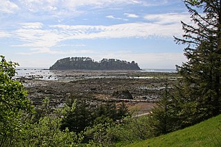
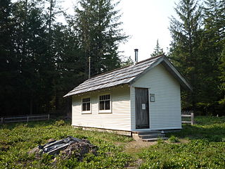
Cape Alava is a cape in the Pacific Northwest region of the United States. Located in Clallam County, Washington, the cape is situated within Olympic National Park and the Makah Indian Reservation, and is accessible via a 3-mile (5 km) boardwalk hike from a ranger station in the park.

Mount Baker Wilderness is a 119,989-acre (48,558 ha) wilderness area within the Mount Baker-Snoqualmie National Forest in the western Cascade Range of northern Washington state. Its eastern border is shared with the boundary of the Stephen Mather Wilderness and North Cascades National Park for a distance of 40 miles. The wilderness extends from State Route 20 north to the Canada–US border. On the west, it is bounded by the foothills of the Puget Sound lowlands.

Cape Flattery is the northwesternmost point of the contiguous United States. It is in Clallam County, Washington on the Olympic Peninsula, where the Strait of Juan de Fuca joins the Pacific Ocean. It is also part of the Makah Reservation, and is the northern boundary of the Olympic Coast National Marine Sanctuary. Cape Flattery can be reached from a short hike, most of which is boardwalked. The westernmost point in the contiguous United States is at Cape Alava, south of Cape Flattery in Olympic National Park. However, the westernmost tip of Cape Flattery is almost exactly as far west as Cape Alava, the difference being approximately 5 seconds of longitude, about 360 feet (110 m), at high tide and somewhat more at low tide.

Makah Reservation is an Indian reservation of the Makah Native Americans located on the northwestern tip of the Olympic Peninsula in Clallam County, Washington, United States. The northern boundary of the reservation is the Strait of Juan de Fuca. The western boundary is the Pacific Ocean. It has a land area of 121.451 square kilometres (46.892 sq mi) and a 2000 census resident population of 1,356 persons. Its largest community is Neah Bay.

The Pacheedaht First Nation is a First Nations band government based on the west coast of Vancouver Island in British Columbia, Canada. Although the Pacheedaht people are Nuu-chah-nulth-aht by culture and language, they are not a member of the Nuu-chah-nulth Tribal Council and define themselves differently.

The Kettle River Range, often called the Kettle Range, is the southernmost range of the Monashee Mountains, located in far southeastern British Columbia, Canada and Ferry County, Washington, in the United States. Most of the northern half of the range is protected by the Colville National Forest and the southern half of the range is located on the Colville Indian Reservation. The highest peak is Copper Butte, which reaches 2,177 metres (7,142 ft). The range is crossed by Washington State Route 20 at Sherman Pass.
Serra do Coqueiro is a mountain range in the border of Brazilian states of Rio Grande do Norte, Ceará and Paraíba. An unnamed peak at Venha-Ver is the highest point in Rio Grande do Norte, reaching 868 metres (2,848 ft).
The Hoko River is a river in the U.S. state of Washington. It originates in the foothills of the Olympic Mountains, and runs about 25 miles (40 km) to the Pacific Ocean through a rugged landscape that has been heavily logged. Its largest tributary is the Little Hoko River, which joins at river mile 3.5-mile (5.6 km). The lower 1 mile (1.6 km) of the Hoko River is estuarine. The Hoko watershed supports chinook, chum, coho, and winter steelhead, with over 48 miles (77 km) of stream miles that provide suitable spawning habitat.
Makah Air Force Station is a closed United States Air Force General Surveillance Radar station. It is located 2.4 miles (3.9 km) south of Neah Bay, Washington. It was closed in 1988 by the Air Force, and turned over to the Federal Aviation Administration (FAA).

The Peter Roose Homestead is a historic homestead in the U.S. state of Washington that was settled by Peter Roose, an immigrant from Bollnäs, Sweden, in 1907. Located in Olympic National Park, the site was added as a historic district to the National Register of Historic Places in 2007.

Versinikia Peak is the sharp peak in Ellsworth Mountains, Antarctica rising to 2918 m on the side ridge that trends 8.8 km from the south rib of Mount Giovinetto on the main crest of north-central Sentinel Range northeastwards via Evans Peak to Debren Pass. It has partly ice-free west and southeast slopes, and surmounts Patton Glacier to the southeast and the head of Rumyana Glacier to the northwest.
Makah Bay is a bay in Clallam County, Washington, United States, located near the community of Neah Bay. Both the Waatch and Tsoo-Yess Rivers flow into this bay.
Crystal Spring is a spring in northern Beaver County, Utah, United States.

Quillehuyte County was a Washington Territory county from January 29, 1868, to 1869. It and Ferguson County are the only two counties of the territory that dissolved, although the Washington Territorial Legislature attempted to dissolve Skamania County in January 1865, but was overruled by the United States Congress. Additionally, some Washington counties have been renamed since their formation; Sawamish County was renamed to Mason in 1864 for example.
References
48°17′38″N124°36′57″W / 48.29389°N 124.61583°W