Kimadanda is a market center in Sandhikharka Municipality of Arghakhanchi District in the Lumbini Zone of Western Nepal. The former village development committee (VDC) was converted into municipality on 18 May 2014 by merging the existing Sandhikharka, Bangla, Narapani, Khanchikot, Kimadada, Argha and Dibharna VDCs. At the time of the 1991 Nepal census, the town had a population of 5,430 living in 1,085 houses. At the time of the 2001 Nepal census, the population was 3,514, of which 53% was literate.
Khanchikot is a market center in Sandhikharka Municipality of Arghakhanchi District. The district lies in the Lumbini Zone of Western Nepal. The former village development committee (VDC) was converted into municipality on 18 May 2014 by merging the existing Sandhikharka, Bangla, Narapani, Khanchikot, Keemadada, Argha and Dibharna VDCs. During 1991 Nepal census it was estimated to have a total population of 4,628 individuals and had 930 houses.
Dhanushadham is a municipality in Danusha District in the Janakpur Zone of south-eastern Nepal. The municipality was established on 18 May 2014 by merging the existing Govindapur, Umprempur, Yagyabhumi, Dhanushadham village development committees (VDCs). It is a religious place of Hindu worship in Nepal. It is believed that a part of Shiva Dhanusha that was broken by Rama during Sita's swayamvara, is housed. Now there is temple around the remaining of bow and visited by Hindu devotees from all over the world. That's why it is named Dhanushadham.

Chandannath is a municipality in Jumla District in the Karnali province of Nepal. The municipality was established on 18 May 2014 by merging the existing Mahat Gaun, Talium, Kartik Swami (Jumla), and Chandannath village development committees (VDCs). At the time of the 1991 Nepal census it had a population of 5,842 persons living in 1,000 individual households.
Bijaya Nagar is a town and market center in Pyuthan Municipality in Pyuthan, a Middle Hills district of Rapti Zone, western Nepal. The formerly Village Development Committee along with Pyuthan Khalanga, Bijubar, Dakha Kwadi, Bijaya Nagar, Dharmawati, Maranthana and Khaira was merged to form the new municipality since 18 May 2014.
Beladevipur is a town in Attariya Municipality in Kailali District in the Seti Zone of western Nepal. The formerly Malakheti, Shreepur, Beladevipur, Geta Village Development Committees were merged to form the new municipality since 18 May 2014. At the time of the 1991 Nepal census it had a population of 5006 living in 621 individual households.
Chuha is a town in Lamki Chuha Municipality in Kailali District in the Seti Zone of western Nepal. The formerly Village development committee was merged along with Baliya VDC to form the new municipality on 18 May 2014. At the time of the 1991 Nepal census it had a population of 10,145 living in 1,497 individual households.
Geta, Nepal is a town in Attariya Municipality in Kailali District in the Seti Zone of western Nepal. The formerly Malakheti, Shreepur, Beladevipur, Geta Village Development Committees were merged to form the new municipality since 18 May 2014. At the time of the 1991 Nepal census it had a population of 7900 living in 1216 individual households.

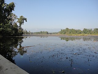
Godawari is a municipality and capital city of Sudurpaschim province located in Kailali District of Nepal.
Sripur is a Village Development Committee in Kailali District in the Seti Zone of western Nepal. The formerly Malakheti, Sripur, Beladevipur, Geta Village Development Committees were merged to form the new municipality since 18 May 2014. At the time of the 1991 Nepal census it had a population of 8430 residing in 1180 individual households.
Atrauli is a town and market center in Hariyon Municipality in Sarlahi District in the Janakpur Zone of south-eastern Nepal. The formerly village development committee was transformed into municipality merging the existing village development committees i.e. Atrouli, Sasapur, Dhaurkauli and Hariyon in May 18, 2014. At the time of the 1991 Nepal census it had a population of 4888 people living in 894 individual households.
Lalbandi is a Municipality in Sarlahi District in the Janakpur Zone of south-eastern Nepal. The municipality was established on 18 May 2014 by merging the existing Jabdi, Lalbandi and Pattharkot VDCs. At the time of the 2011 Nepal Census it had a population of 14583 people living in 3295 individual households.

Katari is a Municipality in Udayapur District in the Province No. 1 of south-eastern Nepal.It lies by the Tawa river having the bridge of length 123.5m. This was established by merging two existing village development committees i.e. Triveni and Katari on 18 May 2014. At the time of the 1991 Nepal census it had a population of 7230 people living in 1410 individual households.
Phulbariya is a town in Mirchaiya Municipality in Siraha District in the Sagarmatha Zone of south-eastern Nepal. The formerly village development committee was merged to form new municipality since 18 May 2014 along with existing Rampur Birta, Malhaniyakhori, Radhopur, Ramnagar Mirchaiya, Phulbariya, Sitapur PraDa and Maheshpur Gamharia Village Development Committees. At the time of the 1991 Nepal census it had a population of 6710 people living in 1273 individual households.
Laksmipur is a village development committee in Kanchanpur District in the Mahakali Zone of south-western Nepal. The former village development committee was converted into Municipality merging with existing Rampur Bilaspur, Laksmipur, Mahakali and Sripur village development committee on 18 May 2014. At the time of the 1991 Nepal census it had a population of 11,767.
Belauri, also known as Sripur is a Municipality in Kanchanpur District in the Mahakali Zone of south-western Nepal. The former village development committee was converted into Municipality merging with existing Rampur Bilaspur, Laxmipur, Mahakali and Sripur village development committee on 18 May 2014. At the time of the 1991 Nepal census it had a population of 14,280 people living in 1877 individual households.
Khaliban is a town in Rampur Municipality in Palpa District in the Lumbini Zone of southern Nepal. The municipality was established on 18 May 2014 by merging the existing Gadakot, Gegha, Khaliban, Darchha village development committee. At the time of the 1991 Nepal census it had a population of 2272 people living in 399 individual households.
Chanai is a town in Shivaraj Municipality in Kapilvastu District in the Lumbini Zone of southern Nepal. The former village development committee was transformed into Municipality from 18 May 2014 by merging the existing Birpur, Nepal, Chanai, Bishunpur, Jawabhari and Shivapur village development committees. At the time of the 1991 Nepal census it had a population of 6141 people living in 1023 individual households.

Lamki Chuha is a municipality in Kailali District in Sudurpashchim Pradesh of Nepal established on 18 May 2014 by merging Baliya and Chuha, two existing village development committees. Later in May 08, 2014 it was formed by merging all the ward of Pratappur Village development committee. Lamki Chuha lies 72 kilometres (45 mi) east of Dhangadhi and 590 km (370 mi) west of the capital, Kathmandu, and is the major provider of education, health and employment opportunities in the eastern Kailali. It is surrounded by Bardagoriya Rural Municipality and Joshipur Rural Municipality in the West, Bardiya District in the East, Mohanyal Rural Municipality in the North and Janaki Rural Municipality in the South. Its Municipal office is located at Lamki chuha 2 Bhalka, Kailali. Mahadev Bajagain is the Mayor of Lamki Chuha Municipality.
Sundar Haraicha is a municipality in Morang District of Province No. 1 in Nepal that was established on 10 March 2017 by merging the former municipalities Sundar Dulari and Koshi Haraicha. At the time of the 2011 Nepal census, the localities out of which Chaudandigadhi would be formed had a joint population of 80,518 people living in 18,610 individual households.