Malikanda

Last updated

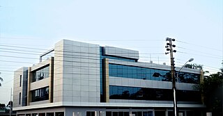
Malikanda is a village at Wazirpur Upazila in Barisal District, Bangladesh, by the River Sandha. Malikanda has two parts: Dakkhin Malikanda and Uttar Malikanda (South Malikanda and North Malikanda). [1]

Wazirpur Upazila Upazila in Barisal Division, Bangladesh

Wazirpur is an Upazila of Barisal District in the Division of Barisal, Bangladesh.

Barisal District District in Barisal Division, Bangladesh

Barisal District, officially known as Barishal District, is a district in south-central Bangladesh, formerly called Bakerganj district, established in 1797. Its headquarters are in the city of Barisal, which is also the headquarters of Barisal Division.

Bangladesh Country in South Asia

Bangladesh, officially the People's Republic of Bangladesh, is a country in South Asia. While it is the 92nd-largest country, spanning 147,570 square kilometres (56,980 sq mi), it is the world's 8th-most populous country with a population nearing 163 million, making it one of the most densely populated countries in the world. Bangladesh shares land borders with India to the west, north and the east and Myanmar to the east, whereas the Bay of Bengal lies to its south. Dhaka, its capital and largest city, is also the economic, political and the cultural hub of the country. Chittagong, the largest sea port, is the second largest city. The country's geography is dominated by the Ganges delta which empties into the Bay of Bengal the combined waters of several river systems, including those of the Brahmaputra and the Ganges. As a result, the country is criss-crossed by numerous rivers and inland water ways. Highlands with evergreen forests cover the landscape in the northeastern and southeastern regions of the country. The country also features the longest natural sea beach and most of the largest mangrove forest in the world. The country's biodiversity includes a vast array of plants and wildlife, including the endangered Bengal tiger, the national animal.

Related Research Articles

Barisal Cadet College Public school in Bangladesh

Barisal Cadet College, is a military high school in Rahmatpur, Babuganj, Barisal, Bangladesh. It is located 12 kilometres (7.5 mi) from Barisal, beside the Dhaka Barisal highway. (location on map)

Amtali Upazila Upazila in Barisal Division, Bangladesh

Amtali is an Upazila of Barguna District in the division of Barisal, Bangladesh.

Bakerganj Upazila Upazila in Barisal Division, Bangladesh

Bakerganj is an Upazila of Barisal District in the Barisal Division, Bangladesh.

Gournadi Upazila Upazila in Barisal Division, Bangladesh

Gournadi is an administrative unit of Barisal District in the Division of Barisal, Bangladesh.

Barisal Sadar Upazila Upazila in Barisal Division, Bangladesh

Barisal Sadar is an Upazila of Barisal District in the Division of Barisal, Bangladesh.

Mehendiganj Upazila Upazila in Barisal Division, Bangladesh

Mehendigonj is an Upazila of Barisal District in the Division of Barisal, Bangladesh. Mehendigonj is popularly known as Patarhat by the local people.

Kathalia Upazila Upazila in Barisal Division, Bangladesh

Kathalia is an Upazila of Jhalakati District in the Division of Barisal, Bangladesh.

Balia, Bangladesh may refer to the following locations in Bangladesh:

Barisal Polytechnic Institute or BPI is a Government Technical Institute in Barisal, Bangladesh. It is one of the largest polytechnic Institutes in Bangladesh. Barisal Polytechnic Institute is the largest Polytechnic Institute in the country and the highest seat of learning in the South region of Bangladesh. The Polytechnic has crossed 48 years of its foundation opening its door for the students with a solemn promise to spread quality of Technical education and research on 1962. Situated at the main campus of the Institute is very close to Barisal city.

Gopalpur or Gopālpur may reference several places in Bangladesh :

Barisal City Corporation organization

Barisal City Corporation is a self-governed municipal administration in Bangladesh that administers and oversees development and maintenance works in the city of Barisal. The corporation covers an area of over 58 square kilometers in the Barisal district where over five million people live as permanent residents. The body was known as Barisal Municipality previously, until it obtained the City Corporation status by a ministry of local government declaration on 25 July 2002.

Global University Bangladesh Bangladeshi university

Global University Bangladesh (GUB) is a private university located at Barisal, a city in south-central Bangladesh. The University Grants Commission of Bangladesh approved it in 2013 and was established in 2015 under the Private University Act 2010. It is the first private university in Barisal Division.

Barisal-5 is a constituency represented in the Jatiya Sangsad of Bangladesh since 2019 by Zahid Faruk of the Awami League.

Barisal-4 is a constituency represented in the Jatiya Sangsad of Bangladesh since 2014 by Pankaj Nath of the Awami League.

Barisal-6 is a constituency represented in the Jatiya Sangsad of Bangladesh since 2014 by Nasreen Jahan Ratna of the Jatiya Party (Ershad).

Barisal-3 is a constituency represented in the Jatiya Sangsad of Bangladesh since 2019 by Golam Kibria Tipu of the Jatiya Party (Ershad).

Barisal-2 is a constituency represented in the Jatiya Sangsad of Bangladesh since 2019 by Shah-e-Alam of the Awami League.

Barisal-1 is a constituency represented in the Jatiya Sangsad of Bangladesh since 2014 by Abul Hasanat Abdullah of the Awami League.

References

  1. "Population Census 2011: Barisal Table C-01" (PDF). Bangladesh Bureau of Statistics. Archived from the original (PDF) on February 8, 2016. Retrieved July 11, 2014.

Coordinates: 23°34′N90°09′E / 23.567°N 90.150°E / 23.567; 90.150

Geographic coordinate system Coordinate system

A geographic coordinate system is a coordinate system that enables every location on Earth to be specified by a set of numbers, letters or symbols. The coordinates are often chosen such that one of the numbers represents a vertical position and two or three of the numbers represent a horizontal position; alternatively, a geographic position may be expressed in a combined three-dimensional Cartesian vector. A common choice of coordinates is latitude, longitude and elevation. To specify a location on a plane requires a map projection.