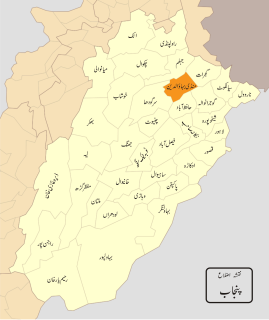
Ajjowal is a small village of Mandi Bahauddin District in the Punjab province of Pakistan.
Sohawa is one of the major towns in Mandi Bahauddin District in Punjab, Pakistan. It is situated on the Phalia Road, almost 3 km out of the city of Mandi Bahauddin. It basically consists of three villages: Sohawa Bolani, Sohawa Jamlani and Sohawa Dilloana and is divided into two Union Councils, Sohawa Bolani(17) and Sohawa Dilloana(18).

Ghaniaan is a village and Union council of Phalia Tehsil, Mandi Bahauddin District, Punjab, Pakistan. It is located at N 32°40'29 & E 73°64'96 with an altitude of 201 metres above sea lavel and lies about 8 km North West of Phalia on the Phalia-Alipur Chatha road near Chenab River Qadirabad Headworks. The nearest police station is Phalia Police Station, which is about 7.5 km to the North west. Population of village is round about 8000. same like other villages of Phalia most of the population is farmers
Chillianwala is a town and union council of Mandi Bahauddin District in the Punjab province of Pakistan. It is located at 32°39'0N 73°36'0E at an altitude of 218 metres and lies to the north-east of the district capital Mandi Bahauddin.
Wara Alam Shah is a town and union council of Mandi Bahauddin District in the Punjab province of Pakistan. It is located at 32°30'30N 73°16'50E.
Chak Jano Kalan is a village and Union council of Phalia Tehsil, Mandi Bahauddin District, Punjab, Pakistan.
Wasu is a town and Union Council of Mandi Bahauddin District in the Punjab province of Pakistan. It is located at 32°34'0N 73°28'60E and has an altitude of 221 metres (728 feet).
Rasul is a town and Union Council of Mandi Bahauddin District in the Punjab province of Pakistan located at 32°42'0N 73°34'0E at an altitude of 233m. Rasul is a river crossing on the Jhelum River.
Chakbasawa or Chak Wasawa is a town and union council of Mandi Bahauddin District in the Punjab province of Pakistan. It is located at 32°34'30N 73°33'30E and has an altitude of 219 metres.
Pindi Bahauddin is a town and union council of Mandi Bahauddin District in the Punjab province of Pakistan. It is located at 32°36'0N 73°28'60E and has an altitude of 217 metres.
Sahna is a town and union council of Mandi Bahauddin District in the Punjab province of Pakistan. It is located at 32°32'60N 73°20'60E and has an altitude of 211 metres.
For the Article on Jat clan, see Mangat (shareef)
Kadhar is a village and union council of Mandi Bahauddin District in the Punjab Province of Pakistan. It is located at an altitude of 203 metres.
Nain Ranjha is a town and union council of Mandi Bahauddin District in the Punjab province of Pakistan. It is located at an altitude of 201 metres (662 feet).
Kotli Khurd is a village in the Mandi Bahauddin District of the Punjab province of Pakistan. It is situated 28 km south east of the district capital - Mandi Bahauddin and 12 km east of the town of Phalia. The population of Kotli Khurd is about 1000. The literacy rate is above 35%. The village is well cultivated area the main crops are wheat rice and sugar cane, most people are farmers and government servants. The village has been developing since the 1947 division.
Dhoul Ranjha is a village and Union council of Phalia Tehsil in Mandi Bahauddin District of Punjab, Pakistan.
Raike is a village and Union council of Phalia Tehsil, Mandi Bahauddin District, Punjab, Pakistan.
Helan is a city union council in Phalia Tehsil, Mandi Bahauddin District, Punjab province, Pakistan. The union council contains 10 villages. Helan is 20 kilometers south-east of Mandi Bahauddin, 8 kilometers north-east of Phalia, 20 kilometers south of Dinga and 4 kilometers north of Mano Chak.
Shaheedanwali is a village and Union Council of Mandi Bahauddin District in the Punjab province of Pakistan. It is situated 04 km east of the district capital - Mandi Bahauddin, 4 km west of the town of Chillianwala.and 4 km south of the town of Mong. The population of Shaheedanwali is about 18,000.