Kingcome Inlet is one of the lesser principal fjords of the British Columbia Coast, north and east of Broughton Island. It is sixth in sequence of the major saltwater fjords north from the 49th parallel near Vancouver and similar in width, on average 2.5 km (1.6 mi), to longer inlets such as Knight Inlet and Bute Inlet, but it is only 35 km (22 mi) in length from the mouth of the Kingcome River to Sutlej Channel, which ultimately connects around Broughton Island to the main regional waterway of the Queen Charlotte Strait. Kingcome Inlet has a short side inlet, Wakeman Sound, fed by the Wakeman River.

Broughton Archipelago Provincial Park is the largest marine provincial park located in British Columbia, Canada. The park is located in the Queen Charlotte Strait around 30 km east of Port McNeill, a town situated on Vancouver Island. In terms of its functions, the park offers tourism opportunities such as kayaking and whale watching, preserves a wide array of wildlife including many at-risk species, and has a long history of use by First Nation peoples.
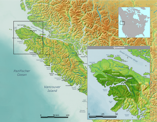
The Quatsino First Nation is the First Nations band government of the Gwat'sinux subgroup of the Kwakwaka'wakw peoples, based in the Quatsino Sound region on the west coast of northern Vancouver Island in British Columbia, Canada, focused on the community of Coal Harbour in Quatsino Sound. It is a member of the Kwakiutl District Council and, for treaty negotiation purposes, the Winalagalis Treaty Group which includes three other members of the Kwakiutl District Council (the Da'naxda'xw Awaetlatla Nation, Gwa'Sala-Nakwaxda'xw Nation, and the Tlatlasikwala Nation.
The Kwakiutl District Council, also spelled Kwakwewlth District Council and Kwakiuth District Council, pronounced Kwagiulth District Council, is a First Nations Tribal Council based on Vancouver Island in British Columbia, Canada, based in the community of Campbell River, British Columbia in the northern Strait of Georgia but including member nations spanning northern Vancouver Island as far as Quatsino Sound. The nations represented within the Kwakiutl District Council are all Kwakwaka'wakw.

The Kwakiutl First Nation is a First Nations government based on northern Vancouver Island in British Columbia, Canada, focused on the community of Port Hardy, British Columbia in the Queen Charlotte Strait region, and also known as the Fort Rupert Band, known in traditional Kwakwaka'wakw terms as the Kwagu'ł or Kwagyewlth. It is a member of the Kwakiutl District Council. It is currently in stage 4 of the British Columbia Treaty Process, having submitted a statement of intent in 1997.
The 'Namgis First Nation is a First Nations band government on northern Vancouver Island in British Columbia, Canada, and on adjoining islands in the southern Queen Charlotte Strait region.
The Tsawataineuk First Nation is a First Nations band government in the Queen Charlotte Strait region north of northern Vancouver Island in the Canadian province of British Columbia. It is a member of the Musgamagw Tsawataineuk Tribal Council, along with the Gwawaenuk and the Kwicksutaineuk-ah-kwa-mish First Nation.

Kwaguʼł are a Kwakwakaʼwakw tribe of the Indigenous peoples of the Pacific Northwest Coast from central British Columbia, on northern Vancouver Island. Their main community is called Tsax̱is or Fort Rupert. The ancestral language is Kwakʼwala, a language that is a part of the Wakashan language group. In their language, Kwaguʼł translates to Smoke-Around-the-World referring to the smoke that exited from the many bighouses in their villages.

The 'Namgis are an Indigenous nation, a part of the Kwakwaka'wakw, in central British Columbia, on northern Vancouver Island. Their main village is now Yalis, on Cormorant Island adjacent to Alert Bay. The Indian Act First Nations government of this nation is the Namgis First Nation. They were formerly known as the Nimpkish.
The Mamalilikulla Band is a First Nations band government based on northern Vancouver Island in British Columbia, Canada. The home territory of the Mamalilikulla and Qwe-Qwa'Sot'Em groups of Kwakwaka'wakw was in the maze of islands and inlets of the eastern Queen Charlotte Strait region around the opening of Knight Inlet, mainly on Village Island, where their principal village Memkumlis is.

The 'Nak'waxda'xw, also known as the Nakoaktok, are an Indigenous nation, a part of the Kwakwaka'wakw, in the Central Coast region of British Columbia, on northern Vancouver Island.
New Vancouver, also known as Tzatsisnukomi, T˜sadzis' nukwame' or t̕sa̱dzis'nukwa̱me'' in the Kwak'wala language, is a Kwakwaka'wakw community on Harbledown Island in the Queen Charlotte Strait region of the Central Coast of British Columbia, near the community of Alert Bay. New Vancouver is the main village of the Da'naxda'xw subgroup of the Kwakwaka'wakw peoples. New Vancouver is at Dead Point on the north end of Harbeldown Island, at the west end of Beware Passage.
Metap, also mit'ap and Meetup and Mit'apdzi and big mit'ap ] is a former Kwakwaka'wakw village at the head of Viner Sound on the northwest coast of Gilford Island in the Queen Charlotte Strait region of the Central Coast of British Columbia, Canada. There is an Indian reserve, Meetup Indian Reserve No. 2, at the location today.
Kalugwis, or Karlukwees or Qalogwis, is the principal community of the Tlowitsis Nation of the Kwakwaka'wakw peoples of the Johnstone Strait region of the South Coast of British Columbia, Canada. It is located on the south shore of Turnour Island facing Beware Passage and is within Karlukwees Indian Reserve No. 1, a.k.a. Karlukwees 1, 10.8 ha.

Turnour Island is an island in the Johnstone Strait region of the Central Coast of British Columbia, located between Gilford Island and West Cracroft Island. On the other side Canoe Passage on its northwest is Village Island, while to its south and southwest is Beware Passage, across from which is Harbledown Island. Gilford Island is to the north across Tribune Channel. Separating Turnour from West Cracroft is Clio Channel.
Memkumlis or, officially Meem Quam Leese, Memkoomlish, Memqumlis, 'mimkumlis or Mi'mkwamlis, commonly known as Mamalilaculla, which is actually the name of the subgroup of the Kwakwaka'wakw whose home it is, is located on the west side of Village Island in the Johnstone Strait region of the Central Coast of British Columbia.
Kliquit or Lekwe't or t'lakwitan, meaning "seaweed body" was a Kwakwaka'wakw village of the Mamalilikulla subgroup located on the north shore of Knight Inlet, east of Hoeya Sound in British Columbia, Canada. The Mamalilikulla used it as a base for fishing and trapping.
Nalakgala or nalaxdlala, meaning "hind end up river", was a Kwakwaka'wakw village at the head of Hoeya Sound on the north side of Knight Inlet in British Columbia. This was a place of origin for the Walas group, but by 1914 the village site and associated harvesting area was claimed by the Mamalilikulla.
The Kwikwasut'inuxw are one of the many subgroups of the Kwakwaka'wakw peoples of the Central Coast of British Columbia, Canada. Their ancestral home is at Gwayasdums on Village Island, which was destroyed by the Nuxalk in 1856.
Apsigiyu or Apsigayu or Apsagayu is a village site of the Kwikwasut'inuxw and Mamalilikulla groups of the Kwakwaka'wakw peoples, located at the head of Shoal Harbour on the northwest side of Gilford Island, in the Queen Charlotte Strait-Johnstone Strait region of the Central Coast of British Columbia, Canada. The village, whose name means "otherside forehead" in Kwak'wala, is used for clam and salmon harvesting, and also for timber harvesting. The village's site is an Indian reserve, Apsagayu Indian Reserve No. 1A, 2.2 ha., and is under the administration of the Mamalilikulla-Qwe'Qwa'Sot'Em Band, along with two others, Compton IR No. 6 and Mahmalillikullah Indian Reserve No. 1, which is the site of Memkumlis, the main village site of the Mamalillikula, which is often referred to as Mamalillikulla.

