
Mono County is a county located in the east central portion of the U.S. state of California. As of the 2020 census, the population was 13,195, making it the fourth-least populous county in California. The county seat is Bridgeport. The county is located east of the Sierra Nevada between Yosemite National Park and Nevada. The only incorporated town in the county is Mammoth Lakes, which is located at the foot of Mammoth Mountain. Other locations, such as June Lake, are also famous as skiing and fishing resorts. Located in the middle of the county is Mono Lake, a vital habitat for millions of migratory and nesting birds. The lake is located in a wild natural setting, with pinnacles of tufa arising out of the salty and alkaline lake. Also located in Mono County is Bodie, the official state gold rush ghost town, which is now a California State Historic Park.

The Ansel Adams Wilderness is a wilderness area in the Sierra Nevada of California, United States. The wilderness spans 231,533 acres (93,698 ha); 33.9% of the territory lies in the Inyo National Forest, 65.8% is in the Sierra National Forest, and the remaining 0.3% covers nearly all of Devils Postpile National Monument. Yosemite National Park lies to the north and northwest, while the John Muir Wilderness lies to the south.

Mammoth Mountain is a lava dome complex partially located within the town of Mammoth Lakes, California, in the Inyo National Forest of Madera and Mono Counties. It is home to a large ski area primarily on the Mono County side.

Tioga Pass is a mountain pass in the Sierra Nevada mountain range of California. State Route 120 runs through it, and serves as the eastern entry point for Yosemite National Park, at the Tioga Pass Entrance Station. It is the highest elevation highway pass in California and in the Sierra Nevada at an elevation of 9,945 ft (3,031 m). Mount Dana is to the east of the pass, and Gaylor Peak to the west.
El Capitan is the name of a rock formation in Yosemite National Park, California.
White Mountain may refer to:

Inyo National Forest is a United States National Forest covering parts of the eastern Sierra Nevada of California and the White Mountains of California and Nevada. The forest hosts several superlatives, including Mount Whitney, the highest point in the contiguous United States; Boundary Peak, the highest point in Nevada; and the Ancient Bristlecone Pine Forest, which protects the oldest living trees in the world. The forest, encompassing much of the Owens Valley, was established by Theodore Roosevelt as a way of sectioning off land to accommodate the Los Angeles Aqueduct project in 1907, making the Inyo National Forest one of the least wooded forests in the U.S. National Forest system.
Grizzly Peak may refer to:
A mammoth is an extinct mammal and close relative to the modern elephant.
Lookout Mountain is a mountain ridge on the border of Alabama, Georgia, and Tennessee.
Emerald Lake may refer to:

Minaret Summit is a mountain pass on Highway 203 in the central Sierra Nevada. The pass, lying on the Madera-Mono County border, is within the Mammoth Ranger District of the Inyo National Forest and located near Devils Postpile National Monument, Mammoth Lakes, and Mammoth Mountain. The elevation of the pass is about 9,265 ft (2,824 m). Highway 203 ends at Minaret Summit. The road continues, now called Reds Meadow Road, until its dead end at the Reds Meadow Pack Station near the Rainbow Falls trailhead.
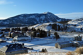
Sepulcher Mountain, elevation 9,642 feet (2,939 m), is a moderate mountain peak in northwest Yellowstone National Park halfway between the summit of Electric Peak and Mammoth Hot Springs. The peak was named Sepulcher by U.S. Army Captain John W. Barlow in 1871 because of its resemblance to a crypt when viewed from Gardiner, Montana.
Bunsen Peak el. 8,564 feet (2,610 m) is a prominent peak due south of Mammoth Hot Springs in Yellowstone National Park, Wyoming. The peak lies on the east flank of Kingman Pass on the Mammoth to Norris section of the Grand Loop Road. The peak was first ascended by Ferdinand V. Hayden and Captain John W. Barlow in 1871, Bunsen Peak was not named until 1872 during the second Hayden Geologic Survey. E. S. Topping named the peak Observation Mountain in 1872 as well, but that name did not stick. The Bunsen Peak Trail with its trailhead just south of Mammoth is a steep 2.1 miles (3.4 km) to the summit. Bunsen Peak was named for the German chemist Robert Bunsen, the inventor of the Bunsen Burner and responsible for early work on volcanic geyser theories.

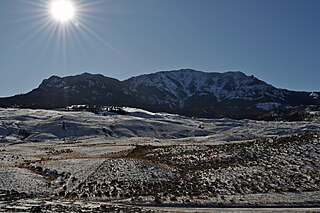
Terrace Mountain is a mountain peak in the Gallatin Range in Yellowstone National Park in Park County, Wyoming, United States. The mountain is located 2.2 miles (3.5 km) southwest of Mammoth Hot Springs. Terrace Mountain was named by the 1878 Hayden Geological Survey because of its proximity to the travertine terraces at Mammoth and because it too is an ancient travertine terrace. The mountain has also been known as "Soda Mountain" and "White Mountain".

Johnson Peak is the highest mountain, in Tuolumne Meadows, Yosemite National Park.

Hiking, rock climbing, and mountain climbing around Tuolumne Meadows in Yosemite National Park has many options.

Mammoth Peak is a mountain in the area of Tuolumne Meadows, Yosemite National Park, California. The summit is a class 1-2 cross-country hike that features river crossings and boulder scrambling. The peak lies at the northern end of the Kuna Crest and is close to California State Route 120. From the road, its summit appears rounded and quite rocky. Though Mammoth Peak is not as popular as other nearby peaks, its relatively easily accessed summit affords tremendous views of Mount Gibbs, Mount Dana, and Mount Lewis.

Kuna Crest is a mountain range near Tuolumne Meadows, in Yosemite National Park, California.
Mount Johnson, Johnson Mountain, or Johnson Peak may refer to: