Manchester Township, Passaic County, New Jersey

Last updated

Manchester Township was a township that existed in New Jersey, United States, from 1837 until it was dissolved in 1908.

A township, in the context of New Jersey local government, refers to one of five types and one of eleven forms of municipal government. As a political entity, a township in New Jersey is a full-fledged municipality, on par with any town, city, borough, or village. They collect property taxes and provide services such as maintaining roads, garbage collection, water, sewer, schools, police and fire protection. The Township form of local government is used by 27% of New Jersey municipalities; however, slightly over 50% of the state's population resides within them.

New Jersey State of the United States of America

New Jersey is a state in the Mid-Atlantic and Northeastern regions of the United States. It is located on a peninsula, bordered on the north and east by the state of New York, particularly along the extent of the length of New York City on its western edge; on the east, southeast, and south by the Atlantic Ocean; on the west by the Delaware River and Pennsylvania; and on the southwest by the Delaware Bay and Delaware. New Jersey is the fourth-smallest state by area but the 11th-most populous, with 9 million residents as of 2017, and the most densely populated of the 50 U.S. states; its biggest city is Newark. New Jersey lies completely within the combined statistical areas of New York City and Philadelphia. New Jersey was the second-wealthiest U.S. state by median household income as of 2017.

The township was formed on February 7, 1837, from portions of Saddle River Township in Bergen County, becoming part of Passaic County which was created on that same date. [1]

Bergen County, New Jersey County in the United States

Bergen County is the most populous county in the U.S. state of New Jersey. As of the 2017 Census estimate, the county's population was 948,406, an increase of 4.8% from the 2010 United States Census, which in turn represented an increase of 20,998 (2.4%) from the 884,118 counted in the 2000 Census. Located in the northeastern corner of New Jersey and its Gateway Region, Bergen County is part of the New York City Metropolitan Area and is directly across the Hudson River from Manhattan, to which it is connected by the George Washington Bridge.
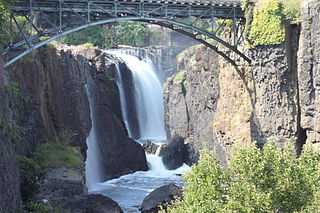
Passaic County, New Jersey County in the United States

Passaic County is a county in the U.S. state of New Jersey that is part of the New York metropolitan area.

As originally constituted, the Township included portions of present-day Hawthorne (formed March 24, 1898), Haledon (April 8, 1908), North Haledon, Prospect Park, Totowa and most of the First Ward of Paterson. [1]

Hawthorne, New Jersey Borough in New Jersey, United States

Hawthorne is a borough in Passaic County, New Jersey, United States. As of the 2010 United States Census, the borough's population was 18,791 reflecting an increase of 573 (+3.1%) from the 18,218 counted in the 2000 Census, which had in turn increased by 1,134 (+6.6%) from the 17,084 counted in the 1990 Census.

Haledon, New Jersey Borough in New Jersey, United States

Haledon is a borough in Passaic County, New Jersey, United States. As of the 2010 United States Census, the borough's population was 8,318, reflecting an increase of 66 (+0.8%) from the 8,252 counted in the 2000 Census, which had in turn increased by 1,301 (+18.7%) from the 6,951 counted in the 1990 Census.

North Haledon, New Jersey Borough in New Jersey, United States

North Haledon is a borough in Passaic County, New Jersey, United States. As of the 2010 United States Census, the borough's population was 8,417, reflecting an increase of 497 (+6.3%) from the 7,920 counted in the 2000 Census, which had in turn declined by 67 (-0.8%) from the 7,987 counted in the 1990 Census.

With the creation of the Borough of Haledon, Manchester Township was dissolved that same day, April 8, 1908. [1]

Related Research Articles

Lodi Township was a township that existed in Bergen County, New Jersey, United States, from 1826 to 1935.

Amwell Township was a Township that existed in Hunterdon County, New Jersey, United States, from 1708 to 1846.

Eastwood was a borough that existed for a brief period of time in Bergen County, New Jersey, United States. It was formed at the height of the "boroughitis" fever that led to the creation of 26 new municipalities in the county during 1894.

Hackensack Township was a township that was formed in 1693 within Bergen County, New Jersey, United States. The township was created by the New Jersey Legislature as one of the first group of townships in New Jersey. Bergen County, which had been created in 1682, was thus split into two parts: Hackensack Township to the north, and Bergen Township to the south.

Palisades Township was a township that existed in Bergen County, New Jersey, United States. The township was in existence from 1871 to 1922.

This article is for the now-defunct town in Hudson County, NJ. For the current towns of the same name in Hunterdon County and Union County, seeUnion Township, Hunterdon County, New Jersey and Union Township, Union County, New Jersey.

Orvil Township was a township that existed in Bergen County, New Jersey, United States, from 1886 to 1919.

Bergen Township was a township that existed in Bergen County, New Jersey. The township was created on February 21, 1893, from the southern section of Lodi Township :

Be It Enacted by the Senate and General Assembly of Portion to be the State of New Jersey, That all that portion of the township of Lodi, in the county of Bergen, lying within the following boundaries, to wit, beginning at the intersection Boundaries, of the northerly boundary of the township of Boiling Springs, in the county of Bergen, with the middle of the Passaic river; running thence easterly along the northerly boundary of said township of Boiling Springs to the middle of the Hackensack River; thence, northerly along the middle of the Hackensack river to a point opposite the mouth of a creek emptying into said river, commonly known as the Upper Mudabock creek; thence, westerly in a straight line to a point where the northerly line of the public road leading from Moonachie to Wood-Ridge, commonly known as the Mousetown road, intersects the westerly line of the public road commonly known as the Moonachie road; thence, westerly along the northerly line of the Mousetown road to the westerly line of the Riser ditch; thence, northerly along the westerly line of said ditch to the northerly line of lands now or formerly belonging to the estate of Richard Vreeland; thence, westerly along said line of lands to the Polifly road; thence, still westerly in the same course as last described, along the northerly line of lands now or formerly belonging to the estate of Benjamin Cox to a line commonly known as the Polifly line; thence, northerly along said line to the southerly line of the public road leading from said Polifly road to the public road commonly known as the River road; thence westerly along the southerly line of said road leading from the Polifly road to the River road; thence, still westerly in line with the last course of the southerly line of said road to the middle of the Saddle river; thence, downstream through the middle of the Saddle river to the middle of the Passaic thence, down stream through the middle of said to the place of beginning, shall be and hereby is set off from the township Lodi, in the county of Bergen, and made a separate township, to be known by the name of the township of Bergen.

Overpeck Township was a township that existed in Bergen County, New Jersey, United States, from 1897 to 1938.

The North Haledon School District is a comprehensive community public school district that serves students in kindergarten through eighth grade from North Haledon, in Passaic County, New Jersey, United States.

Pompton Township is a defunct township in Passaic County, New Jersey, United States, that existed from 1797 until it was dissolved in 1918.

Nottingham Township was a township that existed for almost 168 years in New Jersey, from 1688 until it was dissolved in 1856.

Elizabeth Township, also called Elizabethtown, was a township that existed in Essex County, in the U.S. state of New Jersey, from 1664 until 1855.

Elizabeth Borough was a borough that existed in Essex County, in the U.S. state of New Jersey, from 1740 until 1855.

Rahway Township was a township in New Jersey, United States, that existed from 1804 until it was dissolved in 1861.

The Haledon School District is a community public school district that serves students in pre-kindergarten through eighth grade from Haledon, in Passaic County, New Jersey, United States.

Plainfield Township was a township in New Jersey, United States, that existed from 1847 until it was dissolved in 1878.

The Prospect Park School District is a community public school district that serves students in pre-kindergarten through eighth grade from Prospect Park, in Passaic County, New Jersey, United States. Its only school, Prospect Park Elementary School, has expanded multiple times to accommodate its growing student body, including a $1.5 million preschool expansion completed in 2012.

References

  1. 1 2 3 Snyder, John P. The Story of New Jersey's Civil Boundaries: 1606-1968, Bureau of Geology and Topography; Trenton, New Jersey; 1969. p. 210. Accessed December 11, 2012.

Sources

Coordinates: 40°57′00″N74°10′16″W / 40.950°N 74.171°W / 40.950; -74.171

Geographic coordinate system Coordinate system

A geographic coordinate system is a coordinate system that enables every location on Earth to be specified by a set of numbers, letters or symbols. The coordinates are often chosen such that one of the numbers represents a vertical position and two or three of the numbers represent a horizontal position; alternatively, a geographic position may be expressed in a combined three-dimensional Cartesian vector. A common choice of coordinates is latitude, longitude and elevation. To specify a location on a plane requires a map projection.