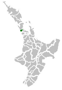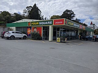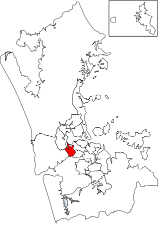
Kaipara District is a territorial authority district in the Northland Region of New Zealand.

Waitakere City was a territorial authority in West Auckland, New Zealand; it was governed by the Waitakere City Council from 1989 to 2010. It was New Zealand's fifth-largest city, with an annual growth of about 2%. In 2010 the council was amalgamated with the other authorities of the Auckland Region to form the current Auckland Council.

Moturoa / Rabbit Island is a small island that lies across the southernmost part of Tasman Bay / Te Tai-o-Aorere, on the northern coast of New Zealand's South Island. The long narrow island runs east–west for 8 kilometres (5 mi), and covers 15 km2 (5.8 sq mi).

Ward is a small town in Marlborough, New Zealand. It is located on State Highway 1, 82 kilometres (51 mi) north of Kaikōura. The Flaxbourne River flows past to the north and into the Pacific Ocean at Ward Beach to the south-east of Ward. A current initiative aims to have the town renamed as Flaxbourne.

Eventfinda Stadium is an indoor arena located in Wairau Valley, on the North Shore of Auckland, New Zealand. The arena opened in 1992 and has a capacity of 4,179.

The New Zealand fairy tern or tara-iti is a subspecies of the fairy tern endemic to New Zealand. It is New Zealand's rarest native breeding bird, with about 40 individuals left in the wild. It nests at four coastal locations between Whangārei and Auckland in the North Island. It is threatened by introduced predators, extreme storms and tides, beach activity, and waterfront development.

Established in 1970, Manukau Institute of Technology (MIT) (Māori: Te Whare Takiura o Manukau) is a Category One Institute of technology in Auckland, New Zealand.
Marsden Point is a broad, flat peninsula that is the southern head of the Whangārei Harbour entrance on the east coast of Northland, New Zealand, 30 kilometres (19 mi) southeast of the city of Whangārei. It is the location of Marsden Point Oil Refinery and the Northport cargo port.

Kaiwaka, known as "the little town of lights", is a settlement in Northland, New Zealand. The Kaiwaka River runs from the east through the area and joins with the Wairau River to form the Otamatea River, which drains into the Kaipara Harbour. State Highway 1 passes through Kaiwaka. Wellsford is 20 kilometres (12 mi) south, Brynderwyn is 8 kilometres (5.0 mi) north, and Whangārei, the closest city, is 60 kilometres (37 mi) to the north. The Mangawhai Heads are 18 kilometres (11 mi) northeast of Kaiwaka.

Mangawhai is a township at the south-west extent of the Mangawhai Harbour, or Mangawhai Estuary, in Northland, New Zealand. The adjacent township of Mangawhai Heads is 5 km north-east, on the lower part of the harbour. Kaiwaka is 13 km south-west, and Waipu is 20 km north-west of Mangawhai Heads.
Mangawhai Heads is a township in Northland, New Zealand. Waipu is 21 kilometres northwest, and Mangawhai is 5 kilometres southwest. Mangawhai Heads is on the north shore of the Mangawhai Harbour.
The Hakaru River is a river in the Northland Region of New Zealand. It starts in the Brynderwyn Hills and flows south to join the Topuni River exiting in the Oruawharo River, which forms part of the Kaipara Harbour.

The Mahitahi River is a river of the southwest of New Zealand's South Island. It flows northwest from the Hooker Range, part of the Southern Alps, reaching the Tasman Sea at Bruce Bay.
The Mangawai River is a small river of the Northland Region of New Zealand. It changes name to the Manganui River (Northland) near to where it is crossed by the North Auckland Line.

The Tongapōrutu River is a river of the Taranaki region of New Zealand's North Island. It initially flows north from its origins near Tahora, turning west to reach the Tasman Sea coast close to the settlement of Tongapōrutu, 15 kilometres (9.3 mi) south of Mokau.

The Whau Local Board is one of the 21 local boards of the Auckland Council. It is the only local board overseen by the council's Whau Ward councillor.

The Maungakiekie-Tāmaki Local Board is one of the 21 local boards of the Auckland Council. It is the only local board overseen by the council's Maungakiekie-Tāmaki Ward councillor.
Rodney County was one of the counties of New Zealand in the North Island, from 1876 until 1989. It came into existence in November 1876, when the provinces were abolished. In the 1989 local government reforms, it merged with Helensville Borough to create Rodney District.

Auckland District Health Board (ADHB) was a district health board that provided healthcare in the Auckland Region in New Zealand, mainly on the Auckland isthmus. This district health board existed between 2001 and 2022 and was governed by a part-elected, part-appointed board. In 2022, its functions and responsibilities were subsumed by Te Whatu Ora and Te Aka Whai Ora.


