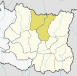
Bala is a Village Development Committee in Sankhuwasabha District in the Kosi Zone of north-eastern Nepal. At the time of the 1991 Nepal census it had a population of 2863 people residing in 576 individual households.

Panchkhappan (पाँचखप्पन) is a Municipality in Sankhuwasabha District in the Kosi Zone of north-eastern Nepal. The municipality was established on 19 September 2017 by merging the existing Wana, Jaljala, and Syabun village development committees (VDCs). The municipality office is established at Wana Bazzar, near to Wana Higher Secondary School. After merging three VDCs' population, it has a population of 14,881 people living in 2,870 individual households according to 1991 Nepal census.

Baneshwar is a former Village Development Committee and a market center in Chainpur Municipality in Sankhuwasabha District in the Kosi Zone of north-eastern Nepal. At the time of the 1991 Nepal census it had a population of 3830 people living in 688 individual households.

Chainpur is a municipality in Sankhuwasabha District in the Kosi Zone of north-eastern Nepal. It was formed by merging five villages i.e. Chainpur, Siddhakali, Siddhapokhari, Baneshwar and Kharang. The municipality was implemented on 18 May 2014. At the time of the 1991 Nepal census it had a population of 4933 people in 948 households.

Dhupu is a village development committee in Sankhuwasabha District in the Kosi Zone of north-eastern Nepal. At the time of the 1991 Nepal census it had a population of 4295 people living in 813 individual households.

Diding is a village development committee in Sankhuwasabha District in the Kosi Zone of north-eastern Nepal.Recently this local place is known for so far the biggest hydroelectric project of nepal, arun iii. According to the new structure of country nepal It fall under the province no.2.At the time of the 1991 Nepal census it had a population of 2900 people living in 566 individual households.

Jaljala is a village development committee in Sankhuwasabha District in the Kosi Zone of north-eastern Nepal. At the time of the 1991 Nepal census it had a population of 5211 people living in 921 individual households.

Madi Mulkharka is a village development committee in Sankhuwasabha District in the Kosi Zone of north-eastern Nepal. At the time of the 1991 Nepal census it had a population of 6201 people living in 1147 individual households.

Madi Rambeni is a village development committee in Sankhuwasabha District in the Koshi Zone of north-eastern Nepal. At the time of the 1991 Nepal census it had a population of 4741 people living in 919 individual households.

Makalu is a village development committee in Sankhuwasabha District in the Koshi Zone of north-eastern Nepal. At the time of the 1991 Nepal census it had a population of 3,560 people living in 694 individual households.
Malta is a village development committee in Sankhuwasabha District in the Kosi Zone of north-eastern Nepal. At the time of the 1991 Nepal census it had a population of 3870 people living in 737 individual households.

Mamling is a village development committee in Sankhuwasabha District in the Kosi Zone of north-eastern Nepal. At the time of the 1991 Nepal census it had a population of 3457 people living in 630 individual households.
Manakamana is a village development committee in Sankhuwasabha District in the Kosi Zone of north-eastern Nepal. At the time of the 1991 Nepal census it had a population of 9029 people living in 1830 individual households.

Mawadin is a village development committee in Sankhuwasabha District in the Kosi Zone of north-eastern Nepal. At the time of the 1991 Nepal census it had a population of 3353 people living in 634 individual households.

Num is a village development committee in Sankhuwasabha District in the Kosi Zone of north-eastern Nepal. At the time of the 1991 Nepal census it had a population of 2526 people living in 468 individual households.

Pawakhola is a village development committee in Sankhuwasabha District in the Kosi Zone of north-eastern Nepal. At the time of the 1991 Nepal census it had a population of 2602 people living in 472 individual households.
Savapokhari is a village development committee in Sankhuwasabha District in the Kosi Zone of north-eastern Nepal. At the time of the 1991 Nepal census it had a population of 2834 people living in 485 individual households. Shavapokhari village development committee contains 9 wards. The major attraction of this village development committee is Shavapokhari lake. This lake is situated at the height of around 3500 m from sea level. Generally people visit this area during the spring season. People more than ten thousand visit this place every year at Janai purnima.

Syabun is a village development committee in Sankhuwasabha District in the Kosi Zone of north-eastern Nepal. At the time of the 1991 Nepal census it had a population of 5603 people living in 1006 individual households.
Tamaphok is a village development committee in Sankhuwasabha District in the Kosi Zone of north-eastern Nepal. At the time of the 1991 Nepal census it had a population of 5634 people living in 1096 individual households.

Yamphu is a village development committee in Sankhuwasabha District in the Kosi Zone of north-eastern Nepal. At the time of the 1991 Nepal census it had a population of 2407 people living in 518 individual households.


