Orléans is a federal electoral district in Ottawa, Ontario, Canada, that has been represented in the House of Commons of Canada since 1988.

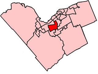
Nepean is a federal electoral district in Ontario, Canada that was represented in the House of Commons of Canada from 1988 to 1997, and was reinstated during the 2012 electoral redistribution.
Centrepointe is a neighbourhood in College Ward in the west end of the City of Ottawa, Ontario, Canada. It is located in the former city of Nepean. It is a newer residential subdivision in the west/central part of Ottawa, developed from 1984 onwards, and is informally bounded by Baseline Road to the north, Woodroffe Avenue to the east, the CN railroad to the south, and the Briargreen subdivision to the west. The housing stock includes approximately 1,000 detached homes, with the remainder mostly townhomes and terrace homes.
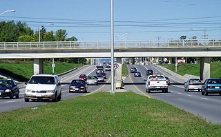
Woodroffe Avenue is a major north-south arterial road in Ottawa, Ontario, Canada's west end. It runs south from the Sir John A. Macdonald Parkway through Baseline Road and Barrhaven to just short of Prince of Wales Drive near Manotick. The road runs through the heart of Nepean in Ottawa's west end. A satellite Via Rail station is also located at the intersection of Fallowfield Road.

Ottawa—Vanier is a provincial electoral district in Ottawa, Ontario, Canada, that has been represented in the Legislative Assembly of Ontario since 1908. It is located in the east end of Ottawa.

Findlay Creek is a suburban neighbourhood in Gloucester-South Nepean Ward in the south end of Ottawa, Ontario, Canada. It is located just south-west of the intersection of Leitrim Road and Bank Street. The eponymous Findlay Creek springs in the Leitrim Wetlands, directly south of the neighbourhood, and is a tributary of the North Castor River.
Grenfell Glen is a small neighbourhood in Knoxdale-Merivale Ward in the city of Ottawa in Ontario, Canada.
Craig Henry is a residential neighbourhood in Knoxdale-Merivale Ward in the west end of Ottawa, Canada. It is located in the former city of Nepean. It is a residential subdivision that was developed from 1971 onwards. The neighbourhood is bordered by Woodroffe Avenue to the east, Greenbank Road to the west, Knoxdale Road to the south and the CN railroad separating it from Centrepointe and Briargreen to the north. The land previously belonged to the Craig Henry farm, and was developed by Jack Aaron.
Qualicum-Graham Park or Qualicum is a suburban neighbourhood in College Ward in the City of Ottawa, Ontario, Canada. It is located in the former City of Nepean in the west end of the city. Many of the residences in the area are executive homes situated on large lots (100x100) being built in the 1960s. Qualicum Street boasts large custom houses built by Bill Teron. The neighbourhood is bounded to the north by the Queensway, to the west by Richmond Road, to the south by Baseline Road, and to the east by Morrison Drive at the former Ottawa-Nepean border towards Redwood. Named after Qualicum Beach in British Columbia.
Leslie Park is a suburban neighbourhood in College Ward in the city of Ottawa, Ontario, Canada. It is located in the former city of Nepean.
Skyline is a neighbourhood in Knoxdale-Merivale Ward in Ottawa, Ontario, Canada. Prior to amalgamation in 2001, the neighbourhood was located in the City of Nepean. It is bounded on the south by Meadowlands Drive of Parkwood Hills, on the west by Clyde Avenue and Merivale Road, on the north by Baseline Road and on the east by the neighbourhood of Fisher Heights.
Fisher Heights is a neighbourhood located within the former City of Nepean in Ottawa, Ontario, Canada. It is located in Knoxdale-Merivale Ward. The area is located south of the Experimental Farm and approximately 8 km away from downtown Ottawa.
Trend-Arlington is a suburban neighbourhood in Knoxdale-Merivale Ward in the city of Ottawa, Ontario, Canada. The neighbourhood is located with in the former City of Nepean in the west end of the city. It is located west of Greenbank Road, east of Highway 416 and Cedarview Road, north of West Hunt Club Road and south of the Leslie Park neighbourhood. Its main road is McClellan Road, which is renamed Banner Road at its north end.

Riverside Park is a neighbourhood in the south end of Ottawa, Canada.
Bel-Air Park is a neighbourhood in College Ward in the west end of Ottawa, Ontario, Canada. It is bounded on the east by the Experimental Farm Pathway, on the south by Baseline Road, on the west by Woodroffe Avenue and on the north by the Queensway.
Crestview is a neighbourhood in College Ward in the west end of Ottawa, Ontario, Canada. It was originally part of the City of Nepean before amalgamation with Ottawa in 2001. Crestview is bounded on the north by Fieldrow Street, on the east by Merivale Road, on the south CN Railtracks and on the west by Woodroffe Avenue. Together with the neighbouring community of Meadowlands, the area is served by the Crestview-Meadowlands Community Association.
Tanglewood, also known as Tanglewood-Hillsdale is a suburban neighbourhood in Knoxdale-Merivale Ward in the city of Ottawa, Ontario, Canada. It is located within the former City of Nepean in the west end of the city. It is located in the federal and provincial ridings of Nepean-Carleton. It is informally bounded by CN Railway to the north, Merivale Road to the east, Hunt Club Road to the south, and Woodroffe Avenue to the west.
Country Place is a residential neighbourhood near the geographical centre of Ottawa, Canada and part of the former city of Nepean. It is a mature residential subdivision with about 400 houses located just inside the Ottawa greenbelt near the Rideau River, and about 11 km from downtown Ottawa. It is bordered by the Black Rapids Creek and the greenbelt to the south, Prince of Wales Drive to the east, Merivale Road to the west, and the Pineglen community to the north. Amberwood Crescent meanders through the community, exiting onto Prince of Wales and Merivale. Tennyson Drive links Country Place to Pineglen.
Briargreen is a suburban neighbourhood located in College Ward in the west end of Ottawa, Ontario, Canada. Prior to amalgamation in 2001 it was located in the City of Nepean. The borders of the neighbourhood are Baseline Road to the north, Centrepointe to the east, Craig Henry to the south, and Greenbank Road to the west. The community was built in the late 1960s to early 1970s same time as the nearby neighbourhoods of Leslie Park and Arlington Woods. The main roads in the community are Ashgrove Crescent and Meadowbank Drive.