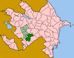
Khojavend is a rayon of Azerbaijan. It has been controlled by the breakaway Nagorno-Karabakh Republic since the Nagorno-Karabakh War except easternmost part, with its northeast half as part of Martuni Province and the rest as part of Hadrut Province.

Ordubad is a rayon of Azerbaijan in the Nakhchivan Autonomous Republic. Ordubad district was established in 1930. In 1963, the district was abolished and given to the Julfa region. Since 1965, it has been an independent district. It borders on Iran in the south, Armenia in the north and west and Julfa region in the east and covers an area of 972 square kilometres (375 sq mi). There is 1 city, 3 settlements, and 43 villages within the district. The administrative centre of the district is the Ordubad city.

Greater Caucasus is the major mountain range of the Caucasus Mountains.

This is a list of the extreme points of Azerbaijan, the points that are farther north, south, east or west than any other location.

The Iori is a river in the South Caucasus that originates in the Greater Caucasus Mountains in eastern Georgia and continues in Azerbaijan, where it is also known as Gabirry (Qabirry) and flows into the Mingachevir reservoir. It is 320 kilometres (200 mi) long. It starts in the mountains north of Tbilisi, flows south toward that city, swings east and flows through the lowlands parallel to and between the Alazani River (north) and the Kura River (south).

Əspərəsti is a village in the Quba Rayon of Azerbaijan. The village forms part of the municipality of Qorxmazoba.

Çolaxlı is a village in the Shaki Rayon of Azerbaijan. The village forms part of the municipality of Cəfərabad.

Mamedoba is a village in the Davachi Rayon of Azerbaijan.

Məsimlər is a village in the Tovuz Rayon of Azerbaijan. The village forms part of the municipality of Böyük Qışlaq.

Manafoba is a village in the Khachmaz Rayon of Azerbaijan. The village forms part of the municipality of Ağaşirinoba.
İkinci Səmədxanlı is a village and municipality in the Masally Rayon of Azerbaijan. It has a population of 391.
Sahillər is a village in the municipality of Seyidlikəndyeri in the Khachmaz Rayon of Azerbaijan.
Heydərli is a village in the municipality of Şəkərbəy in the Gadabay Rayon of Azerbaijan.
Sonalar is a village in the municipality of Hacılar in the Gadabay Rayon of Azerbaijan.
Bedağar is a village in the municipality of Qazma in the Balakan Rayon of Azerbaijan.
Böyüktala is a village in the municipality of Hənifə in the Balakan Rayon of Azerbaijan.
Namxoş is a village in the municipality of Çobansığnaq in the Tovuz Rayon of Azerbaijan.
Kəcavənd is a village in the municipality of Yanıqlı in the Tovuz Rayon of Azerbaijan.
Bala Şamlıq is a village in the municipality of Qəribli in the Tovuz Rayon of Azerbaijan.


