Manvo

Last updated

Coordinates: 41°05′N44°38′E / 41.083°N 44.633°E / 41.083; 44.633

Geographic coordinate system Coordinate system

A geographic coordinate system is a coordinate system that enables every location on Earth to be specified by a set of numbers, letters or symbols. The coordinates are often chosen such that one of the numbers represents a vertical position and two or three of the numbers represent a horizontal position; alternatively, a geographic position may be expressed in a combined three-dimensional Cartesian vector. A common choice of coordinates is latitude, longitude and elevation. To specify a location on a plane requires a map projection.

Manvo
Armenia adm location map.svg
Red pog.svg
Manvo
Coordinates: 41°05′N44°38′E / 41.083°N 44.633°E / 41.083; 44.633
Country Armenia
Marz (Province) Lori Province
Time zone   (UTC+4)
  Summer (DST)  (UTC+5)

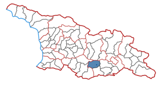
Manvo (also, Manes) is a town in the Lori Province of Armenia.

Lori Province Province in Armenia

Lori, is a province (marz) of Armenia. It is located in the north of the country, bordering Georgia. Vanadzor is the capital and largest city of the province. Other important towns include Stepanavan, Alaverdi, and Spitak. It is home to the UNESCO World Heritage Sites of Haghpat and Sanahin monasteries and the well-preserved Akhtala monastery, where Armenians, Georgians, and Greeks make an annual pilgrimage on September 20–21.

Armenia Republic in South Caucasus in West Asia

Armenia, officially the Republic of Armenia, is a country in the South Caucasus region of Eurasia. Located in Western Asia on the Armenian Highlands, it is bordered by Turkey to the west, Georgia to the north, the de facto independent Republic of Artsakh and Azerbaijan to the east, and Iran and Azerbaijan's exclave of Nakhchivan to the south.

Related Research Articles

Geography of France

The geography of France consists of a terrain that is mostly flat plains or gently rolling hills in the north and west and mountainous in the south and the east.

Ribera dEbre Comarca in Catalonia, Spain

Ribera d'Ebre is a comarca (county) in Catalonia, Spain. The name in Catalan refers to its location on the banks of the river Ebre, usually referred to in English by its Spanish name Ebro.

Sprâncenata Commune in Olt County, Romania

Sprâncenata is a commune in Olt County, Romania.

Torrubia de Soria is a municipality located in the province of Soria, Castile and León, Spain. According to the 2004 census (INE), the municipality has a population of 81 inhabitants.

Tandrano Place in Atsimo-Andrefana, Madagascar

Tandrano is a town and commune in Madagascar. It belongs to the district of Ankazoabo, which is a part of Atsimo-Andrefana Region. The population was 9,000 in 2001 commune census.

Stryje Księże Village in Łódź, Poland

Stryje Księże is a village in the administrative district of Gmina Łask, within Łask County, Łódź Voivodeship, in central Poland. It lies approximately 7 kilometres (4 mi) north-west of Łask and 32 km (20 mi) south-west of the regional capital Łódź.

Vahagnadzor Place in Lori Province, Armenia

Vahagnadzor is a town in the Lori Province of Armenia. The town has a ruined fortress.

Wiksin Village in Masovian, Poland

Wiksin is a village in the administrative district of Gmina Grudusk, within Ciechanów County, Masovian Voivodeship, in east-central Poland. It lies approximately 3 kilometres (2 mi) north of Grudusk, 25 km (16 mi) north of Ciechanów, and 100 km (62 mi) north of Warsaw.

Wólka Okrąglik Village in Masovian, Poland

Wólka Okrąglik is a village in the administrative district of Gmina Kosów Lacki, within Sokołów County, Masovian Voivodeship, in east-central Poland. It lies approximately 6 kilometres (4 mi) north-west of Kosów Lacki, 28 km (17 mi) north-west of Sokołów Podlaski, and 87 km (54 mi) north-east of Warsaw.

Obłotne Village in Lubusz, Poland

Obłotne is a village in the administrative district of Gmina Sulechów, within Zielona Góra County, Lubusz Voivodeship, in western Poland. It lies approximately 2 kilometres (1 mi) east of Sulechów and 19 km (12 mi) north-east of Zielona Góra.

Szyldak Village in Warmian-Masurian, Poland

Szyldak is a village in the administrative district of Gmina Ostróda, within Ostróda County, Warmian-Masurian Voivodeship, in northern Poland. It lies approximately 11 kilometres (7 mi) south-east of Ostróda and 33 km (21 mi) south-west of the regional capital Olsztyn.

Tsalka Municipality

Tsalka is a district of Georgia, in the region of Kvemo Kartli. Its main town is Tsalka.

Koy Sanjaq Place in Kurdistan, Iraq

The town Koy Sanjaq, original Kurdish name Bijhenjar, is located in the Erbil Governorate of Iraqi Kurdistan, close to the Iranian border. Most of the town was property of two families Which were also known by the title of Agha which represents them for being wealthy.

Emmu is a village in Lääneranna Parish, Pärnu County in southwestern Estonia.

Kelba is a village in Rapla Parish, Rapla County in northwestern Estonia.

Staretina is a mountain in the municipality of Livno, Bosnia and Herzegovina. It has an altitude of 1,633 metres (5,358 ft).

Kazashka Reka is a village in the municipality of Avren, in Varna Province, northeastern Bulgaria.

Lnozavod is the name of several rural localities in Russia.

References