Related Research Articles
The Geography of Guyana comprises the physical characteristics of the country in Northern South America and part of Caribbean South America, bordering the North Atlantic Ocean, between Suriname and Venezuela, with a land area of approximately 214,969 square km. The country is situated between 1 and 9 north latitude and between 56 and 62 west longitude. With a 459 km (285 mi)-long Atlantic coastline on the northeast, Guyana is bounded by Venezuela on the west, Brazil on the west and south, and Suriname on the east.

The Guiana Shield is one of the three cratons of the South American Plate. It is a 1.7 billion-year-old Precambrian geological formation in northeast South America that forms a portion of the northern coast. The higher elevations on the shield are called the Guiana Highlands, which is where the table-like mountains called tepuis are found. The Guiana Highlands are also the source of some of the world's most well-known waterfalls such as Angel Falls, Kaieteur Falls and Cuquenan Falls.
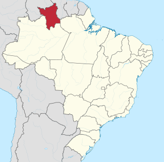
Roraima is one of the 26 states of Brazil. Located in the country's North Region, it is the northernmost and most geographically and logistically isolated state in Brazil. It is bordered by the state of Pará to the southeast, Amazonas to the south and west, Venezuela to the north and northwest, and Guyana to the east.
The Pacaraima or Pakaraima Mountains are a mountain range primarily in southwestern Guyana, and into northern Brazil and eastern Venezuela.

The Ireng River forms part of Guyana's western border with Brazil. It flows through the valleys of the Pakaraima Mountains for most of its length. It is the only major river in Guyana which flows from North to South, up to its confluence into the Takutu River. It is one of the northernmost tributaries of the Amazon river system.

Caracaraí is a municipality located in the state of Roraima in Brazil. Its population is 22,283 and its area is 47,411 square kilometres (18,305 sq mi), making it the largest municipality in Roraima state. Caracaraí is located on the Branco River.
Jufari River is a river forming part of the border between Amazonas and Roraima states in north-western Brazil.
The Ajarani River is a river of Roraima state in northern Brazil.
The Arraia River is a river of Roraima state in northern Brazil.
The Auari River is a river of Roraima state in northern Brazil.
The Caju River is a river of Roraima state in northern Brazil.
The Caroaebe River is a river of Roraima state in northern Brazil, near the equator.
The Catrimani River is a river of Roraima state in northern Brazil.
The Miang River is a river of Roraima state in northern Brazil.
The Paricarana River is a river of Roraima state in northern Brazil.
The Surumu River is a river of Roraima state in northern Brazil.
The Água Boa do Univini River is a river of Roraima state in northern Brazil.
The Ailã River is a river of Roraima state in northern Brazil. It is located in Monte Caburaí, in the municipality of Uiramutã. Its source is the northernmost point of Brazil.
References
Coordinates: 4°17′N59°44′W / 4.283°N 59.733°W