
The Mardy (Welsh : Y Maerdy) is a village in Monmouthshire, south east Wales.
The Mardy (Welsh : Y Maerdy) is a village in Monmouthshire, south east Wales.
Mardy is located immediately to the north of the market town of Abergavenny. On old maps, the Mardy has the Welsh spelling Maerdy.[ citation needed ]
The Mardy has a close community and a varied mix of housing types and ages ranging from old farms recently built executive style homes. There is church one mile further north at Llantilio Pertholey. When the old Llantilio Pertholey Junior and infants mixed school was closed a new one was opened adjacent to the Mardy World War II camp but retained the name Llantilio Pertholey School.
Mardy is also an electoral ward, formed from part of the Llantilio Pertholey community. It elects one county councillor to Monmouthshire County Council. [1]

Llanvapley is a village in the community of Gobion Fawr, in Monmouthshire, south east Wales, United Kingdom. Llan has replaced the (earlier) Eglwys (1254). This village lies 4 miles north east of 2023’s Best Places to Live listed town, Abergavenny.

Maerdy is a village and community in the county borough of Rhondda Cynon Taf, and within the historic county boundaries of Glamorgan, Wales, lying at the head of the Rhondda Fach Valley.
Llanelly is the name of a parish and coterminous community in the principal area of Monmouthshire, within the historic boundaries of Brecknockshire, south-east Wales. It roughly covers the area of the Clydach Gorge. The population of the parish and ward at the 2011 census was 3,899.

Ferndale is a town and community located in the Rhondda Valley in the county borough of Rhondda Cynon Taf, Wales. Neighbouring villages are Blaenllechau, Maerdy and Tylorstown. Ferndale was industrialised in the mid-19th century. The first coal mine shaft was sunk in 1857 and Ferndale was the first community to be intensively industrialised in the Rhondda Valley.
Rumney is a district and community in the east of the city of Cardiff, Wales. It lies east of the Rhymney River, and is historically part of Monmouthshire. On 1 April 1938 the Cardiff Extension Act 1937 incorporated it into the county borough of Cardiff, although it remained part of Monmouthshire, and England until the Local Government Act 1972 made Monmouthshire a part of Wales.

Llantilio Crossenny is a small village and much larger former community, now in the community of Whitecastle, in Monmouthshire, south east Wales, in the United Kingdom. It is situated between the two towns of Abergavenny and Monmouth on the B4233 road. The community included Penrhos, and Llanvihangel-Ystern-Llewern.
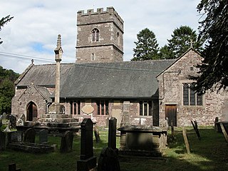
Llantilio Pertholey is a village and community (parish) in Monmouthshire, south east Wales. It is located 2 miles (3.2 km) to the north-east of the market town of Abergavenny, which it is part of, just off the A465 road to Hereford. The parish covers a large area beneath the Skirrid, an outlier of the Black Mountains; much of the parish lies within the easternmost part of the Brecon Beacons National Park.
Mitchel Troy is a village and community in Monmouthshire, south east Wales, in the United Kingdom. It is located 3 miles south west of the county town of Monmouth, just off the A40 road leading towards Raglan. Settlements within the community include Tregare, Dingestow, Cwmcarvan and Wonastow.

Llanover is a village in the community of Goetre Fawr in Monmouthshire, Wales.

Penrhos is a village in the community of Whitecastle in Monmouthshire, south east Wales, United Kingdom.

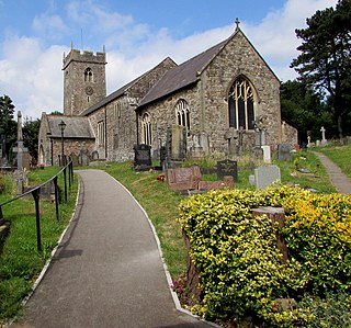
The River Gavenny or sometimes the Gavenny River is a short river in Monmouthshire in south Wales. It rises 1 mile (1.6 km) southwest of the village of Llanvihangel Crucorney from springs near Penyclawdd Court, supplemented by springs in Blaen-Gavenny Wood and tributary streams there and within the Woodland Trust-owned Great Triley Wood. It flows south for about 4 miles (6.4 km) to its confluence with the River Usk towards the eastern end of Castle Meadows at Abergavenny. The town derives its English-language name from the Gavenny's confluence with the River Usk. Of the buildings on the banks of the river, the Gothic Decorated style church of St Teilo at Llantilio Pertholey is especially notable. Parts of the church date from the thirteenth century with multiple additions since. Blaengavenny Farm, the name of which signifies the 'head of the Gavenny', is a sixteenth-century farmhouse near the river's source.

Llangattock is a village, community and electoral ward in the Brecon Beacons National Park in Powys, Wales. It lies in the Usk Valley just across the river from the town of Crickhowell. The Monmouthshire and Brecon Canal passes through the village en route between Brecon and Pontypool. It is in the historic county of Breconshire.
Maerdy Colliery was a coal mine located in the South Wales village of Maerdy, in the Rhondda Valley, located in the county borough of Rhondda Cynon Taf, and within the historic county boundaries of Glamorgan, Wales. Opened in 1875, it closed in December 1990.

Llanfrynach is a village and community in the county of Powys, Wales, and the historic county of Brecknockshire. The population of the community as taken at the 2011 census was 571. It lies just to the southeast of Brecon in the Brecon Beacons National Park. The village sits astride the Nant Menasgin, a right bank tributary of the River Usk. The B4558 passes just to its north and the Monmouthshire and Brecon Canal also passes around the village. The Welsh name signifies the 'church of Brynach'. The community includes the hamlets of Llanhamlach and Groesffordd.
Bwllfa Colliery was a coal mine located in the Dare valley near Cwmdare in Rhondda Cynon Taf, South Wales. It operated from 1856 to 1957, remaining open as a ventilation shaft for Mardy Colliery until 1989.

Trellech United is a community and electoral ward in the county of Monmouthshire, Wales. It lies south of the county town of Monmouth next to the Wales-England border.

Crucorney Welsh: Crucornau is a community in the county of Monmouthshire, Wales. It is the northernmost community in the county and covers the villages of Llanvihangel Crucorney, Pandy, Cwmyoy and Llanthony amongst others. The Vale of Ewyas comprises much of the northern part of the community, with the River Honddu running through Llanthony and Llanvihangel Crucorney, before turning northeast passing Pandy towards the River Monnow. The 2011 population was 1,201.

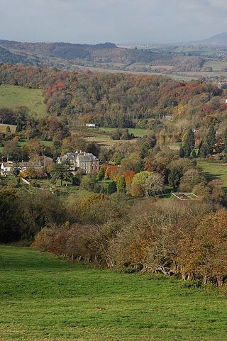
Wern-ddu farmhouse, Llantilio Pertholey, Monmouthshire is a farmhouse of 17th century origins. It has been significantly altered in the 18th, 19th and 20th centuries and the Monmouthshire antiquarian, Sir Joseph Bradney recorded that it had "suffered so much by continual alterations that it shows but little of its antiquity". It is a Grade II* listed building.
The 1973 Gwent County Council election was held on Thursday 12 April 1973 to elect councillors to the new Gwent County Council, governing the new county of Gwent, Wales. It took place on the same day as other county council elections in the United Kingdom.
{{cite book}}: |website= ignored (help)51°50′18″N3°00′31″W / 51.83828°N 3.00868°W
| International | |
|---|---|
| National | |
| | This article relating to a location in Monmouthshire is a stub. You can help Wikipedia by expanding it. |