Marikhali Bridge

Last updated

Marikhali Bridge is a pair of parallel prestressed concrete girder bridges in Bangladesh. [1] It is located along the Dhaka-Chittagong Highway, about 3.2 kilometres (2 mi) north of the more famous Meghna Bridge. [2] Below is the traffic on the bridge in 2004:

Prestressed concrete form of concrete used in construction

Prestressed concrete is a form of concrete used in construction that, while under construction, is substantially "prestressed" (compressed) in the areas that will be subjected to tensile forces while in service in order to strengthen it against these forces.

Girder bridge bridge built of girders placed on bridge abutments and foundation piers

A girder bridge is a bridge that uses girders as the means of supporting its deck. The two most common types of modern steel girder bridge are plate and box.

Bangladesh Country in South Asia

Bangladesh, officially the People's Republic of Bangladesh, is a sovereign country in South Asia. It shares land borders with India and Myanmar (Burma). The country's maritime territory in the Bay of Bengal is roughly equal to the size of its land area. Bangladesh is the world's eighth most populous country as well as its most densely-populated, to the exclusion of small island nations and city-states. Dhaka is its capital and largest city, followed by Chittagong, which has the country's largest port. Bangladesh forms the largest and easternmost part of the Bengal region. Bangladeshis include people from a range of ethnic groups and religions. Bengalis, who speak the official Bengali language, make up 98% of the population. The politically dominant Bengali Muslims make the nation the world's third largest Muslim-majority country. Islam is the official religion of Bangladesh.

Vehicle [2] Truck [2] Bus [2] Light Vehicle [2] Motorcycle [2] Total [2]
March 20045,4874,5451,42381212,282

Related Research Articles

Tongi is a township in Gazipur, Bangladesh, with a population of 350,000. It hosts the Biswa Ijtema and features a BSCIC industrial area, which produces BDT 1500 crore of industrial products annually, and marks the northern border of Dhaka since 1786. Tongi Shahid Memorial School compound is mass burial site of the genocide in Liberation War of Bangladesh.

Gazaria Upazila Upazila in Dhaka Division, Bangladesh

Gazaria Upazila is one of the six upazilas of Munshiganj District in the Division of Dhaka, Bangladesh. It is located on the Meghna river delta, 28 kilometres (17 mi) from the capital city of Dhaka.

Uttara Thana Thana in Dhaka Division, Bangladesh

Uttara Model Town or simply Uttara is a northern Thana and a suburb of Dhaka, the capital of Bangladesh. The name derives from the Bengali word ut'tar meaning "north". It lies on the road to Gazipur, and adjoins Shahjalal International Airport.

Meghna Bridge bridge in Bangladesh

Meghna Bridge is a road bridge in Bangladesh. It was built with the assistance of Japan and officially named Japan Bangladesh Friendship Bridge 1, but it is popularly known as Meghna Bridge. According to a study conducted in 2004 by the Embassy of Japan in Bangladesh, residents living around the Meghna Bridge recognized several positive impacts after the construction of the bridge.

Munshiganj-2 is a constituency represented in the Jatiya Sangsad of Bangladesh since 2008 by Sagufta Yasmin of the Awami League.

Comilla-4 is a constituency represented in the Jatiya Sangsad of Bangladesh since 2014 by Razee Mohammad Fakhrul, of the Awami League since 2018.

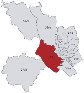
Dhaka-2 constituency of Bangladeshs Jatiya Sangsad

Dhaka-2 is a constituency represented in the Jatiya Sangsad of Bangladesh since 2008 by Qamrul Islam of the Awami League.

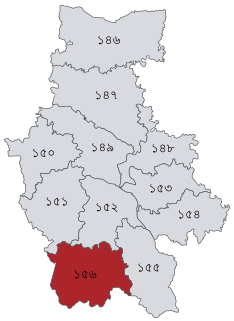
Comilla-1 is a constituency represented in the Jatiya Sangsad of Bangladesh since 2008 by Mohammad Shubid Ali Bhuiyan of the Awami League.

Mymensingh-6 constituency of Bangladeshs Jatiya Sangsad

Mymensingh-6 is a constituency represented in the Jatiya Sangsad of Bangladesh since 2008 by Moslem Uddin of the Awami League.

Mymensingh-7 constituency of Bangladeshs Jatiya Sangsad

Mymensingh-7 is a constituency represented in the Jatiya Sangsad of Bangladesh since 2019 by Ruhul Amin Madani of the Awami League.

Madaripur-1 is a constituency represented in the Jatiya Sangsad of Bangladesh since 1991 by Noor-E-Alam Chowdhury Liton of the Awami League.

Chandpur-2 is a constituency represented in the Jatiya Sangsad of Bangladesh since 2019 by Nurul Amin Ruhul of the Awami League.

Mymensingh-11 constituency of Bangladeshs Jatiya Sangsad

Mymensingh-11 is a constituency represented in the Jatiya Sangsad of Bangladesh since 2019 by Kazim Uddin Ahmed of the Awami League.

Comilla-3 is a constituency represented in the Jatiya Sangsad of Bangladesh since 2014 by Yussuf Abdullah Harun, of the Awami League since 2019.

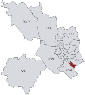
Dhaka-4 constituency of Bangladeshs Jatiya Sangsad

Dhaka-4 is a constituency represented in the Jatiya Sangsad of Bangladesh since 2014 by Sayed Abu Hossain of the Jatiya Party (Ershad).

Narsingdi-2 is a constituency represented in the Jatiya Sangsad of Bangladesh since 2019 by Anwarul Ashraf Khan of the Awami League.

Comilla-2 is a constituency represented in the Jatiya Sangsad of Bangladesh since 2019 by Selima Ahmad of the Awami League.

Manikganj-2 is a constituency represented in the Jatiya Sangsad of Bangladesh since 2014 by Momtaz Begum of the Awami League.

Barisal-2 is a constituency represented in the Jatiya Sangsad of Bangladesh since 2019 by Shah-e-Alam of the Awami League.

Barisal-1 is a constituency represented in the Jatiya Sangsad of Bangladesh since 2014 by Abul Hasanat Abdullah of the Awami League.

References

  1. "Bridge Maintenance management System". Roads and Highways Department, Bangladesh.
  2. 1 2 3 4 5 6 7 "The basic study on the present situation of the previous grant aid project for the bridges in Bangladesh" (PDF). Embassy of Japan in Bangladesh. Archived from the original (PDF) on 22 July 2011.

Coordinates: 23°38′02″N90°35′50″E / 23.6339°N 90.5972°E / 23.6339; 90.5972

Geographic coordinate system Coordinate system

A geographic coordinate system is a coordinate system that enables every location on Earth to be specified by a set of numbers, letters or symbols. The coordinates are often chosen such that one of the numbers represents a vertical position and two or three of the numbers represent a horizontal position; alternatively, a geographic position may be expressed in a combined three-dimensional Cartesian vector. A common choice of coordinates is latitude, longitude and elevation. To specify a location on a plane requires a map projection.