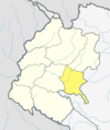
Dadeldhura, a part of Sudurpashchim Province, is one of the seventy-seven districts of Nepal. The district, with Dadeldhura as its district headquarters, covers an area of 1,538 km2 (594 sq mi) and had a population of 126,162 in 2001 and 142,094 in 2011.

A village development committee in Nepal was the lower administrative part of its Ministry of Federal Affairs and Local Development. Each district had several VDCs, similar to municipalities but with greater public-government interaction and administration. There were 3,157 village development committees in Nepal. Each village development committee was further divided into several wards depending on the population of the district, the average being nine wards.
Dumi is a village in the Chaurpati Rural Municipality of Achham District in the Sudurpashchim Province of western Nepal. At the time of the 1991 Nepal census, the village had a population of 1517 living in 338 houses. At 2001, the population was 1937, of which 37.6% was literate.
Siudi is a small town in the Chaurpati Rural Municipality of Achham District in the Sudurpashchim Province of western Nepal. At the time of the 1991 Nepal census, the town had a population of 3744 living in 816 houses. At the time of the 2001 Nepal census, the population was 4533, of which 21% was literate.
Payal is a small town in the Chaurpati Rural Municipality of Achham District in the Sudurpashchim Province of western Nepal. At the time of the 1991 Nepal census, the town had a population of 4404 living in 1015 houses. Jhadbazar is the centre market area of Payal. The town is in Chaurpati Rural Municipality Ward no. 04. At the time of the 2001 Nepal census, the population was 4950, of which 37% was literate.
Bhimgithe is a former village development committee in Baglung District in the Dhaulagiri Zone of central Nepal which now shares the wards 6 and 7 of Badigad Rural Municipality. At the time of the 1991 Nepal census it had a population of 4,459 and had 781 houses in the village.
Malumela is a village in Bajhang District in the Seti Zone of north-western Nepal. Formerly known to be the headquarter of Malumela Village Development Committee and currently known as ward no 09 of Thalara Rural Municipality. It is one of the major wards in Thalara Rural Municipality. At the time of the 1991 Nepal census it had a population of 1,855 and had 319 houses in the village.
Patarasi is a rural municipality located in Jumla District of Karnali Province of Nepal.
Chulachuli is a rural municipality (gaunpalika) out of six rural municipality located in Ilam District of Koshi Province of Nepal. There are a total of 10 municipalities in Ilam in which 4 are urban and 6 are rural.
Dhikurpokhari is a suburb and former Village Development Committee in Kaski District in the Gandaki Province of northern-central Nepal. At the 1991 Nepal census, it had a population of 7,392 persons in 1,427 individual households.

Babare is a village in Kalinchowk Rural Municipality in Dolakha District in the Bagmati Province of north-eastern Nepal. At the time of the 1991 Nepal census it had a population of 3,392 people living in 739 individual households.
Gaurishankar is currently referred to as Ward No. 9 under Gaurishankar Rural Municipality in Bagmati Province, Dolakha District of Nepal. At the time of the 1991 Nepal census it had a population of 1,392 people living in 291 individual households. There are divided to 3 villages which are Tasi Nam, Simi Gau and Beding.
Dimipokhari is a 2 no. Ward of Sunapati Rural Municipality in Ramechhap District which falls under 3 no. province of Nepal.It is located at north-eastern Nepal. At the time of the 1991 Nepal census it had a population of 2,997 people living in 626 individual households.
Doramba is a populated place and a ward of Doramba Rural Municipality. It was a village development committee before 10 March 2017. At the time of the 1991 Nepal census it had a population of 3,640 people living in 664 individual households.
Khandadevi is a populated place and a ward of Khandadevi Rural Municipality. It was a village development committee before 10 March 2017. At the time of the 1991 Nepal census it had a population of 3,751 people living in 650 individual households.
Parsa is a rural municipality in Sarlahi District, a part of Madhesh Province in Nepal. It is situated 10 km East from Malangwa which is headquarter of Sarlahi district. It was formed in 2016 occupying current 6 sections (wards) from previous 6 former VDCs. It occupies an area of 23.12 km2 with a total population of 21,650. The major language spoken in the rural municipality are Maithili and Bajjika.
Triveni is a rural municipality in Salyan District in the Karnali Province of western-central Nepal. At the time of the 1991 Nepal census it had a population of 3789 people living in 710 individual households.
Naraha is a rural municipality in the Siraha District of Province No. 2 in southeastern Nepal. At the time of the 2011 Nepal census, it had a population of 19,369. Ward No. 3 had the largest population, while Ward No. 2 had the smallest.
Helambu is a rural municipality and former village development committee located in Sindhupalchok District of Bagmati Province of central Nepal.
Chaurpati is a Gaupalika(Nepali: गाउपालिका ; gaupalika) in Achham District in the Sudurpashchim Province of far-western Nepal. Chaurpati has a population of 25149.The land area is 182.16 km2.