
Dyfed is a preserved county in southwestern Wales. It is a mostly rural area with a coastline on the Irish Sea and the Bristol Channel.

The Pembrokeshire Coast Path, often called the Pembrokeshire Coastal Path, is a designated National Trail in Pembrokeshire, southwest Wales. Established in 1970, it is a 186-mile (299 km) long-distance walking route, mostly at cliff-top level, with a total of 35,000 feet (11,000 m) of ascent and descent. At its highest point – Pen yr afr, on Cemaes Head – it reaches a height of 574 feet (175 m), and at its lowest point – Sandy Haven crossing, near Milford Haven – it is just 6 feet (2 m) above low water. Whilst most of the coastline faces west, it offers – at varying points – coastal views in every direction of the compass.

Pembrokeshire is a county in the south-west of Wales. It is bordered by Carmarthenshire to the east, Ceredigion to the northeast, and is otherwise surrounded by the sea. Haverfordwest is the largest town and administrative headquarters of Pembrokeshire County Council.

Carmarthenshire is a county in the south-west of Wales. The three largest towns are Llanelli, Carmarthen and Ammanford. Carmarthen is the county town and administrative centre. The county is known as the "Garden of Wales" and is also home to the National Botanic Garden of Wales.

The Bristol Channel is a major inlet in the island of Great Britain, separating South Wales and South West England. It extends from the smaller Severn Estuary of the River Severn to the North Atlantic Ocean. It takes its name from the English city and port of Bristol

Perranporth is a seaside resort town on the north coast of Cornwall, England, United Kingdom. It is 2.1 miles east of the St Agnes Heritage Coastline, and around 7 miles south-west of Newquay. Perranporth and its 2 miles (3 km) long beach face the Atlantic Ocean. It has a population of 3,066, and is the largest settlement in the civil parish of Perranzabuloe. It has an electoral ward in its own name whose population was 4,270 in the 2011 census.

Pembrokeshire Coast National Park is a national park along the Pembrokeshire coast in west Wales.

Carmarthen Bay is an inlet of the South Wales coast, including notable beaches such as Pendine Sands and Cefn Sidan sands. Carmarthen Bay is partially within the Pembrokeshire Coast National Park. The Joint Nature Conservation Committee list Carmarthen Bay and Estuaries as a Special Area of Conservation.

Pendine is a village and community in Carmarthenshire, Wales. Situated on the northern shore of Carmarthen Bay and bordered by the communities of Eglwyscummin and Llanddowror, the population at the 2011 census was 346.

Cefn Sidan, translated from Welsh, means "silky ridge". This long sandy beach and its dunes form the outer edge of the Pembrey Burrows between Burry Port and Kidwelly, facing southwestwards over Carmarthen Bay in South Wales. Cefn Sidan beach is backed by dunes, salt marshes, Pembrey Forest and the Pembrey Country Park.

Pendine Sands is a 7-mile (11 km) beach on the shores of Carmarthen Bay on the south coast of Wales. It stretches west to east from Gilman Point to Laugharne Sands. The village of Pendine is close to the western end of the beach.

Carmarthen West and South Pembrokeshire is a constituency of the House of Commons of the Parliament of the United Kingdom. It elects one Member of Parliament (MP) by the first past the post system of election.
Stepaside is a village six miles north of Tenby, Pembrokeshire, in the community and parish of Amroth. The population in the 2011 census was 619. Once home to both coal and iron mines, it is now a holiday hamlet with a few houses and caravan parks. The Stepaside Heritage Park is situated on the road between it and Wisemans Bridge. Nearby towns and villages include Kilgetty and Amroth.

Amroth is a village, parish and community 7 miles (11 km) northeast of Tenby, Pembrokeshire, Wales. Located on Carmarthen Bay, Amroth is noted for its long sandy beach which stretches the length of the village. It regularly earns a Blue Flag award. and is the south-to-north start of the Pembrokeshire Coast Path. Amroth is within the Pembrokeshire Coast National Park.
Eglwyscummin is a community situated on the south-western boundary of Carmarthenshire in south-west Wales. It is made up of the three ward parishes of Ciffig, Eglwyscummin, and Marros, all surrounding the village of Red Roses, which lies some three miles south of Whitland and forms part of the Laugharne Township electoral ward.

Red Roses is a village in Carmarthenshire, Wales.

Marloes Sands is an approx. 1.5 kilometres (0.93 mi) long remote sandy beach in Pembrokeshire, Wales, near the village of Marloes. It's broadly curved and surrounded by cliffs. Walking on the beach gives great views of Skokholm Island and Gateholm Island.
The bedrock geology of Carmarthenshire in west Wales consists largely of Palaeozoic age sedimentary rocks. Unconsolidated deposits of Quaternary age in Carmarthenshire include a dissected cover of glacial till, valley floor alluvium and some scattered peat deposits in both upland and lowland settings. There are extensive beach and tidal flat deposits along the Carmarthenshire coast. The exploitation of the county's mineral riches, particularly coal and limestone, was a key part of the local economy through much of the nineteenth and twentieth centuries.
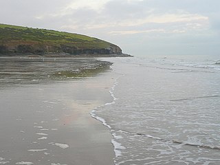
Telpyn Point is a headland on the Carmarthenshire coast, Wales. Set at the back of Carmarthen Bay, to its east are Marros Sands and to the west a beach which stretches in front of the Pembrokeshire village of Amroth. There are numerous sea caves in the quartzitic sandstone cliffs here. A path around the headland carries the Wales Coast Path. The Marros-Pendine Coast is protected as a 'mixed' Site of Special Scientific Interest, i.e. for its biological and geological interest. The good geological exposure of Carboniferous age rock strata at Telpyn Point has led to its name being given to the Telpyn Point Sandstone Formation, a sub-unit of the Marros Group, the modern scientific name for the Millstone Grit series of South Wales.
