
The A30 is a major road in England, running 284 miles (457 km) WSW from London to Land's End.

The Fosse Way was a Roman road built in Britain during the first and second centuries AD that linked Isca Dumnoniorum (Exeter) in the southwest and Lindum Colonia (Lincoln) to the northeast, via Lindinis (Ilchester), Aquae Sulis (Bath), Corinium (Cirencester), and Ratae Corieltauvorum (Leicester).

The A303 is a trunk road in southern England, running between Basingstoke in Hampshire and Honiton in Devon via Stonehenge. Connecting the M3 and the A30, it is part of one of the main routes from London to Devon and Cornwall. It is a primary A road throughout its length, passing through five counties.

East Devon is a local government district in Devon, England. Its council is based in the town of Honiton, although Exmouth is the largest town. The district also contains the towns of Axminster, Budleigh Salterton, Cranbrook, Ottery St Mary, Seaton and Sidmouth, along with numerous villages and surrounding rural areas.
Honiton is a market town and civil parish in East Devon, situated close to the River Otter, 17 miles (27 km) north east of Exeter in the county of Devon. Honiton has a population estimated at 11,822.

The A35 is a major road in southern England, connecting Honiton in Devon and Southampton in Hampshire. It is a trunk road for some of its length. Most of its route passes through Dorset and the New Forest. It originally connected Exeter and Southampton, the original A35 ran along what is now the A3052 joining the present road at Charmouth.
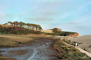
The River Otter is a river that rises in the Blackdown Hills just inside the county of Somerset, England near Otterford, then flows south through East Devon. It enters the English Channel at the western end of Lyme Bay, part of the Jurassic Coast, a UNESCO World Heritage Site. The Permian and Triassic sandstone aquifer in the Otter Valley is one of Devon's largest groundwater sources, supplying drinking water to 200,000 people.

Hemyock is a village and civil parish in Devon, England. It is about 8 miles north-west of Honiton and 5 miles (8 km) south of the Somerset town of Wellington. The 2011 Census recorded the parish's population as 1,519. Hemyock is part of the electoral ward of Upper Culm. The population of this ward at the above census was 4,039. The River Culm flows through Hemyock. Hemyock was the former home of the St Ivel dairy processing plant, formerly where the butter-spreads 'St Ivel Gold' and 'Utterly-Butterly' were produced before being moved to a factory in the north of England.

The Blackdown Hills National Landscape is a National Landscape along the Somerset-Devon border in south-western England, which were designated in 1991 as an Area of Outstanding Natural Beauty (AONB). In November 2023, it has become 'Blackdown Hills National Landscape' The area encompasses a set of hills of the same name.
Tiverton and Honiton is a constituency in Devon, England. The current MP is Richard Foord of the Liberal Democrats, elected at a by-election on 23 June 2022.

Cranbrook is a new town being developed in East Devon, England, which at the 2021 census, had a population of 6,743 residents across 8 "phases". However, the town is growing at a fast pace. It is located 9 kilometres east-north-east of the centre of Exeter, just north-west of the village of Rockbeare, between the B3174 road and the West of England Main Line railway. The civil parish was formed on 1 April 2015.

Orway is a small hamlet, approximately 1.5 miles squared, situated just on the edge of the Blackdown Hills in Devon, United Kingdom. It is located in the parish of Kentisbeare, near Cullompton.
Wilmington is a village between Axminster and Honiton in East Devon on the A35 road.

Clayhidon is a village and civil parish in Mid Devon, England. The parish church is St. Andrews. The parish is in the Blackdown Hills and its northern and eastern boundaries form part of the Devon – Somerset border. From the south-east it has boundaries with the Devon parishes of Upottery, Luppitt and Hemyock.
Yarcombe is a village and civil parish in the county of Devon, England, situated in the East Devon administrative district on the A30 road near the towns of Honiton and Chard. It is sited in the steep rolling meadows and ancient woods of the Yarty Valley on the south edge of the Blackdown Hills, an Area of Outstanding Natural Beauty. The population according to the 2011 census was 500.

Clyst Honiton is an English village and civil parish five miles from Exeter in the East Devon district, in the county of Devon. The church is St Michael and All Angels. Exeter International Airport which opened in 1938 is located on the outskirts of the village. The village was originally on the main A30 road from Exeter to Honiton but was bypassed in the 1990s. Another bypass to the east of the village linking the A30 to the new developments around Cranbrook opened in October 2013.

Cotleigh is a village and civil parish near Honiton in Devon, England. It is surrounded clockwise from the north by the parishes of Upottery, Stockland, Offwell and Monkton. In the 19th century the rector of Cotleigh Devon was also rector of Barwick, Somerset.

The River Yarty is a river in east Devon, England, near the boundary with Somerset and Dorset.

Sheldon is a village and civil parish in the East Devon district of the county of Devon in England. It is located in the Blackdown Hills, 6.5 miles (10.5 km) north-northwest of Honiton. In the 2011 UK census, its population was recorded as 189 persons, with an average (mean) age of 45.
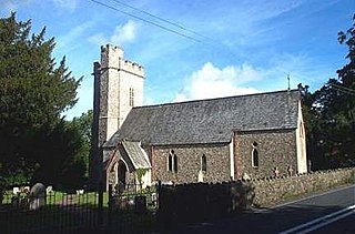
Monkton is a village and civil parish on the River Otter, about 2 miles north east of Honiton railway station, in the East Devon district, in the county of Devon, England. In 2011 the parish had a population of 169. The parish touches Cotleigh, Upottery, Honiton, Offwell and Luppitt. The parish is in the Blackdown Hills Area of Outstanding Natural Beauty.
