Jauja Province is a Peruvian province. It is one of the nine provinces of the Junín Region. To the north it borders with the Yauli, Tarma and Chanchamayo Provinces. To the east with the Satipo Province, to the south with the Concepción Province and to the west with the Lima Region. The capital of the Jauja Province is the city of Jauja. The city was founded by Francisco Pizarro as the first capital of Peru.

Tukumach'ay or Tuku Mach'ay is a mountain in the Paryaqaqa or Waruchiri mountain range in the Andes of Peru, about 5,350 metres (17,552 ft) high. It is situated in the Junín Region, Jauja Province, Canchayllo District. Tukumach'ay lies north-east of the Paryaqaqa, between the mountain Tunshu in the northwest and the lake Qarwaqucha in the southeast.
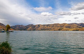
Lake Llacsacocha is a lake in Peru located in the Junín Region, Jauja Province, Canchayllo District. It lies northeast of a lake with the same name, southwest of Chalhuacocha and west of Mancacocha.
Mancacocha is a lake in Peru located in the Junín Region, Jauja Province, Canchayllo District. It lies east of the lake Llacsacocha, southwest of the lake Chalhuacocha and south of the mountain Chalhuacocha (possibly from Quechua Challwaqucha). Mancacocha is connected with the lake Chaquipaque southeast of it, situated at the foot of the mountain Chaquipaque.
Qarwaqucha is a lake in Peru located in the Junín Region, Jauja Province, Canchayllo District. It lies southeast of the peaks of Tunshu and Tukumach'ay and west of a lake named Wayllakancha (Huayllacancha). It belongs to the watershed of the Mantaro River.
Inka Mach'ay is an archaeological site in Peru. It is situated in the Huancavelica Region, Tayacaja Province, Ñahuimpuquio District.
Quillcay Machay or Qillqay Mach'ay is an archaeological site in Peru. It is situated in the Huánuco Region, Huamalíes Province, Singa District. The site is known for its rock paintings. It was declared a National Cultural Heritage of Peru by Resolución Directoral No. 533/INC on June 18, 2002.
Tampu Mach'ay or Tampumach'ay is an archaeological site in Peru. It is located in the Huancavelica Region, Tayacaja Province, Acostambo District. Tampu Mach'ay is situated near the main square of Acostambo at a height of about 3,400 metres (11,155 ft).
Hatun Machay is a rock forest with archaeological remains in Peru. It was declared a National Cultural Heritage by Resolución Directoral No. 944/INC-2010 on May 7, 2010. Hatun Mach'ay is situated on the western side of the Cordillera Negra in the Ancash Region, Recuay Province, Pampas Chico District, at a height of about 4,200 metres (13,780 ft).
Putkaqucha is a 5,236-metre-high (17,178 ft) mountain in the Waytapallana mountain range in Peru. It is located in the Junín Region, Concepción Province, Comas District, and in the Huancayo Province, on the border of the districts of El Tambo and Quilcas. Putkaqucha lies southwest of Puywan and northwest of Waytapallana and Ch'uspi.
Warmi Mach'ay is a mountain in the Andes of Peru, about 4,800 m (15,748 ft) high. It is situated in the Huancavelica Region, Huancavelica Province, Acobambilla District, and in the Junín Region, Huancayo Province, Chongos Alto District. Warmi Mach'ay lies between the lakes named Warmiqucha in the southeast and Quylluqucha in the northwest.
Saqra Mach'ay is a mountain in the Andes of Peru, about 4,600 m (15,100 ft) high. It is located in the Pasco Region, Daniel Alcides Carrión Province, Yanahuanca District. Saqra Mach'ay lies southwest of Puka Mach'ay.
Saqra Mach'ay is a mountain in the Andes of Peru, about 4,750 m (15,580 ft) high. It is located in the Huánuco Region, Pachitea Province, Panao District, and in the Pasco Region, Pasco Province, Ticlacayan District. Saqra Mach'ay lies northwest of the Waqurunchu mountain range, southeast of Wamanripayuq.
Qullqi Mach'ay is a mountain in the Andes of Peru which reaches an altitude of approximately 4,600 metres (15,092 ft). It is located in the Junín Region, Yauli Province, Carhuacayan District. Qullqi Mach'ay lies southwest of the lake named Waskhaqucha.
Suwa Mach'ay is a mountain in the Andes of Peru which reaches a height of approximately 4,400 m (14,400 ft). It lies in the Junín Region, Tarma Province, on the border of the districts of Huasahuasi and Palcamayo. Suwa Mach'ay lies southeast of a lake name Mamanqucha.
Uchku Mach'ay is a mountain in the Andes of Peru which reaches a height of approximately 4,000 m (13,000 ft). It lies in the Junín Region, Tarma Province, Tarma District.
Uqsha Mach'ay is a mountain in the Andes of Peru which reaches a height of approximately 4,800 metres (15,748 ft). It is located in the Junín Region, Jauja Province, on the border of the districts of Apata and Molinos.
Antikuna is a mountain in the Andes of Peru which reaches a height of approximately 4,800 metres (15,748 ft). It is located in the Junín Region, Jauja Province, Apata District. Antikuna lies south of Utkhulasu and T'uruqucha.
Waqutuyuq is a mountain in the Andes of Peru which reaches a height of approximately 4,200 metres (13,780 ft). It is located in the Junín Region, Jauja Province, Pomacancha District.
Puka Mach'ay is a mountain in Peru which reaches a height of approximately 4,600 m (15,100 ft). It is located in the Junín Region, Yauli Province, Morococha District.


