Related Research Articles

Rio de Janeiro, or simply Rio, is the capital of the state of the same name, Brazil's third most populous state, and the second most populous city in Brazil, after São Paulo. Listed by the GaWC as a beta global city, Rio de Janeiro is the sixth most populous city in the Americas. Part of the city has been designated as a World Heritage Site, named "Rio de Janeiro: Carioca Landscapes between the Mountain and the Sea", on 1 July 2012 as a Cultural Landscape.

Rio de Janeiro is one of the 27 federative units of Brazil. It has the second largest economy of Brazil, with the largest being that of the state of São Paulo. The state, which has 8.2% of the Brazilian population, is responsible for 9.2% of the Brazilian GDP.
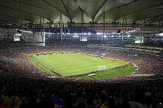
Maracanã Stadium, officially named Estádio Jornalista Mário Filho, is an association football stadium in Rio de Janeiro, Brazil. The stadium is part of a complex that includes an arena known by the name of Maracanãzinho, which means "The Little Maracanã" in Portuguese. Owned by the Rio de Janeiro state government, the stadium is now managed by the clubs Flamengo and Fluminense. It is located at the Maracanã neighborhood, named after the Rio Maracanã, a now canalized river in Rio de Janeiro.

Duque de Caxias is a city on Guanabara Bay and part of Rio de Janeiro metropolitan area, southeastern Brazil.
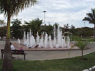
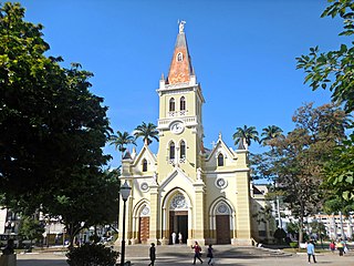
Volta Redonda is the name of a municipality in the Rio de Janeiro state of Brazil with an area of 182.81 km2, located from 350m to 707m above the sea level and with a population of 273,988 inhabitants. The area around the city has nearly 700,000 km2. Its name is due to the round shape of a curve in the Paraíba do Sul river around which the city was built.
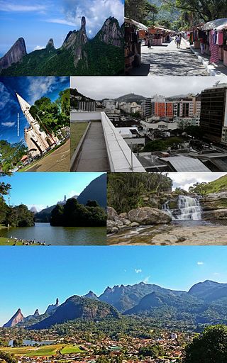
Teresópolis is a Brazilian municipality located in the state of Rio de Janeiro, in a mountainous region known as Região Serrana. The Serra dos Órgãos National Park lies partly within the city limits. The city is known as the home of the Brazil national football team, since it hosts CBF's training ground at Granja Comary.
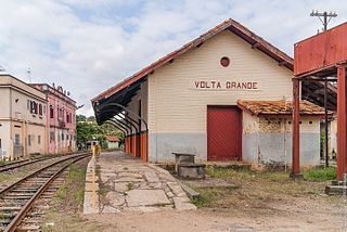
Volta Grande is a Brazilian municipality in the state of Minas Gerais. As of 2020 its population was estimated to be 5,261.

Nova Iguaçu is a municipality in Rio de Janeiro state in Brazil.

Rodrigo de Freitas Lagoon is a lagoon in the district of Lagoa in the Zona Sul area of Rio de Janeiro. The lagoon is connected to the Atlantic Ocean, allowing sea water to enter by a canal along the edge of a park locally known as Jardim de Alah.

Ipatinga is a municipality in eastern Minas Gerais state, Brazil. The city was founded on 29 April 1964 and covers a total area of 164.8 km2 (63.6 sq mi). Its population is 267,333 as of 2021. It is part of the Vale do Aço metropolitan area.
Caratinga is a municipality in eastern Minas Gerais state, Brazil. The population in 2020 was 92,603 inhabitants and the total area of the municipality was 1,251 km2. The elevation is 578 meters above sea level, with maximum elevation of 1,516 m in the Serra do Rio Preto and 330 m at the mouth of the Córrego Boachá.

The Baixada Fluminense is a region in the state of Rio de Janeiro, in southeastern Brazil. It is located on Guanabara Bay, between Rio de Janeiro to the south and the Serra dos Órgãos range of hills to the north.

Concordia was a steel-hulled barquentine that was built in Poland in 1992 for the West Island College, Montreal, Canada. She served as a sail training ship until she capsized and sank on 17 February 2010.

Maricá is a municipality located in the Brazilian state of Rio de Janeiro.
Paraíba do Sul is a municipality located in the Brazilian state of Rio de Janeiro. Its population was 44,518 (2020) and its area is 581 km².

Baependi is a Brazilian municipality located in the state of Minas Gerais.
The Macabuzinho River is a river of Rio de Janeiro state in southeastern Brazil.
The Mazomba River is a river of Rio de Janeiro state in southeastern Brazil.

Ilha das Cobras is an island located within Guanabara Bay in the city and state of Rio de Janeiro, Brazil. It is east of the neighborhood Guanabara. It is home to the Arsenal de Marinha do Rio de Janeiro base of the Brazilian Navy.

Deutsche Schule Rio de Janeiro is a German international school in Botafogo, Rio de Janeiro, Brazil. It serves levels Kindergarten/Educação Infantil through klasse 12/turma 12. It is located in the former US Embassy.
References
Coordinates: 22°53′S42°20′W / 22.883°S 42.333°W