Chin State is a state in western Myanmar. The 36,019-square-kilometre (13,907 sq mi) Chin State is bordered by Sagaing Division and Magway Division to the east, Rakhine State to the south, Bangladesh to the south-west, and the Indian states of Mizoram to the west and Manipur to the north. The population of Chin state is about 478,801 in 2014 census. The capital of the state is Hakha. The state is a mountainous region with few transportation links. Chin State is sparsely populated and remains one of the least developed areas of the country. Chin State has the highest poverty rate of 73% as per the released figures from the first official survey. The official radio broadcasting dialect of Chin is Falam. There are 53 different subtribes and languages in Chin State. There are nine townships in Chin State. Hakha, Thantlang, Falam, Tedim, Tonzang, Matupi, Mindat, Kanpetlet and Paletwa townships. In 1896, it became a part of Pakokku Hill Tracts Districts of British Burma until January 4, 1948. Only Paletwa township became a part of Arakan Hill Tracts District of British Burma.

The Division of Cowper is an Australian electoral division in the state of New South Wales.
Orara River, a perennial stream of the Clarence River catchment, is located in the Northern Rivers district of New South Wales, Australia.

Ulong is a small town located on the Mid North Coast region, neighbouring the Northern Tablelands, of New South Wales, Australia.

Myall River, an open semi-mature brackish freshwater barrier estuary of the Mid-Coast Council system, is located in the Mid North Coast region of New South Wales, Australia.
Dakabin is a locality in Moreton Bay Region, Queensland, Australia. It is 26 kilometres (16 mi) north of Brisbane CBD.
Matupi Township is a township of Mindat District in the Chin State of Burma (Myanmar). Matupi is the administrative center for the township.

Matupi is a town in the Matupi Township of Chin State in western Myanmar. There are 6 major Chin tribes living in Matupi; the Matu, Mara, Dai, Zotung, Lautu and Khumi tribes.

Camden Haven is a parish in the Mid North Coast region of New South Wales, Australia, approximately 30 km south of the major regional centre of Port Macquarie. The harbour is located where the Camden Haven River empties into the Tasman Sea.

Titan was a floating crane that operated in Sydney Harbour from 1919 until 1991. She was fabricated in Carlisle in the United Kingdom, then sent to Cockatoo Island Dockyard in Sydney for assembly, before entering service with the Royal Australian Navy (RAN).
Warnes River, a perennial stream of the Macleay River catchment, is located in the Northern Tablelands district of New South Wales, Australia.
The Agnes was a wooden carvel cutter built in 1853 in Sydney Harbour. It was lost at Newcastle Bight, New South Wales, on 13 July 1860, when it was blown ashore in a gale whilst travelling between Newcastle and Sydney. The ship master was Henry Hardy.

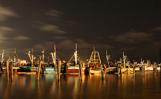
Royapuram fishing harbour, also known as Chennai fishing harbour or Kasimedu fishing harbour, is one of the major fishing grounds for catching fishes and crustaceans located at Kasimedu in the Royapuram area of Chennai, India. The harbour is located north of the Chennai Port and is under the administrative control of the Chennai Port Trust. The harbour is also a shipbuilding facility, chiefly building fishing boats. The nearest railway station is the Royapuram Railway Station.
Kalang River, a perennial river of the Bellinger River catchment, is located in the Mid North Coast region of New South Wales, Australia.
Thaiphum is a Southern Kuki-Chin language spoken in 4 villages of Matupi township, Chin State, Burma.
The Georges Creek, a perennial stream that is part of the Macleay River catchment, is located in the Northern Tablelands and Mid North Coast regions of New South Wales, Australia.

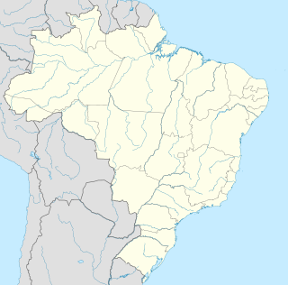
Santo Antônio de Matupi, also called Km 180, is a small town on the Trans-Amazonian Highway (BR-230) in the state of Amazonas, Brazil. The economy mainly depends on timber extraction and cattle farming. Compared to other communities in the state it is relatively prosperous, but there are crimes related to drugs, vehicle theft and so on.

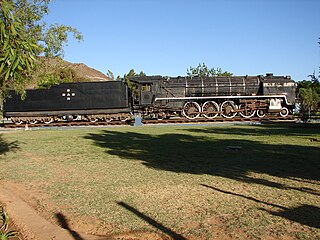
The South African type EW tender was a steam locomotive tender.

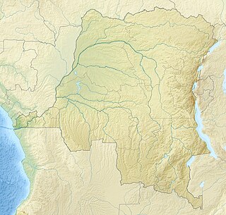
Matupi Cave is a cave in the Mount Hoyo massif of the Ituri Rainforest, Democratic Republic of the Congo and northeastern Zaire, where archaeologists have found evidence for Later Stone Age human occupation spanning over 40,000 years. The cave has some of the earliest evidence in the world for microlithic tool technologies.


