History

Mauku was the first settlement in the Franklin area to have a church. St Bride's Church was opened on the 14th, July, 1861. [2] : 35
The Mauku Historical Cemetery is located 4 kilometres (2.5 mi) north of the settlement. [3]
Mauku is a locality located 10 km (6.2 mi) west of Pukekohe. [1]

Mauku was the first settlement in the Franklin area to have a church. St Bride's Church was opened on the 14th, July, 1861. [2] : 35
The Mauku Historical Cemetery is located 4 kilometres (2.5 mi) north of the settlement. [3]
Franklin District was a New Zealand territorial authority that lay between the Auckland metropolitan area and the Waikato Plains. As a formal territory, it was abolished on 31 October 2010 and divided between Auckland Council in the Auckland Region to the north and Waikato and Hauraki districts in the Waikato region to the south and east. The Auckland portion is now part of the Franklin Ward, which also includes rural parts of the former Manukau City.
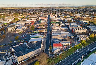
Pukekohe is a town in the Auckland Region of the North Island of New Zealand. Located at the southern edge of the Auckland Region, between the southern shore of the Manukau Harbour and the mouth of the Waikato River. The hills of Pukekohe and nearby Bombay Hills form the natural southern limit of the Auckland region. Pukekohe is located within the political boundaries of the Auckland Council, following the abolition of the Franklin District Council on 1 November 2010.
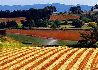
Puni is a rural locality in the Franklin ward of Auckland in the North Island of New Zealand. It is predominantly a dairy farming and market gardening area. The main type of crops grown are potatoes, carrots, and onions.

Waiuku is a rural town in the Auckland Region of New Zealand. It is located at the southern end of the Waiuku River, which is an estuarial arm of the Manukau Harbour, and lies on the isthmus of the Āwhitu Peninsula, which extends to the northeast. It is 40 kilometres southwest of Auckland city centre, and 12 kilometres north of the mouth of the Waikato River.

The Bombay Hills are a range of hills to the south of Auckland, New Zealand. Though only a small and seemingly insignificant range of hills, they lie at the southern boundary of the Auckland region, and serve as a divide between Auckland and the Waikato region. There is a 19th-century settlement, Bombay, on the old main road south of Auckland, the Great South Road.
Ramarama, previously known as Sheppards Bush, is a small community at the far south of the Auckland Region in New Zealand's North Island, located just to the north of the Bombay Hills. Ramarama has an off-ramp at exit 466 on the motorway south of Auckland. The suburb is effectively sliced in two by the motorway, this section of which was constructed in 1978.

Ostend is a settlement on Waiheke Island, in New Zealand's Hauraki Gulf within the Auckland Region. Ostend is located in the west of the island, on and around a small peninsula which juts into Putiki Bay, one of two large indentations in the island's southwest coast. The southwest of the island contains much of the island's population, with Ostend being located immediately to the east of the settlement of Surfdale, and to the southwest of Onetangi.
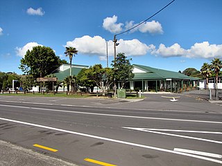
Waimauku is a small locality in the Auckland Region of New Zealand. It comes under the jurisdiction of Auckland Council, and is in the council's Rodney ward. Waimauku is approximately 4 kilometres west of Huapai on State Highway 16 at the junction with the road to Muriwai Beach. Helensville is 16 km to the north-west. Waimauku is a Māori word which is literally translated as wai: stream and mauku: varieties of small ferns.

Pukekohe railway station is a temporarily closed railway station in Pukekohe, New Zealand. It is the southern terminus of the Southern Line of the Auckland railway network.
The Defence of Pukekohe East was an action during the Invasion of the Waikato, part of the New Zealand Wars. On 13 September and 14 September 1863, 11 settlers and 6 militia men inside a half-completed stockade around the Pukekohe East church held off a Māori taua or war party of approximately 200 men from Ngāti Maniapoto and Ngāti Pou iwi, until they were relieved by detachments of the 18th, 65th and 70th Regiments. In a series of actions around the stockade the taua sustained 20% casualties and retreated.

Karaka is a small rural area in the south of Auckland, New Zealand. Formerly part of Franklin District and under the authority of the Franklin District Council, it is now part of Auckland Council following the amalgamation of the Auckland region's councils.

Pukekohe Park Raceway was a former FIA Grade 3 car racing track that was situated on the outside of the Pukekohe Park Thoroughbred Racetrack, located in the surrounds of Pukekohe.
Port Waikato is a New Zealand parliamentary electorate which existed for four parliamentary terms from 1996 to 2008, and was recreated by the 2019/20 electoral redistribution ahead of the 2020 election. It was held by Bill Birch for one term, and by Paul Hutchison for the following three terms. From 2020, it was held by Andrew Bayly. All of these were members of the National Party.
Pukekohe Intermediate School is a New Zealand intermediate school located in the rural community of Pukekohe, Auckland. It primarily receives students from Pukekohe Hill, Pukekohe Valley, Pukekohe East, Puni, Mauku and Patumahoe primary schools.
Paerata is a small settlement immediately to the north of Pukekohe, in the North Island of New Zealand. It is located on State Highway 22 some 10 kilometres (6.2 mi) south of the Manukau Harbour. Wesley College is located close to the northern edge of Paerata.

Buckland is a small town in the Franklin ward of Auckland Regional Council, on the south-east side of Pukekohe, between Pukekohe and Tuakau, and on the northern boundary of Waikato District. It is part of the Pukekohe urban area.
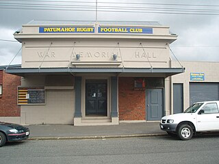
Patumāhoe is a small town of Auckland, New Zealand. It is in the Franklin Ward of Auckland Council.
The Counties Manukau cricket team represents the southern part of the Auckland Region, including the Auckland outer suburbs of Manurewa, Manukau and Papakura and the surrounding rural areas, and including Tuakau in the Waikato region. It competes in the Hawke Cup. Its base is in Manurewa, where its home ground is Weymouth Oval.
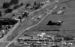
Paerātā railway station is a railway station under construction in Auckland, New Zealand. It is due to open in 2025 as part of the Auckland railway electrification project. It will serve the Paerata area, linking with the new Paerata Rise housing development. The station will be located on the existing North Island Main Trunk railway line, adjacent to the planned eastern extent of the development.

The South Auckland volcanic field, also known as the Franklin Volcanic Field, is an area of extinct monogenetic volcanoes around Pukekohe, the Franklin area and north-western Waikato, south of the Auckland volcanic field. The field contains at least 82 volcanoes, which erupted between 550,000 and 1,600,000 years ago.