The Neptune Range is a mountain range, 70 nautical miles long, lying west-southwest of Forrestal Range in the central part of the Pensacola Mountains, Antarctica. The range comprises Washington Escarpment with its associated ridges, valleys and peaks, the Iroquois Plateau, the Schmidt and the Williams Hills.

The Prince Charles Mountains are a major group of mountains in Mac. Robertson Land in Antarctica, including the Athos Range, the Porthos Range, and the Aramis Range. The highest peak is Mount Menzies, with a height of 3,228 m (10,591 ft). Other prominent peaks are Mount Izabelle and Mount Stinear. These mountains, together with other scattered peaks, form an arc about 420 km (260 mi) long, extending from the vicinity of Mount Starlight in the north to Goodspeed Nunataks in the south.

KTBT is a Top 40 (CHR) radio station, serving the Tulsa area. The iHeartMedia outlet broadcasts with an ERP of 27 kW and is licensed to Broken Arrow, Oklahoma. The station can be heard as far north as southeast Kansas. Its studios are located at the Tulsa Event Center in Southeast Tulsa and its transmitter site is near Lookout Mountain in southwest Tulsa.

Talarrubias is a municipality located in the province of Badajoz, Extremadura, Spain. According to the 2005 census (INE), the municipality has a population of 3216 inhabitants.

Brahojos de Medina is a municipality located in the province of Valladolid, Castile and León, Spain. According to the 2004 census (INE), the municipality has a population of 166 inhabitants.

Liv Glacier is a steep valley glacier, 40 nautical miles long, emerging from the Antarctic Plateau just southeast of Barnum Peak and draining north through the Queen Maud Mountains to enter Ross Ice Shelf between Mayer Crags and Duncan Mountains. It was discovered in 1911 by Roald Amundsen, who named it for the daughter of Fridtjof Nansen.

Municipality Municipality is the first municipal section of Hernando Siles Province in the Chuquisaca Department in Bolivia. Its seat is Monteagudo.
The Berlengas River is a river of Piauí state in northeastern Brazil.

Quipapá is a city located in the state of Pernambuco, Brazil. Located at 186 km away from Recife, capital of the state of Pernambuco. Has an estimated population of 26,175 inhabitants.

Apéndice Island, also known as Isla Telegrafista Rivera or Sterneck Island, is an island in Hughes Bay lying north of Renzo Point on Relyovo Peninsula and west of Sucia Point on Sladun Peninsula, Graham Land in Antarctica. The name appears on an Argentine government chart of 1957. It forms part of the Cierva Point and offshore islands Important Bird Area and ASPA 134.

The Marshall Archipelago is an extensive group of large ice-covered islands within the Sulzberger Ice Shelf off Antarctica. Several of the islands were discovered and plotted by the Byrd Antarctic Expeditions and by the United States Antarctic Service (1939–41), all led by Admiral Richard E. Byrd. The full extent of the archipelago was mapped by the United States Geological Survey from surveys and U.S. Navy air photos (1959–65). The name was proposed by Admiral Byrd for General of the Army George C. Marshall, who made financial contributions as a private individual and also, on the same basis, provided advisory assistance to the Byrd expedition of 1933–35.

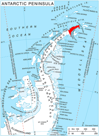
Tait Glacier is a glacier about 4 nautical miles (7 km) long on the southwest coast of James Ross Island, flowing southwest into Carlsson Bay. Probably first seen by Dr. Otto Nordenskjold in 1903. Surveyed by Falkland Islands Dependencies Survey (FIDS) in 1945. Named by United Kingdom Antarctic Place-Names Committee (UK-APC) for Murdo F. Tait, FIDS meteorological observer at Hope Bay in 1952 and 1953.
Schmidt Hills is a group of rock hills, 15 nautical miles long, lying north of Childs Glacier and west of Roderick Valley in the Neptune Range of the Pensacola Mountains, Antarctica.

Sjogren Glacier is a glacier 12.5 miles (20 km) long in the south part of Trinity Peninsula, flowing southeast from Detroit Plateau in between Aldomir Ridge and Hazarbasanov Ridge to enter Prince Gustav Channel at the head of Sjögren Inlet, west of Royak Point. Discovered in 1903 by the Swedish Antarctic Expedition under Nordenskjold. He named it Sjogren Fiord after a patron of the expedition. The true nature of the feature was determined by the Falkland Islands Dependencies Survey (FIDS) in 1945.

Luke Glacier is a glacier at least 15 nautical miles (28 km) long, flowing northwest into the head of Leroux Bay on the west coast of Graham Land, Antarctica. It is surmounted by Mount Chevreux on the south, Mount Perchot on the southwest and Mount Radotina on the northeast. The glacier was first sighted and roughly surveyed in 1909 by the Fourth French Antarctic Expedition. It was resurveyed in 1935–36 by the British Graham Land Expedition and later named for George Lawson Johnston, 1st Baron Luke of Pavenham, Chairman of Bovril Ltd, who contributed toward the cost of the expedition.
Langley Peak is a peak 3 nautical miles (6 km) east of Curtiss Bay, rising above the west end of Wright Ice Piedmont in Graham Land, Antarctica. It was mapped from air photos taken by Hunting Aerosurveys (1955–57), and was named by the UK Antarctic Place-Names Committee for American mathematician Samuel P. Langley, one time Secretary of the Smithsonian Institution, and designer of the first satisfactory powered model airplane, in 1896.
Batinding-Diémé is a settlement in Senegal.

Chikankata District is a district of Southern Province, Zambia. It was separated from Mazabuka District in December 2011.


