Mayne Preceptory

Last updated

Coordinates: 50°40′40.627″N2°23′1.741″W / 50.67795194°N 2.38381694°W / 50.67795194; -2.38381694

Geographic coordinate system Coordinate system

A geographic coordinate system is a coordinate system that enables every location on Earth to be specified by a set of numbers, letters or symbols. The coordinates are often chosen such that one of the numbers represents a vertical position and two or three of the numbers represent a horizontal position; alternatively, a geographic position may be expressed in a combined three-dimensional Cartesian vector. A common choice of coordinates is latitude, longitude and elevation. To specify a location on a plane requires a map projection.

Mayne Preceptory was a medieval house of Knights Hospitaller in Dorset, England, which caused the name of the settlement to change from Domesday-era Maine (one of two named Maine in Cullifordtree Hundred [1] ) to Friar Mayne by the mid 14th century.

Knights Hospitaller Western Christian military order

The Order of Knights of the Hospital of Saint John of Jerusalem, also known as the Order of Saint John, Order of Hospitallers, Knights Hospitaller, Knights Hospitalier or Hospitallers, was a medieval and early modern Catholic military order. It was headquartered in the Kingdom of Jerusalem, on the island of Rhodes, in Malta and St Petersburg.

Dorset County of England

Dorset is a county in South West England on the English Channel coast. The ceremonial county comprises the unitary authority areas of Bournemouth, Christchurch and Poole and Dorset. Covering an area of 2,653 square kilometres (1,024 sq mi), Dorset borders Devon to the west, Somerset to the north-west, Wiltshire to the north-east, and Hampshire to the east. The county town is Dorchester which is in the south. After the reorganisation of local government in 1974 the county's border was extended eastward to incorporate the Hampshire towns of Bournemouth and Christchurch. Around half of the population lives in the South East Dorset conurbation, while the rest of the county is largely rural with a low population density.

The preceptory was established between 1290 and 1338. It declined in activity until 1533, where it began leasing its bailiwick to provide stipends for rectories, vicarages and the larger preceptories in other locations.

A bailiwick is usually the area of jurisdiction of a bailiff, and once also applied to territories in which a privately appointed bailiff exercised the sheriff's functions under a royal or imperial writ. The word is now more generally used in a metaphorical sense, to indicate a sphere of authority, experience, activity, study, or interest. A bailiwick was also the territorial division of the Teutonic Order. Here, various “Komtur(en)” formed a Ballei province.

Its lands were forfeited to the crown at the Dissolution of the Monasteries in the early 16th century and were eventually sold. Its location was within modern Broadmayne parish.

Broadmayne village in United Kingdom

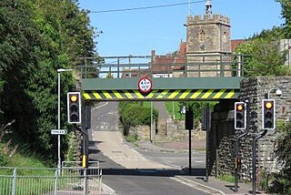
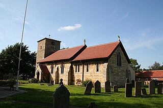
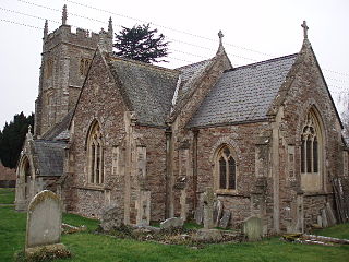
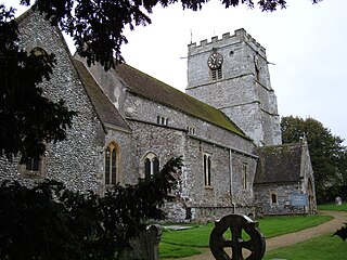
Broadmayne is a village in the English county of Dorset. It lies two miles south-east of the county town Dorchester. The A352 main road between Dorchester and Wareham passes through the village. In the 2001 Census the population of the village was 1,864, reducing to 1,204 at the 2011 Census. There is an electoral ward of the same name whose population at the above census was 1,870. Village facilities and services include a Post Office, a clinic and a public house. There are two churches in the village, both of which were redesigned by Thomas Hardy. The parish church of St. Martin dates from the 13th century and has a notable south tower.

Related Research Articles

Fordingbridge town in the New Forest District of Hampshire, England

Fordingbridge is a town and broader civil parish with a population of 6,000 on the River Avon in the New Forest District of Hampshire, England, near to the Dorset and Wiltshire borders and on the edge of the New Forest, with museum and a late medieval 7-arch bridge. It is 81 miles (130 km) southwest of London, and 10 miles (16 km) south of the city of Salisbury. Fordingbridge is a former market town. The Avon Valley Path passes through the town. The town excluding linear settlement Sandleheath has a density of 30.2 persons per hectare.

West Knighton, Dorset village in the United Kingdom

West Knighton is a village and civil parish in south Dorset, England, situated 3 miles (4.8 km) southeast of the county town Dorchester. It has an 11th-century church and a village pub. In the 2011 census the civil parish had a population of 375.

Templecombe village in the United Kingdom

Templecombe is a village in Somerset, England, situated on the A357 road five miles south of Wincanton, twelve miles east of Yeovil, and 30 miles west of Salisbury. The village has a population of 1,560. Along with the hamlet of Combe Throop it forms the parish of Abbas and Templecombe.

Eagle, Lincolnshire village in United Kingdom

Eagle is a village in the North Kesteven district of Lincolnshire, England. It is situated 7 miles (11 km) south-west from Lincoln and 2 miles (3.2 km) east from North Scarle. Eagle is part of the civil parish of Eagle and Swinethorpe. The population of the civil parish taken at the 2011 census was 793.

Durston village in the United Kingdom

Durston is a village and civil parish in Somerset, England, situated on the A361 road 5 miles (8.0 km) north east of Taunton and 6 miles (9.7 km) south of Bridgwater in the Taunton Deane district. The parish lies on undulating ground between the lowest slopes of the Quantock Hills and the valley of the River Tone at the Curry and Hay Moors. The village has a population of 136.

Brimpton a village located in West Berkshire, United Kingdom

Brimpton is a mostly rural village and civil parish in West Berkshire, England. The village occupies a few square miles of land between the Kennet and Avon Canal, a long tributary the Enborne which is used as part of the Hampshire boundary and the winding slopes of an escarpment in the far south-east, beyond the Enborne which is almost contiguous with the larger settlement of Baughurst a wood-buffered part of Tadley post town. This high common field contains five round barrows from the period of the Heptarchy in Anglo Saxon England.

Aslackby Preceptory

Aslackby Preceptory in Lincolnshire lay to the south-east of Aslackby Church. Until about 1891 a tower, possibly of the preceptory church, together with a vaulted undercroft, survived as part the Temple farmhouse. Temple farmhouse was subsequently rebuilt and a 15th-century window and a stone pinnacle remain in the garden

Heather, Leicestershire human settlement in United Kingdom

Heather is a village west of Ibstock in North West Leicestershire, England. The population of the civil parish was 949 at the 2001 census reducing to 920 at the 2011 census. In the Domesday Book of 1086, its name is recorded as Hadre, meaning "the heathland".

Aslackby and Laughton civil parish in Lincolnshire

Aslackby and Laughton is a civil parish in the South Kesteven district of Lincolnshire, England. According to the 2001 census the parish had a population of 243, in 102 households. increasing slightly to 251 in 118 households at the 2011 census. It consists of the village of Aslackby, the hamlet of Laughton, and scattered farms.

North Baddesley village in United Kingdom

North Baddesley is a large village and civil parish in Hampshire, England. It is situated 3 mi (5 km) east of the town of Romsey and 6 mi (10 km) north of Southampton. It occupies an area of approximately 9.15 km2 (3.53 sq mi), and is home to a population of just over 10,000 people, reducing to 7,000 at the 2011 Census. It is located in the Test Valley; a river famous for trout fishing. North Baddesley is one of the largest villages in the South of England.

Melchbourne Preceptory was a priory in Melchbourne, Bedfordshire, England. It was established in the 12th century and disestablished around 1550.

Locko Preceptory

Locko Preceptory was a Preceptory of the Military and Hospitaller Order of Saint Lazarus of Jerusalem, situated just over a mile north of Spondon, Derbyshire; the site is today part of the Locko Park estate. It is the only recorded Lazarite Preceptory in England.

Cranborne Priory Grade I listed priory in the United Kingdom

Cranborne Priory was a priory in Cranborne in Dorset, England. The priory church survives as Cranborne's parish church, the Church of St Mary and St Bartholomew, and is a Grade I listed building, with parts of the building dating back to the 12th century.

Great Limber Preceptory, Limber Magna was a Camera (farm) of the Knights Templar and later the Knights Hospitaller in the village of Great Limber, Lincolnshire, England.

Hammoon village in the United Kingdom

Hammoon is a small village and civil parish in North Dorset, England, sited on a river terrace of alluvial silt by the River Stour, about 2 miles (3.2 km) east of the small town of Sturminster Newton. Its name is derived from the Old English ham, meaning dwelling, and the surname of the Norman lord of the manor. In 2001 the parish had 19 households and a population of 49. In 2013 the estimated population of the parish was 40.

Heather Preceptory

Heather Preceptory was a preceptory of the Knights Hospitaller, established in the village of Heather, Leicestershire, United Kingdom.

Witham Preceptory

The site of the former preceptory at Temple Hill, South Witham. It 'has been largely under pasture' since the Knights Templar left in 1308.]] Withham Preceptory, one of the smallest Knights Templar preceptories in England, was founded, before 1164, at Temple Hill, near South Witham, Lincolnshire, and was abandoned in the early 14th century.

References