Mayow Park

Last updated
Mayow Park
Mayow Park - geograph.org.uk - 840960.jpg
Mayow Park is the oldest municipal park in Lewisham photo: Stephen Craven, geograph.org.uk
Typepublic park
Location Sydenham, London, England
Coordinates 51°25′47″N0°02′57″W / 51.42986°N 0.049214°W / 51.42986; -0.049214 Coordinates: 51°25′47″N0°02′57″W / 51.42986°N 0.049214°W / 51.42986; -0.049214
Area7 hectares (17 acres)
Created1 June 1878 (1 June 1878)
Operated byLondon Borough of Lewisham
Open8am-sunset
StatusOpen year round
Website lewisham.gov.uk

Mayow Park, formerly known as Sydenham Recreation Ground, is a municipal park in London Borough of Lewisham. Located on Mayow Road in Sydenham, south east London, it is the borough's oldest park and its second oldest public open space after Blackheath. [1] The park has a Green Flag Award. [2]

London Borough of Lewisham Borough in United Kingdom

Lewisham is a London borough in South London, England and forms part of Inner London. The principal settlement of the borough is Lewisham. The local authority is Lewisham London Borough Council and it is based in Catford. Lewisham is also well known for its high school exclusion rates, in 2018 Lewisham had the 3rd highest school exclusion rates in the United Kingdom.

Sydenham, London area in the London Borough of Lewisham, England

Sydenham is a district within the south east London Boroughs of Lewisham, Bromley and Southwark. Prior to the creation of the County of London in 1889, Sydenham was located in Kent, bordering Surrey. Historically, the area was very affluent, with the Crystal Palace being relocated to Sydenham Hill in 1854. Today Sydenham is a diverse area, with a population of 28,378 and borders Forest Hill, Dulwich, Crystal Palace, Penge, Beckenham, Catford and Bellingham.

Blackheath, London inner suburban area of South East London, England

Blackheath is a district of south east London, England straddling the Royal Borough of Greenwich and the London Borough of Lewisham. It has borders with parts of London hubs Lewisham and Greenwich and other borders with Lee, Kidbrooke and a small part of Deptford.

Contents

History

The park opened in 1878 as Sydenham Recreation Ground. It was built on a site owned by the Mayow family, which at one time owned most of the land between Sydenham Road and Perry Vale. [1]

Perry Vale Neighbourhood of London

Perry Vale is a neighbourhood and electoral ward in the London Borough of Lewisham. It is 10.5 km (6.5 mi) southeast of Charing Cross and located near Forest Hill to the east of Forest Hill railway station, where the railway line forms the western boundary. The ward is named after the main road Perry Vale which passes through, this road is part of the B227 road which is called Perry Rise further to the south. The electoral ward has existed since the London Borough of Lewisham revised its wards and ward boundaries in 2002.

Reverend William Taylor Jones, headmaster of Sydenham College, played a key role in finding both the funding and the land for the park. His campaign began with an 1875 letter to the local newspaper bemoaning the lack of public space in the borough for recreation and implying that this was having a negative impact on the morals of the population – particularly young people and the poor. Six months later, when an editorial in the paper questioned why so little progress had been made, Taylor Jones discussed the two major issues of funding and finding suitable land. [3]

Taylor Jones formed a committee of influential local residents, including Frederick Horniman and Rev. Augustus Legge and, by February 1876, he was able to announce that Mayow Wynell Adams (then squire of Sydenham) was able to offer a parcel of land for around half its market value. [1] [3]

Frederick John Horniman British politician

Frederick John Horniman was an English tea trader and founder of the Horniman Museum in London.

Augustus Legge British bishop

Augustus Legge was Bishop of Lichfield from 1891 until 1913.

It took a further two years of negotiations and fundraising before the park opened as Sydenham and Forest Hill Public Recreation Ground in June 1878. [3] Taylor Jones’ role in its establishment is commemorated with a drinking fountain, erected after a public subscription. [1]

Layout and notable features

Covering an area of 7 hectares (17 acres), the site is notable for its mature English oak trees. There are at least 20, including pollarded specimens, that are older than the park. It has been described as Lewisham’s finest collection of mature oak trees apart from those in Beckenham Place Park. Other notable trees include araucaria, ginkgo and holm oak. [1]

<i>Quercus robur</i> species of plant

Quercus robur, commonly known as common oak, pedunculate oak, European oak or English oak, is a species of flowering plant in the beech and oak family, Fagaceae. It is native to most of Europe west of the Caucasus. The tree is widely cultivated in temperate regions and has escaped into the wild in scattered parts of China and North America.

Pollarding technique of severe pruning of trees

Pollarding, a pruning system involving the removal of the upper branches of a tree, promotes a dense head of foliage and branches. In ancient Rome, Propertius mentioned pollarding during the 1st century BCE. The practice occurred commonly in Europe since medieval times, and takes place today in urban areas worldwide, primarily to maintain trees at a determined height.

Beckenham Place Park

Beckenham Place Park is a large park located near Beckenham in the London Borough of Lewisham. It lies close to the border with London Borough of Bromley. The Palladian-style mansion that gave the park its name now serves as a community centre and cafe.

The park includes a bowling green, two tennis courts, children’s playground, cafeteria, nature reserve and meadow area. [2]

Park initiatives

Friends of Mayow Park was established in 1993 and is a group of park users that works with London Borough of Lewisham to improve the landscape and community resources of the park. [1] Recent projects include renovation of flowerbeds and installation of a new pathway near the Mayow Road end of the park, and the planting of a community orchard and fruit hedgerow. [4] [5]

There is also a community garden, known as Grow Mayow, located on a former park keeper’s depot, that offers opportunities to get involved with gardening and growing produce. [6]

Related Research Articles

Catford district in south London, England

Catford is a district of south east London, England, and the administrative centre of the London Borough of Lewisham. It is southwest of Lewisham itself, mostly in the Rushey Green and Catford South wards.

Honor Oak human settlement in United Kingdom

Honor Oak is an inner suburban area principally of the London Borough of Lewisham, with part in the London Borough of Southwark. It is named after the oak tree on One Tree Hill that Elizabeth I is reputed to have picnicked under.

Forest Hill, London suburb of South East London, England

Forest Hill is a district of the London Borough of Lewisham in south east London, England, on the South Circular Road, which is home to the Horniman Museum.

Lewisham West (UK Parliament constituency) Parliamentary constituency in the United Kingdom, 1918-2010

Lewisham West was a borough constituency in south-east London represented in the House of Commons of the Parliament of the United Kingdom. It elected one Member of Parliament (MP) by the first past the post system of election from 1918, until it was abolished for the 2010 general election.

Parks and open spaces in the London Borough of Croydon

The London Borough of Croydon has over 120 parks and open spaces within its boundaries, ranging from the 200 acre (80ha) Selsdon Wood Nature Reserve to many recreation grounds and sports fields scattered throughout the Borough. Croydon covers an area of 86.52 km², the 256th largest district in England. Croydon's physical features consist of many hills and rivers that are spread out across the borough and into the North Downs, Surrey and the rest of South London. Some of the open spaces in Croydon form part of the well-known London LOOP walks where the first section was opened on 3 May 1996 with a ceremony on Farthing Downs in Coulsdon. As a borough in Outer London it also contains some open countryside in the form of country parks. Croydon Council is associated with several other boroughs who are taking part in the Downlands Countryside Management Project. These boroughs are Sutton; and by Surrey County Council; the City of London Corporation; the Surrey districts of Reigate and Banstead and Tandridge; and the Countryside Agency. An additional partner is Natural Britain.

Parks and open spaces in the London Borough of Lewisham

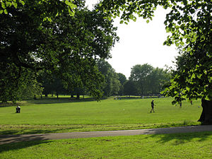
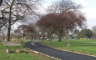
Lewisham parks and open spaces are part of the "green lung" of London and include a diverse range of sites, from small urban parks and gardens to one of the most historic natural landscapes in Greater London at Blackheath. While overall control rests with London Borough of Lewisham, management of borough-owned parks and their facilities is contracted out to Glendale Grounds Management.

Edgwarebury Park is a 22-hectare park in Edgware in the London Borough of Barnet. It was once part of the manor of Earlsbury, which was first mentioned in 1216. In the later Middle Ages it was owned by All Souls College, Oxford, and there is still evidence of the older landscape of fields and woodland. Hendon Rural District and Middlesex County Council bought the land in two parts in 1929 and 1932, and the park opened in the latter year. It is now owned and managed by Barnet Council.

Selhurst suburb in the London Borough of Croydon, London, England

Selhurst is a London suburb in the Borough of Croydon 7.8 miles (12.6 km) south-south-east of Charing Cross. The area is bounded by South Norwood, Croydon and Thornton Heath. The home stadium of Crystal Palace Football Club, called Selhurst Park, is sited at the northern end of the neighbourhood. The BRIT School, a performing arts school operated by The BRIT foundation, more commonly known for the BRIT Awards, is located in the area.

Deptford Park park in Deptford, London

Deptford Park is a public park in Deptford south-east London. It is owned by London Borough of Lewisham.

Blythe Hill Fields

Blythe Hill Fields, also sometimes known as Blythe Hill is an area of elevated open land in the London Borough of Lewisham that commands panoramic views over Canary Wharf, the City, Kent and Surrey. The surrounding areas of Blythe Hill Fields involve Catford to the south and southeast, Crofton Park to the north, and Forest Hill to the north west.

Sydenham Wells Park

Sydenham Wells Park is located in Sydenham, south east London. It includes parks and fields. The park is owned by the London Borough of Lewisham and maintained by Glendale. Wells Park is named after medicinal springs which were found in Sydenham in the seventeenth century, when Sydenham was still in Kent. This attracted crowds of people to the area. Some of the former wells in the area are within the park's grounds and the springs are still active. In 1901 the park was opened to the public and is one of nine parks in the borough to have a Green flag award. Open times vary throughout the year.

Old Court House Recreation Ground

Old Court House Recreation Ground is a public park in High Barnet in the London Borough of Barnet. It is one of the borough's Premier Parks and received a Green Flag Award for 2009-2010.

Brookmill Park

Brookmill Park, formerly known as Ravensbourne Park, is a small public park and nature reserve in the London Borough of Lewisham. It runs parallel to Brookmill Road, Deptford and the River Ravensbourne. It is located between Deptford Bridge and Elverson Road on the Docklands Light Railway (DLR).

Forster Memorial Park

Forster Memorial Park, is a public park in London Borough of Lewisham. It takes up the land between Bellingham Road and Whitefoot Lane, Catford – the park and surrounding roads form Southend or Southend Village. The nearest stations are Bellingham and Beckenham Hill.

Ladywell Fields

Ladywell Fields, originally Ladywell Recreation Ground is a public park in the London Borough of Lewisham created from three historic fields. It is located near Ladywell railway station at the northern end of the park, and Catford Bridge at the southern end.

Mountsfield Park

Mountsfield Park is a public park in Catford, near to Hither Green within the London Borough of Lewisham. The nearest railway stations are Hither Green, Catford and Catford Bridge.

One Tree Hill, Honor Oak

One Tree Hill is a defining feature of Honor Oak, mostly in London Borough of Southwark but parts also in the London Borough of Lewisham. It includes a 7 hectare public park, local nature reserve and Site of Borough Importance for Nature Conservation, Grade 1, which is owned and managed by Southwark Council. Its name, and that of the Honor Oak area, derive from the Oak of Honor, a tree on the hill which marked the southern boundary of the Norman Honour of Gloucester.

References

  1. 1 2 3 4 5 6 "London Gardens Online". London Gardens Online. Retrieved 2013-07-08.
  2. 1 2 "Lewisham Council - Mayow Park". Lewisham.gov.uk. Retrieved 2013-07-08.
  3. 1 2 3 Steve Grindlay (2008-11-05). "Sydenham and Forest Hill Local History: The Origins of Mayow Park". Sydenhamforesthillhistory.blogspot.co.uk. Retrieved 2013-07-08.
  4. "Work starts on new garden at Mayow Park". The Sydenham Society. Retrieved 2013-07-08.
  5. "Mayow Park Hedge | Hedgerow Harvest | Food for Free | Healthy Eating | Local Food | Community Orchards | Foraging". Hedgerow Harvest. 2012-01-28. Archived from the original on 2013-09-28. Retrieved 2013-07-08.
  6. "Grow Mayow Community Garden: ABOUT US". Growmayow.blogspot.co.uk. Retrieved 2013-07-08.

External sources