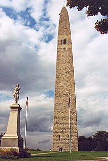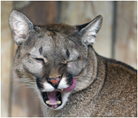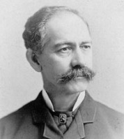
Bennington County is a county in the U.S. state of Vermont. As of the 2010 census, the population was 37,125. The shire towns are jointly Bennington and Manchester. Its largest municipality is the town of Bennington. The county was created in 1778.

Shaftsbury is a town in Bennington County, Vermont, United States. The population was 3,590 at the 2010 census.

South Shaftsbury is a census-designated place (CDP) in the town of Shaftsbury in Bennington County, Vermont, United States. The population was 683 at the 2010 census.

Middlebury is the shire town of Addison County, Vermont, United States. The population was 8,496 at the 2010 census. Middlebury is home to Middlebury College and the Henry Sheldon Museum of Vermont History.

Bennington is a town in Bennington County, Vermont, in the United States. It is one of two shire towns of the county, the other being Manchester. The population is 15,431, as of 2014 US Census estimates. Bennington is the most populous town in southern Vermont, the third-largest town in Vermont and the sixth-largest municipality in the state including the cities of Burlington, Rutland, and South Burlington in the count.

Manchester is a town in, and one of two shire towns of, Bennington County, Vermont, United States. The population was 4,391 at the 2010 census.

The Walloomsac River from the Native American name, Wal-loom-sac is a 16.8-mile-long (27.0 km) tributary of the Hoosic River in the northeastern United States. It rises in southwestern Vermont, in the Green Mountains east of the town of Bennington in Woodford Hollow at the confluence of Bolles Brook and City Stream where it is labeled Walloomsac Brook on maps but is locally known as "The Roaring Branch". The river then flows west toward Bennington and passes the downtown area to the north. For many years this section was intermittent due to the water having been diverted to power mills in town. This divergence gave the name Walloomsac to a portion of the river flowing through town on the present course of South Stream. The combined Walloomsac / South Stream joins the Roaring Branch northwest of town. From here the river flows westward as the Walloomsac River and joins the Hoosic River below Hoosick Falls, New York.

Bennington College is a private liberal arts college in Bennington, Vermont. The college was founded in 1932 to explore new approaches in higher education, including an emphasis on self-directed learning and hands-on experience in the field. Originally a women's college, it became co-educational in 1969. Bennington was the first college to include visual and performing arts as an equal partner in the liberal arts curriculum. It is accredited by the New England Association of Schools & Colleges.

The Park–McCullough Historic House is one of the finest and best-preserved Victorian mansions in New England. It is a thirty-five room mansion, set on 200 acres of grounds, and located off Vermont Route 67A in North Bennington, Vermont, USA.

The Catamount Tavern was a tavern in Old Bennington, Vermont, United States. Originally known as Fay’s House, it is marked now by a granite and copper statue placed in 1896. It was built 1769 and burned in 1871. During the tavern's 102 years of existence, it was the site of many important events in Vermont's colonial and revolutionary history.

Vermont Route 279 (VT 279), often referred to as the Bennington Bypass, is a two and three-lane undivided northwest bypass of Bennington in Bennington County, Vermont, in the United States. It extends for roughly 6.7 miles (10.8 km) from the New York state line northwest of Bennington to an intersection with VT 9 east of the downtown district. At its west end, VT 279 connects to New York State Route 915G (NY 915G), an unsigned reference route leading to NY 7 in Hoosick, New York.

Urban Andrain Woodbury was an American Civil War veteran, an entrepreneur and a U.S. politician of the Republican Party. He served as mayor of Burlington, lieutenant governor, and as the 45th governor of Vermont.

Southwestern Vermont Medical Center (SVMC) is a non-profit general medical surgical hospital located in Bennington, Vermont. It is licensed for 99-beds. Founded in the early 20th Century by donations from Henry W. Putnam and his son, SVMC is the only hospital in Bennington County, Vermont. It also serves portions of western Windham County, Vermont, eastern Rensselaer County, New York, and eastern Washington County, New York.

Trenor William Park was an American lawyer, political figure, businessman, and philanthropist.
Green Mountain Community Network (GMCN) is a private, nonprofit organization, that owns and operates the public transit system by local bus in Bennington County in southwestern Vermont called the Green Mountain Express. Their bus service currently has 3 local "fixed deviated" weekday routes in Bennington: the Red, Blue and Brown routes, which can deviate up to 1/4 mile from their alignment upon request. They also have two local Saturday routes, and three commuter routes: the Orange Line, with weekday plus Saturday service to Manchester; the Purple Line, with weekday service to Williamstown, Massachusetts; and the Emerald line, with weekday service to Wilmington. The Emerald Line is a partnership between West Dover-based Southeast Vermont Transit's "the MOOver" and GMCN.

Robert E. Healy was a Vermont attorney and judge. He was notable as one of the original appointees to the Securities and Exchange Commission, where he served from 1934 to 1946. In addition, he served briefly as an Associate Justice of the Vermont Supreme Court from 1914 to 1915.


