McDonald Park

Last updated

Coordinates: 49°05′28″N122°08′02″W / 49.091°N 122.134°W / 49.091; -122.134

Geographic coordinate system Coordinate system

A geographic coordinate system is a coordinate system that enables every location on Earth to be specified by a set of numbers, letters or symbols. The coordinates are often chosen such that one of the numbers represents a vertical position and two or three of the numbers represent a horizontal position; alternatively, a geographic position may be expressed in a combined three-dimensional Cartesian vector. A common choice of coordinates is latitude, longitude and elevation. To specify a location on a plane requires a map projection.

McDonald Park, in Abbotsford, British Columbia, Canada, is a dark-sky preserve, [1] designated thus by the Royal Astronomical Society of Canada. [2]

Abbotsford, British Columbia City in British Columbia, Canada

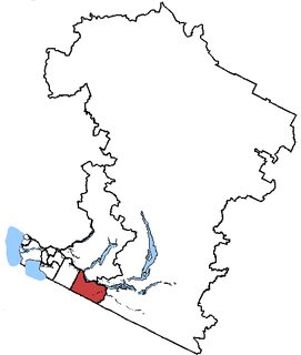
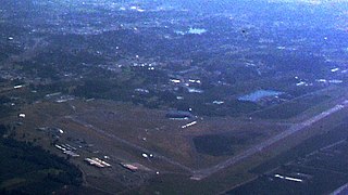
Abbotsford is a city located in British Columbia, adjacent to the Canada–United States border, Greater Vancouver and the Fraser River. With an estimated population of 141,397 people it is the largest municipality in the province outside Metro Vancouver. Abbotsford-Mission has the third highest proportion of visible minorities among census metropolitan areas in Canada, after the Greater Toronto Area and the Greater Vancouver CMA. It is home to Tradex, the University of the Fraser Valley, and Abbotsford International Airport.

Dark-sky preserve an area that restricts artificial light pollution

A dark-sky preserve (DSP) is an area, usually surrounding a park or observatory, that restricts artificial light pollution. The purpose of a dark sky preserve is generally to promote astronomy. Because different national organizations have worked independently to create their programs, different terms have been used to describe the areas. This has led to confusion between the terms reserve, preserve, and park. The International Dark-Sky Association (IDA) chooses reserve to avoid confusion with park, when using the initialisms "IDSR" and "IDSP".

The Royal Astronomical Society of Canada (RASC) is a national, non-profit, charitable organization devoted to the advancement of astronomy and related sciences. At present, there are 28 local branches of the Society, called Centres, in towns and cities across the country from St. John's, Newfoundland, to Victoria, British Columbia, and as far north as Whitehorse, Yukon. There are about 5100 members from coast to coast to coast, and internationally. The membership is composed primarily of amateur astronomers and also includes numerous professional astronomers and astronomy educators. The RASC is the Canadian equivalent of the British Astronomical Association.

The park is located in a valley, and at night light pollution from the nearby cities of Abbotsford, Chilliwack, and Mission is blocked by Sumas Mountain. [2] The park opens at night for observations under the auspices of the Fraser Valley Astronomers Society. [3]

Light pollution presence of anthropogenic light in the night environment, exacerbated by excessive, misdirected or obtrusive uses of light, blamed for compromising health, disrupting ecosystems and spoiling aesthetic environments

Light pollution, also known as photopollution, is the presence of anthropogenic light in the night environment. It is exacerbated by excessive, misdirected or obtrusive uses of light, but even carefully used light fundamentally alters natural conditions. As a major side-effect of urbanization, it is blamed for compromising health, disrupting ecosystems and spoiling aesthetic environments.

Chilliwack City in British Columbia, Canada

Chilliwack is the 7th largest agglomeration in British Columbia, Canada. Historically an agricultural community, most of its 83,788 residents are now city-dwellers. Chilliwack is the seat of the Fraser Valley Regional District and its second largest city. This city is surrounded by mountains and recreational areas such as Cultus Lake and Chilliwack Lake Provincial Parks. It is located 102 kilometres southeast of Vancouver. There are many outdoor activities in the area, including hiking, horseback riding, archery, biking, camping, fishing, and golf.

Mission, British Columbia District municipality in British Columbia, Canada

Mission is a district municipality in the Lower Mainland of the province of British Columbia, Canada. It was incorporated as a district municipality in 1892, growing to include additional villages and rural areas over the years, adding the original Town of Mission City, long an independent core of the region, in 1969.

Related Research Articles

The Fraser Valley is the region of the Fraser River basin in southwestern British Columbia downstream of the Fraser Canyon. The term is sometimes used outside British Columbia to refer to the entire basin including the Fraser Canyon and up from there to its source, but in general British Columbian usage of the term refers to the stretch of the river downstream from the town of Hope, and includes all of the Canadian portion of the Fraser Lowland and areas flanking it.

Abbotsford (electoral district) Federal electoral district

Abbotsford is a federal electoral district in British Columbia, Canada, that has been represented in the House of Commons of Canada since 2004.

Abbotsford International Airport airport in Abbotsford, British Columbia, Canada

Abbotsford International Airport is located in Abbotsford, British Columbia, Canada, 2.2 nautical miles southwest of the city centre. It is the second largest airport in the Lower Mainland, after Vancouver International Airport (YVR), and is in close proximity to British Columbia Highway 1, and the US border. It is located about 40 kilometres (25 mi) from Surrey city centre and 65 kilometres (40 mi) from downtown Vancouver.

University of the Fraser Valley

The University of the Fraser Valley (UFV), formerly known as University College of the Fraser Valley and Fraser Valley College, is a Canadian public university with campuses in Abbotsford, Chilliwack, Mission and Hope, British Columbia. Founded in 1974 as Fraser Valley College, it was a response to the need for expanded vocational training in the communities of the Fraser Valley. In 1988, it became a university college, with degree-granting status. As the University College of the Fraser Valley, it grew rapidly, becoming one of the largest university colleges in Canada.

Fraser Valley Regional District second-level administrative country subdivision

The Fraser Valley Regional District (FVRD) is a regional district in British Columbia, Canada. Its headquarters are in the city of Chilliwack. The FVRD covers an area of 13,361.74 km² (5,159 sq mi). It was created by an amalgamation of the Fraser-Cheam Regional District and Central Fraser Valley Regional District and the portion of the Dewdney-Alouette Regional District from and including the District of Mission eastwards.

Skybridge (TransLink)

The SkyBridge is a cable-stayed bridge in Metro Vancouver, British Columbia, Canada. Built between 1987 and 1989, it spans the Fraser River and connects New Westminster with Surrey. The SkyBridge opened for revenue use on March 16, 1990 with the second half of the Phase II extension of SkyTrain to Scott Road Station.

Aldergrove is a community in the Township of Langley within British Columbia, Canada, approximately 59 km (37 mi) east of Vancouver. The community is urban in nature and, although not incorporated as a town, is often referred to as one. This is a predominantly agricultural area, with crops including medical cannabis, grown by Canopy Growth Corporation, in the Agricultural Land Reserve area. This grow operation is the largest federally licensed cannabis facility in the world, with 400,000 sq. ft. of growing space and may eventually reach 1.3 million sq. ft.

CIVL-FM

CIVL-FM is a Canadian radio station located at the University of the Fraser Valley in Abbotsford, British Columbia. More commonly known as CIVL Radio, the station serves the Fraser Valley Regional District, specifically the surrounding communities of UFV in Abbotsford, Chilliwack and Mission.

Jane & Gerry Swan Track at Rotary Stadium is a fully lighted, multi-purpose stadium located in Abbotsford, British Columbia. It features a rubberized 400 metre running track with wide turns and full field event facilities. The grandstand contains 4,000 seats.

Huntingdon is a community within Abbotsford, British Columbia, Canada. It is located immediately north of the Canada–US border, and is the location of the Sumas-Huntingdon Border Crossing. The main road through the community is Highway 11. The name of the community is also the present name of the border crossing connecting to Sumas, Washington.

Sumas Peak is an official name for the summit of Sumas Mountain, which is located in the on the south shore of the Fraser River in the Fraser Valley between Abbotsford and Chilliwack, British Columbia. Elevation 910 m (2,986 ft) above sea level, prominence 875 m (2,871 ft). The mountain is mostly tree covered to the summit, with only its far southwestern end being the locale for development of residential neighbourhoods adjacent to downtown Abbotsford and the Mission By-Pass. A trail, the Centennial Trail (part of the Trans-Canada Trail, crosses the mountain from east to west. There is also a road to a microwave tower on the peak. Chadsey Lake and the associated park are also located near the peak.

The Mission Railway Bridge is a Canadian Pacific Railway bridge spanning the Fraser River between Mission, and Abbotsford, British Columbia, Canada.

Sumas Mountain (British Columbia) mountain in Canada

Sumas Mountain, also referred to as Canadian Sumas to distinguish it from an identically-named mountain just south in Washington state, is a mountain rising from the floodplain of the Fraser River in the Lower Mainland of southwestern British Columbia, Canada. Its western end is in the urban area of Abbotsford and is home to a number of suburban areas of that city, notably Clayburn. In its central portion is the historic community of Straiton, officially named in 1904 for Thomas Bell Straiton who founded a homestead on Sumas Mountain in 1893 and also a store and post office. Its higher eastern reaches tower over Greendale, a community within the City of Chilliwack and is mostly wilderness; the mountain's summit, Sumas Peak, is located in this area, along with Chadsey Lake. The mountain is separated from the Cascade Mountains by the drained lake now called Sumas Prairie, south of which is its American sister, Sumas Mountain, and which is part of the greater floodplain of the Fraser River. West of the mountain is Matsqui Prairie, another floodplain, and north of the Fraser, which lies along the mountain's north flank, are similar floodplains - Nicomen Island and Hatzic Prairie.

Matsqui Island is a large island in the Fraser River in the Central Fraser Valley region of British Columbia, Canada, located between the City of Abbotsford (S) and the District of Mission (N) and about a mile downstream from the Mission Bridge. Though technically located within the District of Mission, Matsqui Island and adjoining sandbars are part of the Matsqui Indian Reserve and are governed by the Matsqui First Nation.

Matsqui is a former District Municipality in British Columbia, Canada. It was incorporated in 1892, and merged with the District Municipality of Abbotsford in 1995 to create the new City of Abbotsford. Matsqui used to be the west part of what is now Abbotsford. It had commercial growth in the Clearbrook area which then spilled over to Abbotsford.

Sevenoaks Shopping Centre is a shopping mall complex in Abbotsford, British Columbia, Canada. Sevenoaks has over 100 retail stores, services and food establishments.

The Central Fraser Valley Regional District was a regional district in the province of British Columbia, Canada, located in the Lower Mainland region, south of the Fraser River and west of Chilliwack. It comprised the Township and City of Langley, the Village of Abbotsford, and the Districts of Matsqui and Sumas, plus adjoining unincorporated areas.

Sumas was a district municipality in the Fraser Valley region of British Columbia, Canada, located between the then-Village of Abbotsford (W) and Chilliwack (E). It was amalgamated with the Village of Abbotsford in 1972 into the District of Abbotsford.

Gur Sikh Temple Church in Abbotsford, British Columbia

The Gur Sikh Temple (Gurdwara) of Abbotsford in British Columbia is the oldest existing Sikh temple in North America and a National Historic Site Canada. This makes it currently (2010) the only Sikh temple outside of India and Pakistan, that is designated as national historic site.

References

  1. Nursall, Kim (8 September 2012). "Annual meteor shower to light up sky this weekend". The Vancouver Sun . Retrieved 12 May 2016.
  2. 1 2 Christie, Jack (13 July 2011). "Best spots for sky-gazing at night". The Georgia Straight . Retrieved 12 May 2016.
  3. "FVAS Dark Sky Park". Fraser Valley Astronomers Society. Retrieved 12 May 2016.