
North Las Vegas Airport is three miles northwest of downtown Las Vegas, in North Las Vegas, in the State of Nevada. It is owned by Clark County and operated by the Clark County Department of Aviation.

Yakima Air Terminal is a public airport three miles south of Yakima, in Yakima County, Washington. Owned by the City of Yakima, it is used for general aviation and commercial air service. Yakima is served by one scheduled air carrier and two non-scheduled carriers. Sun Country Airlines provide charter flights to Laughlin, NV and Xtra Airways provide charter flights to Wendover, NV.
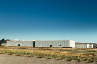
Indiana County–Jimmy Stewart Airport is a county-owned public airport two miles (3 km) east of the borough of Indiana, in Indiana County, Pennsylvania. The airport is about 65 miles (105 km) northeast of Pittsburgh and is in the Pittsburgh Combined Statistical Area. It is classified as a business service airport by the Pennsylvania Bureau of Aviation.

Rostraver Airport is a public use airport in Westmoreland County, Pennsylvania, United States.

Plymouth Municipal Airport is a town-owned, public-use airport located four nautical miles (7 km) southwest of the central business district of Plymouth, a town in Plymouth County, Massachusetts, United States. According to the FAA's National Plan of Integrated Airport Systems for 2009–2013, it is categorized as a general aviation airport. Due to space issues, the airport has 2 gates in Carver, Massachusetts.
Hazleton Regional Airport is a public airport two miles northwest of Hazleton, in Luzerne County, Pennsylvania.

Baker City Municipal Airport is three miles north of Baker City, in Baker County, Oregon. The National Plan of Integrated Airport Systems for 2011–2015 categorized it as a general aviation facility.

McMinnville Municipal Airport is three miles southeast of McMinnville, in Yamhill County, Oregon. The FAA's National Plan of Integrated Airport Systems for 2009–2013 categorized it as a general aviation facility. It is across Oregon Route 18 from the Evergreen Aviation & Space Museum, home to the Hughes H-4 Hercules or Spruce Goose.
Perkiomen Valley Airport is a privately owned, public use airport located two nautical miles (4 km) northeast of the central business district of Collegeville, a borough in Montgomery County, Pennsylvania, United States. The airport was opened on March 1, 1938. It was included in the National Plan of Integrated Airport Systems for 2009–2013, which categorized it as a general aviation facility.
Quakertown Airport is a public airport in Bucks County, Pennsylvania, owned by the Bucks County Airport Authority. It is two miles west of Quakertown, Pennsylvania and was dedicated on 22 January 1965. It is home to the Civil Air Patrol Squadron 904.

Indianapolis Regional Airport is a public use airport in Hancock County, Indiana, United States. Owned by Indianapolis Airport Authority, it is 12 nautical miles (22 km) east of the central business district of Indianapolis. The airport is also 7 nautical miles (13 km) northwest of Greenfield and 3 nautical miles (6 km) southwest of McCordsville. It was known as Mount Comfort Airport until March 2011.
Zelienople Municipal Airport is a public airport in Beaver County, Pennsylvania, a mile west of Zelienople, a borough in Butler County, Pennsylvania, in the Pittsburgh metropolitan area. The airport is owned by the Borough of Zelienople and operated by the Zelienople Municipal Authority. The National Plan of Integrated Airport Systems for 2011–2015 categorized it as a general aviation facility.

Laurel Municipal Airport is two miles north of Laurel, in Yellowstone County, Montana, and eleven miles (18 km) southwest of Billings, Montana. The National Plan of Integrated Airport Systems for 2011–2015 categorized it as a general aviation facility. It sees no airlines.
Dillon Airport is a county-owned airport five miles northeast of Dillon, in Beaverhead County, Montana.
New Castle Municipal Airport is a small municipal airport located in Union Township, Lawrence County, Pennsylvania serving Lawrence County, Pennsylvania, part of the Pittsburgh metropolitan area. Union Township is an outskirt of New Castle, Pennsylvania hence the name. The airport is located four nautical miles northwest of the central business district of New Castle. The airport is a public-owned airport and is controlled by the Lawrence County Airport Authority.
Bedford County Airport is a public airport in Bedford County, Pennsylvania. It is owned by the Bedford County Airport Authority and is five miles north of the borough of Bedford, Pennsylvania. It opened in 1994.
Ebensburg Airport is a public airport located approximately 3 miles (4.8 km) southwest of Ebensburg, Pennsylvania. It provides general aviation service.
Penn Valley Airport is a public airport a mile north of Selinsgrove, a borough in Snyder County, Pennsylvania. It is owned by the Penn Valley Airport Authority. The National Plan of Integrated Airport Systems for 2011–2015 categorized it as a general aviation facility.
Husky Haven Airport is a small airport located in Montrose, Pennsylvania. The airport serves Susquehanna County, Pennsylvania as a general aviation airport. The airport's single runway is 1,900 ft × 100 ft. The airport was commissioned in July 1969.
Carlisle Airport (Pennsylvania) is a privately owned, public use airport located one nautical miles southeast of the central business district of Carlisle, a city in Cumberland County, Pennsylvania, United States. This airport is owned and operated by Business Airport of Carlisle, Inc.


