Lac du Bonnet is a provincial electoral division in the Canadian province of Manitoba. It was created by redistribution in 1957, and has formally existed since the provincial election of 1958. It is a relatively large constituency, located to the northeast of Winnipeg.

Centretown United Church is an historic church located in Ottawa, Ontario, Canada at 507 Bank Street at Argyle in the Centretown area. It was built in 1906 as the Stewarton Presbyterian Church using Gothic Revival architecture under the architecture of Moses Chamberlain Edey, (designer of Heritage site the Aberdeen Pavilion and the Daly Building. The corner stone was laid by Sir Mortimer Clarke, Lieutenant Governor of Ontario. Centretown United Church is a member church of the United Church of Canada.

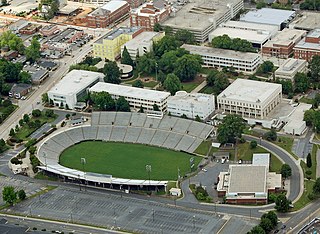
American Legion Memorial Stadium is a 17,000-seat stadium located on 7th Street in the Elizabeth community of Charlotte, North Carolina. It is located on a complex with the Grady Cole Center. Both are located next to Central Piedmont Community College. Independence Park Stadium, a tiny public baseball stadium, is also close by. Memorial Stadium is mainly used for high school sporting events and also serves as a public venue. Before the construction of nearby Bank of America Stadium in 1996, Memorial Stadium was Charlotte's largest outdoor stadium, and is still the largest municipal venue in the city.

The 17th congressional district of Ohio is an obsolete congressional district last represented by Representative Tim Ryan.

Crumpsall Park is a small municipal park in the Crumpsall ward of Manchester, North West England.

The Skowhegan School of Painting and Sculpture is an artists residency located in Madison, Maine, just outside of Skowhegan. Every year, the program accepts online applications from emerging artists from November through January, and selects 65 to participate in the nine-week intensive summer program. Admissions decisions are announced in April. The School provides participants with housing, food, and studio space, and the campus offers a library, media lab, and sculpture shop, among other amenities. The tuition for the program is $6,000, however aid is available, ensuring that everyone accepted into the program can attend, regardless of financial need.
Cambridge Centre is a shopping mall in Cambridge, Ontario, Canada, located at 355 Hespeler Road. In the 1980s, Hespeler Road became the city's major commercial area, and is now known as the Highway 24/Hespeler Road Commercial District. The main anchor store is a Hudson's Bay, with two vacant anchors last occupied by Target and Sears.

Queen Victoria Street, named after the British monarch who reigned from 1837 to 1901, is a street in London which runs east by north from its junction with New Bridge Street and Victoria Embankment in the Castle Baynard ward of the City of London, along a section that divides the wards of Queenhithe and Bread Street, then lastly through the middle of Cordwainer ward, until it reaches Mansion House Street at Bank junction. Beyond Bank junction, the street continues north-east as Threadneedle Street which joins Bishopsgate. Other streets linked to Queen Victoria Street include Puddle Dock, Cannon Street, Walbrook and Poultry.

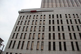
The Andrew Young School of Policy Studies is located within Georgia State University. The school houses the Criminal Justice & Criminology, Economics, Social Work and Public Management and Policy divisions of the second largest school in the state of Georgia.

Buena Vista is a neighborhood in Miami, Florida, United States. It is located south of Little Haiti, north of the Miami Design District.
The Blue Angel is a nightclub in Liverpool, England. It is located where Seel Street meets Berry Street in Liverpool City Centre. It is a venue in Liverpool in which the Beatles, Rolling Stones, Bob Dylan and many other bands played at in the 1960s. It was historically a jazz club, but it now plays pop music.

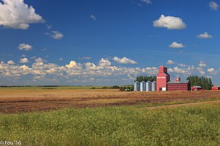
Bresaylor is an unincorporated community in Rural Municipality of Paynton No. 470, Saskatchewan, Canada. It is the home of the Bresaylor Heritage Museum, containing artifacts from the area.

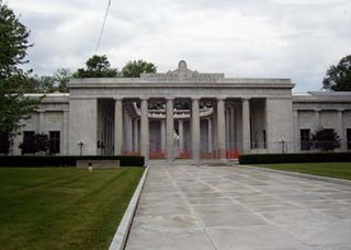
Hotel Champlain is a historic hotel building located in Plattsburgh, New York. It served as William McKinley's "Summer White House". It is now the site of Clinton Community College.

The Aspetuck River is a 17.0-mile-long (27.4 km) river in the U.S. state of Connecticut. The river rises in the hills located in Huntington State Park in Bethel, with a watershed of approximately 430 acres (170 ha). The river flows generally southerly through Redding, Connecticut to the Aspetuck Reservoir, the Hemlock Reservoir in Easton and Fairfield and finally into the Saugatuck River in Westport, Connecticut and then into the Long Island Sound. It flows through the village of Aspetuck at an average depth of 2.5 feet (0.76 m). The word Aspetuck can be translated as "river originating at the high place" in an Algonquian language.

The Iron Range Historical Society is an historical society that operates a research library in McKinley, Minnesota. The society is a non-profit organization that exists through donations and volunteers. Its mission is "to collect, preserve, and share the history of Minnesota’s Iron Ranges for the benefit of future generations."
Lake Latonka is a census-designated place located in Coolspring and Jackson Townships in Mercer County in the state of Pennsylvania. The community surrounds Lake Latonka in which it got its name. As of the 2010 census the population was 1,012 residents.
Emerald Lakes is a census-designated place located in Tobyhanna and Tunkhannock Townships in Monroe County in the state of Pennsylvania. The community is located near Interstates 80 and 380. As of the 2010 census the population was 2,886 residents.
Fruitville is an unincorporated community in southeast Howell County, in the U.S. state of Missouri.


