
Wezep is a town in the municipality of Oldebroek, Netherlands. Located in the province of Gelderland, it had about 13,500 inhabitants in 2012. The Wezep railway station, located on the Utrecht–Kampen railway, is the town's main landmark. The municipality's TV station is called LOCO TV.
Daarlerveen is a village in the Dutch province of Overijssel. It is located in the municipality of Hellendoorn, about 2 km south of the town of Vroomshoop.
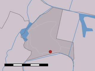
Wetering is a village in the Dutch province of Overijssel. It is located in the municipality of Steenwijkerland, about 9 km southwest of the town of Steenwijk.

Eefde is a village in the Dutch province of Gelderland. It is located in the municipality of Lochem, about 3 km northeast of the city of Zutphen.
Rouveen is a village in the Dutch province of Overijssel. It is located in the municipality of Staphorst, about 4 km southwest of that town.
Egede is a hamlet in the Dutch province of Overijssel. It is located in the municipality of Hellendoorn, about 9 km north of the town of Nijverdal.

Sloten is a village in the Dutch province of North Holland. It is a part of the municipality of Amsterdam, and lies about 6 km west of the city centre. Sloten was a separate municipality until 1921. Since then, Sloten(founded in the year 990) became the oldest part of Amsterdam.
Vinkebrug is a hamlet in the Dutch province of North Holland. It is a part of the municipality of Haarlemmermeer and lies about 6 km (3.7 mi) east of Haarlem.
De Haar is a hamlet in the Dutch province of Drenthe. It is located in the municipality of Hoogeveen, about 7 km northeast of that town.
Halfweg is a hamlet in the Dutch province of Overijssel. It is located in the municipality of Staphorst, about 4 km northeast of that town.
Nolde is a hamlet in the Dutch province of Drenthe. It is located in the municipality of De Wolden, about 4 km south of Zuidwolde.
Noordwijk is a hamlet in the Dutch province of Drenthe. It is located in the municipality of De Wolden, about 1 km north of De Wijk, from which it derives its name.
Voorst is a village in the Dutch province of Gelderland. It is located in the municipality of Oude IJsselstreek, about 3 km east of the town of Gendringen.
't Haantje is a hamlet in the Dutch province of Overijssel. It is located in the municipality of Hardenberg, about 5 km north of the town of Hardenberg.
't Zand is a hamlet in the Dutch province of Gelderland. It is located in the municipality of Hattem, about 6 km west of the city of Zwolle.
Anholt is a hamlet in northeast Netherlands. It is located in the municipality De Wolden, Drenthe, about 2 km west of Pesse.
Basse is a small village in the Dutch province of Overijssel. It is located in the municipality Steenwijkerland, about 7 km northwest of Steenwijk.
Bent is a small hamlet in the Dutch province of South Holland. It is located in the municipality of Alphen aan den Rijn, about 2 km northwest of the village Hazerswoude-Dorp.
Pesse is a village in the Dutch province of Drenthe. It is located in the municipality of Hoogeveen.

De Lutte is a village in the Dutch province of Overijssel. It is located in the municipality of Losser. It is located close to the border between the Netherlands and Germany. De Lutte is connected to Germany and Oldenzaal and Hengelo by the A1.


