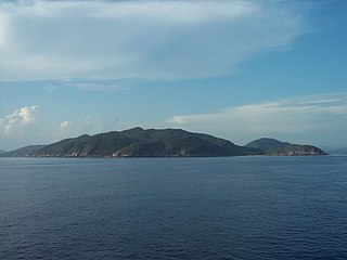
Natuna Regency is an islands regency located in the northernmost part of the Province of Riau Islands, Indonesia. It contains at least 154 islands, of which 127 of them are reported as uninhabited. This archipelago, with a land area of 1,978.49 km2 out of a total area of 264,198.37 km2 area, contains 17 administrative districts (kecamatan).

Anambas Islands Regency is a small archipelago of Indonesia, located 150 nautical miles northeast of Batam Island in the North Natuna Sea between the Malaysian mainland to the west and the island of Borneo to the east. Geographically part of the Tudjuh Archipelago, it is administratively a regency within the Riau Islands Province. It covers a land area of 661.47 square kilometres (255.39 sq mi) and had a population of 37,411 at the 2010 Census and 47,402 at the 2020 Census; the official estimate as at mid 2023 was 50,140. The administrative centre is at Tarempa on Siantan Island.

The Lingga Regency is a group of 600 islands in Indonesia, located south of Singapore and along both sides of the equator, off the eastern coast of Riau Province on Sumatra island. They are due south of the populated Riau Archipelago, known for the industrial island of Batam and the tourist-frequented island of Bintan, although the Lingga Islands themselves are rarely visited due to the infrequent local transportation. The equator goes through the northern tip of Lingga Island, the main island in the archipelago.

Bengkalis Regency is a regency of Indonesia in Riau Province. The regency was originally established in 1956 and then included most of the northern part of the province, but on 4 October 1999 it was divided up, with most of the territory being split off to form the new Rokan Hilir Regency, Siak Regency and the city of Dumai. On 19 December 2008 a further five districts were removed to create the new Meranti Islands Regency, leaving eight districts in the Bengkalis Regency. These eight districts has increased since 2010 to eleven by the splitting of existing districts on the Sumatran mainland.

Pelalawan is a regency (kabupaten) of Riau Province, Indonesia. It is located on the island of Sumatra. The regency was created on 4 October 1999 as a result of the division of Kampar Regency, of which it was previously the eastern 43%. It now has an area of 13,408.72 km2 and had a population of 301,829 at the 2010 Census and 390,046 at the 2020 Census; the official estimate as at mid 2023 was 415,469. The administrative centre is in the town of Pangkalan Kerinci.

Indragiri Hilir is the most eastern regency (kabupaten) of Riau Province, Indonesia. It is located on the island of Sumatra. The regency has an area of 13,136.14 km2 and had a population of 661,779 at the 2010 census and 654,909 at the 2020 Census; the official estimate as at mid 2023 was 695,571. The administrative centre of the regency is the town of Tembilahan.

Indragiri Hulu is a landlocked regency (kabupaten) of Riau, Indonesia. It is located on the island of Sumatra. The original regency was split in two on 4 October 1999, with the western half being created as a separate Kuantan Singingi Regency. The regency now has an area of 8,198.71 km2 and had a population of 363,442 at the 2010 census, 408,704 at the 2015 census and 444,548 at the 2020 census; the official estimate as at mid 2023 was 472,799. The administrative seat of the regency is located at the town of Rengat.

Kampar is a regency (kabupaten) of Riau Province of Indonesia. The regency formerly included a much larger part of Riau Province, but on 4 October 1999 the western districts were split off to form a separate Rokan Hulu Regency, and the eastern districts were split off to form a new Pelalawan Regency. It now has an area of 11,289.28 km2 and had a population of 688,204 at the 2010 Census, and 841,332 at the 2020 Census; the official estimate as at mid 2023 was 860,379. The administrative centre of the regency is located at the town of Bangkinang.

Rokan Hulu is a regency (kabupaten) of Riau Province of Indonesia. It is located on the island of Sumatra. Rokan Hulu Regency was created on 4 October 1999 as a result of the division of Kampar Regency, of which it was previously the western 24%. The new Regency was established under Law No. 53 of 1999 and Law No. 11 of 2003 on changes to Law Decree No. 53 of 1999, which is reinforced by the Constitutional Court Decision No. 010 / PUU-1/2004, dated 26 August 2004. It mainly occupies the upper part of the catchment area of the Rokan River, and has an area of 7,588.13 km². It had 474,843 inhabitants at the 2010 Census and 561,385 at the 2020 Census; the official estimate as at mid 2023 was 573,520. The administrative centre of the regency is located at the town of Pasir Pengaraian in Rambah District.

Bintan Regency is an administrative area in the Riau Islands Province of Indonesia. Bintan Regency includes all of Bintan Island and also includes many outlying islands including the Tambelan Archipelago and Badas Islands situated between Bintan and West Kalimantan; altogether there are 273 islands comprising the regency.

Rupat is an island in the Strait of Malacca, and forms part of Bengkalis Regency within Riau, Indonesia. It lies just off the eastern coast of Sumatra, across from Dumai city, from which it is separated by the Rupat Strait. Its area is 1,704.98 km2 (658.30 sq mi). The island is sparsely populated, with a population density of 36 per km2. Rupat was one of thousands of abandoned islands, but its population is growing yearly, which has made the government expand the area for the settlement.
Rangsang is an island of the Meranti Islands Regency of Riau Province in the Strait of Malacca, Sumatra, Indonesia. Administratively, it consists of the three districts (kecamatan) of Rangsang, Rangsang Pesisir and Rangsang Barat. The island had a population of 51,452 at the 2010 Census and 58,464 at the 2020 Census; the official estimate as at mid 2023 was 60,900. It is just north of Tebing Tinggi Island, about 24 kilometres (15 mi) south-west of Great Karimun island and 22 kilometres (14 mi) west of Kundur Island.
Padang Island is an island in Riau province, Indonesia, close to the east coast of Sumatra island. The area is 1,110 km² and the population at the 2020 Census was 32,934; the official estimate as at mid 2023 was 34,000. Administratively, it forms the districts (kecamatan) of Merbau and Tasik Putri Puyu within the Meranti Islands Regency of Riau province. It should not be confused with the city of Padang, West Sumatra, or the island of Padang in Borneo.

The Karimun Regency is located in the Riau Islands Province, Indonesia. Besides the central island of Great Karimun, the regency also includes the island of Kundur and over 240 lesser islands. The district covers a land area of 1,339.9 km2 and a sea area of 6,460 km2, and its population was 212,561 at the 2010 census and 253,457 at the 2020 census; the official estimate as at mid 2023 was 270,121.

Nias Regency is a regency in North Sumatra province, Indonesia; it lies on the east side of Nias Island. The regency originally covered the entire island, but was reduced to the northern half, with an area of 3,495.39 square kilometres, following the creation of the new regency of Nias Selatan on 25 February 2003. It was further reduced by the creation of the new regencies of North Nias and West Nias and the independent municipality of Gunungsitoli from other parts of Nias Regency on 29 October 2008. Since the separation of the new regencies and municipality, the reduced Regency now covers 853.44 km2 of land in the eastern part of the island, and had a population of 131,377 at the 2010 Census and 146,672 at the 2020 Census; the official estimate as at mid 2023 was 146,895. Its seat is the town of Gido.

Nias Selatan Regency is a regency in North Sumatra province, Indonesia, created on 25 February 2003 by the division of the existing Nias Regency. The regency covers a land area of 2,487.99 square kilometres and according to the 2010 census had a population of 289,708; the 2020 Census showed a population of 360,531, while the official estimate for mid 2023 was 368,834. Its administrative centre is the port of Teluk Dalam. Apart from the southern portion of Nias Island, the regency also includes the smaller Batu Islands to the south, lying between Nias and Siberut; these islands occupy nearly half of the land area of the Regency, but have just 9% of its population.
The Kampar Kanan River is a river in Riau province, Sumatra island, Indonesia. It is a tributary of the Kampar River.

Meranti Islands is an archipelago, most of which forms a regency (kabupaten) of Riau Province and lies off the eastern coast of the island of Sumatra, Indonesia. It was created on 19 December 2008 by the separating of these large islands from the mainly mainland regency of Bengkalis. The regency comprises the islands of Tebing Tinggi, Rangsang, Padang, and Merbau, together with minor offshore islands, but does not include Bengkalis Island to the north, which is geographically part of the archipelago but remains within Bengkalis Regency. The principal town is Selat Panjang on Tebing Tinggi Island. The regency covers an area of 3,623.93 km2 and had a population of 176,290 at the 2010 Census and 206,116 at the 2020 Census; the official estimate as of mid-2023 was 211,771.

Riau Malays are a sub-group of Malays native to Riau and Riau Islands province on the eastern region of Sumatra. Today they only make up 29% of Riau Island population while in Riau's they still form a plurality of the population at around 45%. Riau Malays especially coastal Riau and Riau Islands share the same or similar cultural, historical and linguistic background with Johorean and Singaporean Malays due to its common origin starting from Malacca in the 15th century to as recently as Johor Empire in the 18th century.


