
Stonehenge is a prehistoric megalithic structure on Salisbury Plain in Wiltshire, England, two miles (3 km) west of Amesbury. It consists of an outer ring of vertical sarsen standing stones, each around 13 feet (4.0 m) high, seven feet (2.1 m) wide, and weighing around 25 tons, topped by connecting horizontal lintel stones, held in place with mortise and tenon joints, a feature unique among contemporary monuments. Inside is a ring of smaller bluestones. Inside these are free-standing trilithons, two bulkier vertical sarsens joined by one lintel. The whole monument, now ruinous, is aligned towards the sunrise on the summer solstice and sunset on the winter solstice. The stones are set within earthworks in the middle of the densest complex of Neolithic and Bronze Age monuments in England, including several hundred tumuli.
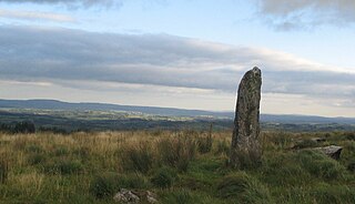
A menhir, standing stone, orthostat, or lith is a large upright stone, emplaced in the ground by humans, typically dating from the European middle Bronze Age. They can be found individually as monoliths, or as part of a group of similar stones. Menhirs' size can vary considerably, but they often taper toward the top.

A megalith is a large stone that has been used to construct a prehistoric structure or monument, either alone or together with other stones. There are over 35,000 structures or arrangements in Europe alone, located widely from Sweden to the Mediterranean sea.

Durrington Walls is the site of a large Neolithic settlement and later henge enclosure located in the Stonehenge World Heritage Site in England. It lies 2 miles (3.2 km) north-east of Stonehenge in the parish of Durrington, just north of Amesbury in Wiltshire. The henge is the second-largest Late Neolithic palisaded enclosure known in the United Kingdom, after Hindwell in Wales.

The Coffin Stone, also known as the Coffin and the Table Stone, is a large sarsen stone at the foot of Blue Bell Hill near Aylesford in the south-eastern English county of Kent. Now lying horizontally, the stone probably once stood upright nearby. Various archaeologists have argued that the stone was part of a now-destroyed chambered long barrow constructed in the fourth millennium BCE, during Britain's Early Neolithic period.
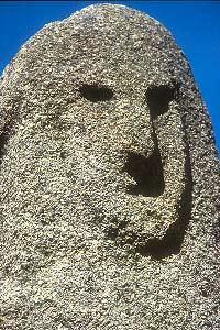
Filitosa is a megalithic site in southern Corsica, France. The period of occupation spans from the end of the Neolithic era and the beginning of the Bronze Age, until around the Roman times in Corsica.

Kilmartin Glen is an area in Argyll north of Knapdale. It has the most important concentration of Neolithic and Bronze Age remains in mainland Scotland. The glen is located between Oban and Lochgilphead, surrounding the village of Kilmartin. In the village, Kilmartin Museum explains the stories of this ancient landscape and the people who dwelt there. There are more than 800 ancient monuments within a six-mile (ten-kilometre) radius of the village, with 150 monuments being prehistoric. Monuments include standing stones, a henge monument, numerous cists, and a "linear cemetery" comprising five burial cairns. Several of these, as well as many natural rocks, are decorated with cup and ring marks.
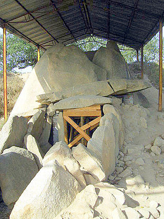
Great Dolmen of Zambujeiro is a megalithic monument located in Nossa Senhora da Tourega, near Valverde, in the municipality of Évora, considered one of the biggest such structures in the Iberian Peninsula.
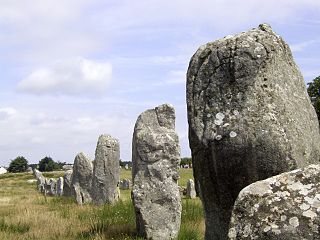
The Carnac stones are an exceptionally dense collection of megalithic sites near the south coast of Brittany in northwestern France, consisting of stone alignments (rows), dolmens, tumuli and single menhirs. More than 3,000 prehistoric standing stones were hewn from local granite and erected by the pre-Celtic people of Brittany and form the largest such collection in the world. Most of the stones are within the Breton municipality of Carnac, but some to the east are within neighboring La Trinité-sur-Mer. The stones were erected at some stage during the Neolithic period, probably around 3300 BC, but some may date to as early as 4500 BC.

Reckange is a small town in the commune of Mersch, in central Luxembourg. As of 2024, the town has a population of 1,046.

The dolmens of Jersey are Neolithic sites, including dolmens, in Jersey. They range over a wide period, from around 4800 BC to 2250 BC, these dates covering the periods roughly designated as Neolithic, or “new stone age”, to Chalcolithic, or “copper age”.

The Bull Ring is a Class II henge that was built in the late Neolithic period near Dove Holes in Derbyshire, England.

The Ness of Brodgar is an archaeological site covering 2.5 hectares between the Ring of Brodgar and the Stones of Stenness in the Heart of Neolithic Orkney World Heritage Site on the main Island of Orkney, Scotland. The site was excavated from 2003 to 2024, when it was infilled due to concerns about damage to the structures exposed by excavation.

The Menhir de Champ-Dolent is a menhir, or upright standing stone, located in a field outside the town of Dol-de-Bretagne. It is the second largest standing stone in Brittany and is over 9 metres high.
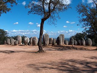
The Cromlech of the Almendres is a megalithic complex, located 4.5 road km WSW of the village of Nossa Senhora de Guadalupe, in the civil parish of Nossa Senhora da Tourega e Nossa Senhora de Guadalupe, municipality of Évora, in the Portuguese Alentejo. The largest existing group of structured menhirs in the Iberian Peninsula, this archaeological site consists of several megalithic structures: cromlechs and menhir stones, that belong to the so-called "megalithic universe of Évora", with clear parallels to other cromlechs in Évora District, such as Portela Mogos and the Vale Maria do Meio Cromlech.

The Burzahom archaeological site is located in the Srinagar district of the Kashmir Valley of Jammu and Kashmir, India. Archaeological excavations have revealed four phases of cultural significance between 3000 BCE and 1000 BCE. Periods I and II represent the Neolithic era; Period III the Megalithic era ; and Period IV relates to the early Historical Period. The findings, recorded in stratified cultural deposits representing prehistoric human activity in Kashmir, are based on detailed investigations that cover all aspects of the physical evidence of the site, including the ancient flora and fauna.
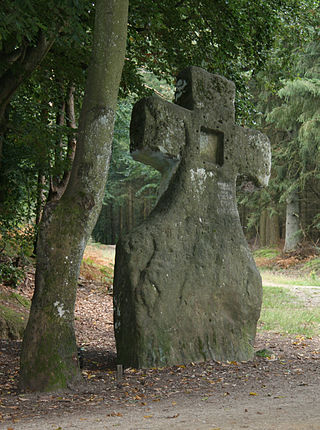
The Ferschweiler Plateau, which is home to the villages of Ferschweiler and Ernzen among others, is an extensive highland area made from sandstone and is located in the collective municipality of Irrel in the county of Bitburg-Prüm in the German state of Rhineland-Palatinate. From a landscape perspective the Ferschweiler Plateau lies within the South Eifel, a region in the Eifel Mountains.

Archaeology is promoted in Jersey by the Société Jersiaise and by Jersey Heritage. Promotion in the Bailiwick of Guernsey being undertaken by La Société Guernesiaise, Guernsey Museums, the Alderney Society with World War II work also undertaken by Festung Guernsey.

Kealkill stone circle is a Bronze Age axial five-stone circle located just outside the village of Kealkill, County Cork in southwest Ireland. When it was excavated in 1938 it was thought the crucial axial stone indicated an alignment to the north, contrary to the general alignment of such stone circles to the southwest. However, later archaeologists have thought it is the comparatively insignificant stone to the southwest that is the axial stone. There are two associated standing stones nearby, one of which had fallen and was re-erected in 1938.


