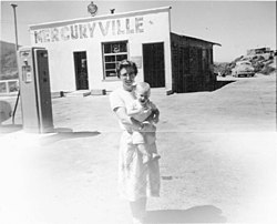
Cinnabar, or cinnabarite, also known as mercurblende is the bright scarlet to brick-red form of mercury(II) sulfide (HgS). It is the most common source ore for refining elemental mercury and is the historic source for the brilliant red or scarlet pigment termed vermilion and associated red mercury pigments.

Beowawe is a small town in Eureka County, Nevada, United States.
Terlingua is a mining district and census-designated place (CDP) in southwestern Brewster County, Texas, United States. It is located near the Rio Grande and the villages of Lajitas and Study Butte, Texas, as well as the Mexican state of Chihuahua. The discovery of cinnabar, from which the metal mercury is extracted, in the mid-1880s brought miners to the area, creating a city of 2,000 people. The only remnants of the mining days are a ghost town of the Howard Perry-owned Chisos Mining Company and several nearby capped and abandoned mines: the California Hill, the Rainbow, the 248, and the Study Butte mines. The mineral terlinguaite was first found in the vicinity of California Hill.

New Idria was an unincorporated town in San Benito County, California. It was named after the New Idria Mercury Mine, which closed in 1972, resulting in a ghost town.

Steamboat Springs is a small volcanic field of rhyolitic lava domes and flows in western Nevada, located south of Reno. There is extensive geothermal activity in the area, including numerous hot springs, steam vents, and fumaroles. The residential portions of this area, located mostly east of Steamboat Creek and south of modern-day SR 341, are now known simply as Steamboat.
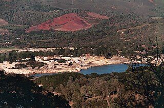
The Sulphur Bank Mine is located near Clearlake Oaks and Clear Lake in Lake County, California. The 150-acre (0.61 km2) mine became one of the most noted mercury producers in the world.

New Almaden, known in Spanish as Nueva Almadén, is a historic community and former mercury mine in the Capitancillos Hills of San Jose, California, located at the southwestern point of Almaden Valley in South San Jose. New Almaden is divided into two parts: the mines and much of their immediate surroundings, including historic ghost town settlements in the Capintancillas, which together form the Almaden Quicksilver County Park, and the largely residential historic district surrounding the Casa Grande.

The Mayacamas Mountains are located in northwestern California in the United States. The mountain range is part of the Northern Inner Coast Ranges, of the California Coast Ranges System.

Idrialite is a rare hydrocarbon mineral with approximate chemical formula C22H14.

Calpine Corporation is the largest generator of electricity from natural gas and geothermal resources in the United States, with operations in competitive power markets.

Mercur is a historical hard rock mining ghost town in Tooele County, Utah, United States. In 1891, it became the site of the first successful use of the cyanide process of gold extraction in the United States, the dominant metallurgy today. Its elevation above sea level is approximately 2,042 m. The nearby Mercur Gold Mine was re-opened by Barrick Gold in 1985, with mining operations again coming to an end in 1997. The reclamation and restoration project was set to continue up to 2010.

The Geysers is the world's largest geothermal field, containing a complex of 18 geothermal power plants, drawing steam from more than 350 wells, located in the Mayacamas Mountains approximately 72 miles (116 km) north of San Francisco, California.

Mogollon, also called the Mogollon Historic District, is a former mining town located in the Mogollon Mountains in Catron County, New Mexico, United States. Located east of Glenwood and Alma, it was founded in the 1880s at the bottom of Silver Creek Canyon to support the gold and silver mines in the surrounding mountains. The "Little Fannie" mine became the most important employer for the town. During the 1890s, Mogollon had a transient population of between 3,000 and 6,000 miners. Because of its isolation, it had a reputation as one of the wildest mining towns in the West. Today Mogollon is listed as Fannie Hill Mill and Company Town Historic District on the National Register of Historic Places.
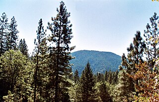
Cobb Mountain is the tallest mountain in the Mayacamas Mountains of California.
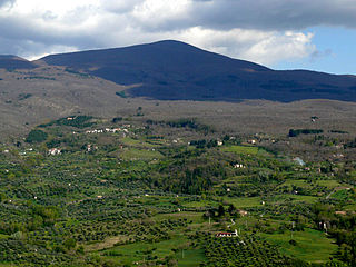
Mount Amiata is the largest of the lava domes in the Amiata lava dome complex located about 20 km northwest of Lake Bolsena in the southern Tuscany region of Italy. It is located within the provinces of Grosseto and Siena.

Big Sulphur Creek is a westward-flowing stream in northern Sonoma County, California, United States, which springs from The Geysers in the Mayacamas Mountains and runs 20 miles (32 km) to empty into the Russian River.
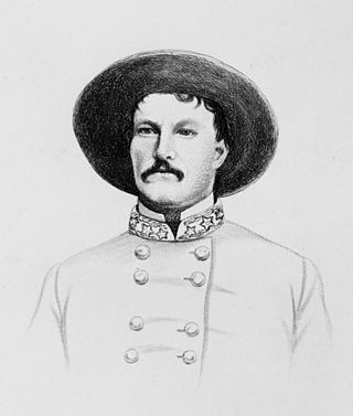
Archibald Campbell Godwin, a brigadier general in the Confederate States Army who was killed at the Battle of Opequon during the American Civil War. Due to his death soon after his appointment, the Confederate Senate never confirmed Godwin's promotion to the grade of brigadier general.

Castle Dome Landing, Arizona is a ghost town in the Castle Dome Mountains of Yuma County in the U.S. state of Arizona. It was first settled as a transport depot and mining camp around 1863 in what was then the Arizona Territory.

The New Idria Mercury Mine encompasses 8,000 acres of land in the Diablo Mountain range, incorporating the town of Idria in San Benito County, California. Idria, initially named New Idria, is situated at 36°25′01″N120°40′24″W and 2440 feet (680m) above mean sea level. The area was, in the past, recorded in the US Census Bureau as a rural community; however, Idria has become a ghost town since the closing of once lucrative mining operations in the early 1970s.