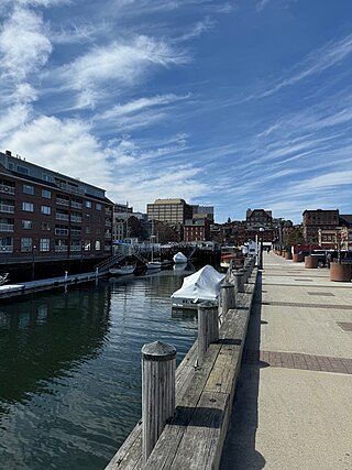
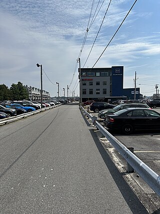
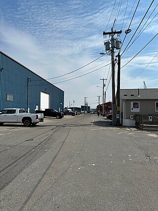
The Portland Fish Pier is a fishing pier located in Portland, Maine, on the edge of the Fore River. It is a major hub for the commercial fishing industry, and is home to the Portland Fish Exchange, where over 20 million pounds (9.1 kt) of seafood a year are bought and sold. A fishermen's memorial is also located at the pier.
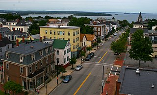
Munjoy Hill is both a neighborhood and prominent geographical feature of Portland, Maine. It is located east of downtown and south of East Deering, the neighborhood it is connected to by Tukey's Bridge. The neighborhood historically had a large Irish and Italian American population.

Portland Public Library is the main library of the public library system in Portland, Maine, USA. It is located at 5 Monument Square on Congress Street in the Old Port of Portland, Maine. The library has three neighborhood branches, Burbank branch, Peaks Island branch, and Riverton branch.

The great fire of Portland, Maine, sometimes known as the 1866 great fire of Portland, occurred on July 4, 1866—the second Independence Day after the end of the American Civil War. Five years before the Great Chicago Fire, this was the greatest fire yet seen in an American city. It started in a boat house on Commercial Street, likely caused by a firecracker or a cigar ash. The fire spread to a lumber yard and on to a sugar house, then spread across the city, eventually burning out on Munjoy Hill in the city's east end. Two people died in the fire and 10,000 people were made homeless. 1,800 buildings were burned to the ground. This included the federal Exchange Building by which was replaced with the custom house. Soon after the fire, Portland native and acclaimed poet Henry Wadsworth Longfellow described his old home town: "Desolation, desolation, desolation. It reminded me of Pompeii, that 'sepult city."
Kennedy Park is a neighborhood in East Bayside in downtown Portland, Maine, built around a park, athletic fields, basketball courts, a playground and the Boyd Street Urban Garden.
The Arts District is a section of downtown Portland, Maine’s designated in 1995 as to promote the cultural community and creative economy of the city. It covers a large part of upper Congress Street towards the West End and spans Congress Street toward the East ending at Portland City Hall and its Merrill Auditorium concert hall.
Portland, Maine, is home to many neighborhoods.
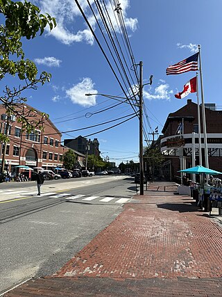
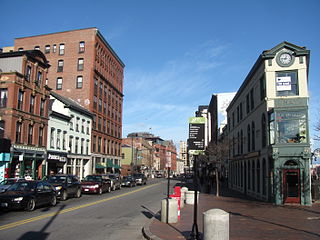
Commercial Street is a downtown street in the Old Port of Portland, Maine, United States. It is part of U.S. Route 1A. It became the Old Port's waterfront in the early 20th century, replacing Fore Street, after land was reclaimed from the waters of Casco Bay and the Fore River.
Monument Square is a town square in downtown Portland, Maine, about halfway between the East Bayside and Old Port neighborhoods. The Time and Temperature Building, Fidelity Trust Building, and the main branch of the Portland Public Library are on Congress Street, across from the square, while One Monument Square and One City Center are among the buildings on the square itself.

Franklin Street is a four-lane street in Portland, Maine, United States. It is a major corridor for traffic from Interstate 295 to Portland's downtown, Old Port, and to other neighborhoods located on the Portland peninsula. Part of U.S. Route 1A, it is around 0.77 miles (1.24 km) long, running between Marginal Way in the northwest and Commercial Street in the southeast.
Congress Street is the main street in Portland, Maine. Around 5.77 miles (9.29 km) long, it stretches from County Road, Portland's southwestern border with Westbrook, through a number of neighborhoods, before ending overlooking the Eastern Promenade on Munjoy Hill. In March 2009, the Portland City Council designated much of the inner portion of Congress Street a historic district. The western section of the street includes the city's Arts District.

Forest Avenue is a major street in Portland, Maine, United States. It runs for around 4.78 miles (7.69 km), from Bridgton Road in the northwest to Congress Street, in downtown Portland, in the southeast. It is the main artery for traffic entering and leaving Portland to and from the north via city streets. The street ends in Portland's Arts District.

MaineWharf is a historic wharf in Portland, Maine. It is located on Commercial Street, between Franklin Street and Pearl Street, on the edge of the Fore River. On the waterfront side, it is situated between Maine State Pier and Custom House Wharf.

Custom HouseWharf is a historic wharf in Portland, Maine, on the edge of the Fore River. Named for Portland's United States Custom House, which stands across Commercial Street from the wharf, on Pearl Street, the wharf is located between Maine Wharf and Portland Pier.
Long Wharf is a historic wharf in Portland, Maine, on the edge of the Fore River. It stands across Commercial Street, between Market Street and Moulton Street and, on the waterfront side, between Portland Pier and Chandler's Wharf.
Chandler's Wharf is a historic wharf in Portland, Maine, on the edge of the Fore River. It stands across Commercial Street from Dana Street and, on the waterfront side, between Long Wharf and Widgery Wharf.

Cumberland Avenue is a downtown street in Portland, Maine, United States. Part of Maine State Route 100, it runs for around 1.57 miles (2.53 km) from Merrill Street, on Munjoy Hill in the northeast, to Deering Avenue in the southwest.
Union Wharf is a historic wharf in Portland, Maine. It stands across Commercial Street from Union Street and, on the waterfront side, between Widgery Wharf and Merrill's Wharf, on the edge of the Fore River.

Fore Street is a downtown street in Portland, Maine, United States. Dating to 1724, it runs for around 1 mile (1.6 km), from the Eastern Promenade on Munjoy Hill in the northeast to Pleasant Street in the southwest. Near its midsection, Fore Street crosses Franklin Street. It splits briefly at Boothby Square, shortly after passing the United States Custom House. The street passes through the Old Port district.

India Street is a downtown street and neighborhood in Portland, Maine, United States. Situated near the western foot of Munjoy Hill, it runs for around 0.28 miles (0.45 km), from Congress Street in the northwest to Commercial Street and Thames Street in the southeast. It was the city's first street, and the location of the first settlement of European immigrants to the city in the 17th century. There are thirty handmade bricks in the sidewalk commemorating the neighborhood's notable events. In 1680, when Thomas Danforth was Deputy Governor of the Massachusetts Bay Colony, the street was known as Broad Street. After the incorporation of the Town of Falmouth in 1718, the street was known as High King Street.
