Jaguarão is a municipality in the southern Brazilian state of Rio Grande do Sul located on the shores of the Jaguarão River, bordering Uruguay.
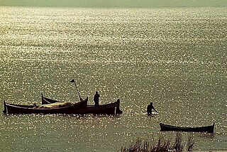
Lagoon Mirim or Merín is a large estuarine lagoon which extends from southern Rio Grande do Sul state in Brazil into eastern Uruguay. Lagoa Mirim is separated from the Atlantic Ocean by a sandy, partially barren isthmus.

The Jaguarão or Yaguarón River is a Brazilian and Uruguayan river. It forms the border between Uruguay and Rio Grande do Sul state in southernmost Brazil.

The Santiago microregion is a micro-region in the western part of the state of Rio Grande do Sul, Brazil. Its total area is of 11,213.844 km².

Herval is a Brazilian municipality in the southern part of the state of Rio Grande do Sul. The population is 6,975 in an area of 1757.84 km². Its elevation is 287 m. Its main industry is agriculture.

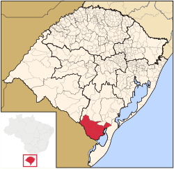
The Litoral Lagunar Microregion is a microregion in the southern part of the state of Rio Grande do Sul, Brazil. Its total area is of 9,379.518 km².

The Serras de Sudeste Microregion is a microregion in the southern part of the state of Rio Grande do Sul, Brazil. It is named after a hill range named Serras de Sudeste, which means Southeastern Mountain Ranges. The area is 16,512.614 km².

The Centro Ocidental Rio-Grandense is one of the seven mesoregions of the state of Rio Grande do Sul in Brazil. It consists of 31 municipalities, grouped in three microregions:
Constantina, Rio Grande do Sul is a municipality in the state of Rio Grande do Sul, Brazil. Founded April 14, 1959. The municipality's motto is "Celeiro da Hospitalidade", meaning "Barn Hospitality".

Planalto is a municipality in the state of Rio Grande do Sul, Brazil, located at 27°19′44″S53°03′31″W, at an altitude of 568 meters above sea level. It has a total area of 237.35 km². Its estimated population in 2004 was of 11,702 inhabitants, and in 2007 it was of 10,589 inhabitants.
Santa Lúcia, Paraná is a municipality in the state of Paraná in the Southern Region of Brazil.

Várzea is a municipality in the state of Rio Grande do Norte in the Northeast region of Brazil.
KGBT is a Spanish-language radio station that serves the Rio Grande Valley border area.

Sudoeste Rio-Grandense is one of the seven mesoregions of the state of Rio Grande do Sul in Brazil. It consists of 19 municipalities, grouped in three microregions:

Sudeste Rio-Grandense is one of the seven Mesoregions of the state of Rio Grande do Sul in Brazil. It consists of 25 municipalities, grouped in four Microregions:

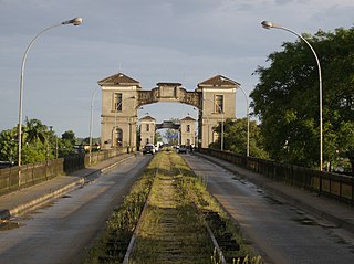
The Baron of Mauá International Bridge is a bridge that crosses the Jaguarão River, linking the cities of Jaguarão, Rio Grande do Sul, Brazil and Río Branco, Uruguay.

The Campanha Central micro-region is a microregion in the western part of the state of Rio Grande do Sul, Brazil.

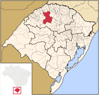
The Microregion of Frederico Westphalen was one of the Microregions of the Rio Grande do Sul state, in Brazil. It belonged to the mesoregion of the Noroeste Rio-Grandense. Its population was estimated by the IBGE to be of 175,391 in 2005, divided in 27 municipalities. Its total area is of 5,182.529 km². The IBGE has since discontinued the microregion system for population tracking, replacing it with the term "immediate geographic region".

Noroeste Rio-Grandense was one of the seven Mesoregions on the state of Rio Grande do Sul in Brazil. It included 216 municipalities grouped in thirteen microregions.
The Microregion of Ijuí is one of the Microregions of the Rio Grande do Sul state, in Brazil. It belongs to the mesoregion of the Noroeste Rio-Grandense. Its population was estimated by the IBGE to be of 183.142 inhabitants in 2005, and it is divided in 15 Municipalities. Its total area is of 5.100,402 km².