Mammoth is a town in Pinal County, Arizona, United States. The population was 1,426 at the 2010 census; according to 2014 Census Bureau estimates, the population of the town is 1,472.

Higginsville is a city in Lafayette County, Missouri, United States. The population was 4,797 at the 2010 census.
The demographics of Toronto, Ontario, Canada make Toronto one of the most multicultural and multiracial cities in the world. In 2016, 51.5% of the residents of the city proper belonged to a visible minority group, compared with 49.1% in 2011, and 13.6% in 1981. Toronto also has established ethnic neighbourhoods such as Chinatown, Corso Italia, Little Italy, Little India, Greektown, Koreatown, Little Jamaica, Little Portugal and Roncesvalles, which celebrate the city's multiculturalism.

National Route A002 Autopista Teniente General Pablo Riccheri connects Avenida General Paz with Ministro Pistarini International Airport (Ezeiza).

Bemesetron (MDL-72222) is a drug which acts as an antagonist at the 5HT3 receptor. It has antiemetic effects comparable to metoclopramide, however it is not used clinically, instead its main application is in scientific research studying the involvement of the 5HT3 receptor in the actions of drugs of abuse.
Czartki is a village in the administrative district of Gmina Warta, within Sieradz County, Łódź Voivodeship, in central Poland.
South Asian Gate (南亚之门) is a planned skyscraper in the city of Kunming, China. It will be situated in the Tuodong Lu Central Business District. The project was first announced in 2008 as the tallest building in the Yunnan province at 72 storeys, with a height of 316m. However, the final design had the height reduced to 268m.
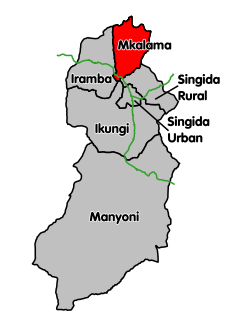
Gumanga is an administrative ward in the Mkalama District of the Singida Region of Tanzania. According to the 2002 census, the ward has a total population of 9,896. According to the 2012 census, the population had increased to 10,948.
Ibaga is an administrative ward in the Mkalama District of the Singida Region of Tanzania. According to the 2002 census, the ward has a total population of 10,672. According to the 2012 census, the population had increased to 11,712.
Iguguno is an administrative ward in the Mkalama District of the Singida Region of Tanzania. According to the 2002 census, the ward had a total population of 21,617. The town is popular business center for crops like cereals and sunflower. It is arguably the most developed town in the district.There are a few schools both primary and secondary in the town. According to the 2012 census, the population had increased to 25,860.
Ilunda is an administrative ward in the Mkalama District of the Singida Region of Tanzania. According to the 2002 census, the ward has a total population of 19,465. According to the 2012 census, the population had increased to 21,622.
Mpambala is an administrative ward in the Mkalama District of the Singida Region of Tanzania. According to the 2002 census, the ward had a total population of 10,882. According to the 2012 census, the population had increased to 11,192.
Msingi is an administrative ward in the Mkalama District of the Singida Region of Tanzania. According to the 2002 census, the ward has a total population of 6,439. According to the 2012 census, the population had increased to 7,289.
Mwanga is an administrative ward in the Mkalama District of the Singida Region of Tanzania. According to the 2002 census, the ward had a total population of 21,474. According to the 2012 census, the population had increased to 26,024.
Mwangeza is an administrative ward in the Mkalama District of the Singida Region of Tanzania. According to the 2002 census, the ward has a total population of 12,445. According to the 2012 census, the population had increased to 19,258.
Nduguti is an administrative ward in the Mkalama District of the Singida Region of Tanzania. According to the 2002 census, the ward has a total population of 15,955. According to the 2012 census, the population had decreased to 8,638.
Nkinto is an administrative ward in the Mkalama District of the Singida Region of Tanzania. According to the 2002 census, the ward has a total population of 13,367. According to the 2012 census, the population had decreased to 10,372.

Eshel is a former settlement in Fresno County, California. It was located on the Southern Pacific Railroad 3 miles (4.8 km) north-northeast of Malaga, at an elevation of 312 feet. Eshel still appeared on maps as of 1923.

Grab is a village in the municipality of Trnovo, Republika Srpska, Bosnia and Herzegovina.
Kruševci is a village in the municipality of Sokolac, Bosnia and Herzegovina.