Related Research Articles

Cartography is the study and practice of making and using maps. Combining science, aesthetics and technique, cartography builds on the premise that reality can be modeled in ways that communicate spatial information effectively.

The National Geospatial-Intelligence Agency (NGA) is a combat support agency within the United States Department of Defense whose primary mission is collecting, analyzing, and distributing geospatial intelligence (GEOINT) in support of national security. Initially known as the National Imagery and Mapping Agency (NIMA) from 1996 to 2003, it is a member of the United States Intelligence Community.
A GIS software program is a computer program to support the use of a geographic information system, providing the ability to create, store, manage, query, analyze, and visualize geographic data, that is, data representing phenomena for which location is important. The GIS software industry encompasses a broad range of commercial and open-source products that provide some or all of these capabilities within various information technology architectures.

The Survey of India is India's central engineering agency in charge of mapping and surveying. Set up in 1767 to help consolidate the territories of the British East India Company, it is one of the oldest Engineering Departments of the Government of India. Its members are from Survey of India Service cadre of Civil Services of India and Army Officers from the Indian Army Corps of Engineers. It is headed by the Surveyor General of India. At present, Survey of India is headed by Naveen Tomar.
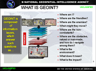
In the United States, geospatial intelligence (GEOINT) is intelligence about the human activity on earth derived from the exploitation and analysis of imagery and geospatial information that describes, assesses, and visually depicts physical features and geographically referenced activities on the Earth. GEOINT, as defined in US Code, consists of imagery, imagery intelligence (IMINT) and geospatial information.

The Vector Map (VMAP), also called Vector Smart Map, is a vector-based collection of geographic information system (GIS) data about Earth at various levels of detail. Level 0 coverage is global and entirely in the public domain. Level 1 is only partly in the public domain.

Royal School of Military Survey is a joint services survey training facility associated with the Corps of Royal Engineers (RE) but attached to the United Kingdom Defence Intelligence and Security Centre (DISC).

The Royal Australian Survey Corps was a Corps of the Australian Army, formed on 1 July 1915 and disbanded on 1 July 1996. As one of the principal military survey units in Australia, the role of the Royal Australian Survey Corps was to provide the maps, aeronautical charts, hydrographical charts and geodetic and control survey data required for land combat operations.
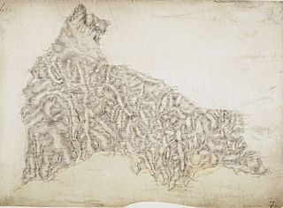
A national mapping agency is an organisation, usually publicly owned, that produces topographic maps and geographic information of a country. Some national mapping agencies also deal with cadastral matters.
Geographic information systems (GIS) play a constantly evolving role in geospatial intelligence (GEOINT) and United States national security. These technologies allow a user to efficiently manage, analyze, and produce geospatial data, to combine GEOINT with other forms of intelligence collection, and to perform highly developed analysis and visual production of geospatial data. Therefore, GIS produces up-to-date and more reliable GEOINT to reduce uncertainty for a decisionmaker. Since GIS programs are Web-enabled, a user can constantly work with a decision maker to solve their GEOINT and national security related problems from anywhere in the world. There are many types of GIS software used in GEOINT and national security, such as Google Earth, ERDAS IMAGINE, GeoNetwork opensource, and Esri ArcGIS.

The Army Map Service (AMS) was the military cartographic agency of the United States Department of Defense from 1941 to 1968, subordinated to the United States Army Corps of Engineers. On September 1, 1968, the AMS was redesignated the U.S. Army Topographic Command (USATC) and continued as an independent organization until January 1, 1972, when it was merged into the new Defense Mapping Agency (DMA) and redesignated as the DMA Topographic Center (DMATC). On October 1, 1996, DMA was folded into the National Imagery and Mapping Agency (NIMA), which was redesignated as the National Geospatial-Intelligence Agency (NGA) in 2003.

Evasion charts or escape maps are maps made for servicemembers, and intended to be used when caught behind enemy lines to assist in performing escape and evasion. Such documents were secreted to prisoners of war by various means to aid in escape attempts.

The Army Geospatial Information Center is the military geographical, cartographical and geospatial intelligence agency of the Portuguese Army.

The Engineer Terrain Intelligence Regiment is a regiment of the South African Army Engineer Formation. The unit is based in Pretoria, Gauteng. It is responsible for providing the cartography needs of the South African Army.
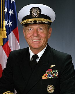
Rear Admiral Joseph John "Jack" Dantone Jr. of U.S. Navy, was last director of Defense Mapping Agency (DMA) from May 1996 to September 1996. He was also the Acting Director of National Imagery and Mapping Agency (NIMA) from October 1996 to March 1998. He played a major role in transition of DMA into NIMA.

James C. King is a retired United States Army Lieutenant General. A career Military Intelligence officer, he served on active duty from 1968 to 2001. At the time of his retirement he was serving as the Director of the National Imagery and Mapping Agency, one of the intelligence agencies of the United States Intelligence Community.

Lieutenant General Howard W. Penney of United States Army, was first director of Defense Mapping Agency from July 1972 to August 1974. Under Penney's leadership, the new agency focused its assets into a decentralized structure with a lean staff to respond to the rising demands for geographic information by a variety of military users.
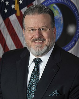
Justin Poole was the seventh Deputy Director of the National Geospatial-Intelligence Agency (NGA). As deputy director of NGA, he assisted the director in leading the agency and managing the day-to-day operations of NGA and the National System for Geospatial-Intelligence. He became the deputy director on August 10, 2017, after more than 26 years of service with NGA and its predecessor organizations. He resigned on June 11, 2019, following a Department of Defense probe into allegations of personal misconduct.

Alexander James Kent is a British cartographer, geographer and academic. He is Reader in Cartography and Geographical Information Science at Canterbury Christ Church University and a Senior Research Associate of the Oxford Centre for Islamic Studies at the University of Oxford.
The United States Army Geospatial Intelligence Battalion, previously known as the 3rd Military Intelligence Center, is a military intelligence battalion specializing in the production and exploitation of geospatial intelligence (GEOINT), and the only operational military command at the National Geospatial-Intelligence Agency (NGA). Co-located within the NGA headquarters (NGA-East) on Fort Belvoir in Springfield, Virginia, the unit produces and analyzes geospatial intelligence products for ground combat forces in close collaboration with its host agency and other members of the U.S. Intelligence Community. Though colocated with NGA, the AGB differs from NGA's own Support Teams in that it receives tasking from the Army.
References
- ↑ "Military Mapping Maidens of WWII | National Geospatial-Intelligence Agency". www.nga.mil. Retrieved 2022-05-20.
- ↑ Osborn, Carlyn (2016-03-11). "Millie the Mapper | Worlds Revealed: Geography & Maps at The Library Of Congress". blogs.loc.gov. Retrieved 2022-05-21.
- 1 2 3 4 The Military Mapping Maidens of the Army Map Service - Judith Tyner, CSU Long Beach , retrieved 2022-05-21
- 1 2 3 4 Tyner, Judith (2021). Women in American cartography: an invisible social history. ISBN 1-4985-4831-8. OCLC 1255465394.
- 1 2 3 "Mapping Maidens' Chart Course for Today's Mapmakers | National Geospatial-Intelligence Agency". www.nga.mil. Retrieved 2022-05-20.
- 1 2 "On The Map: Bea McPherson Charted Course of Women Mapmakers | Kent State University". www.kent.edu. Retrieved 2022-05-20.
- ↑ "Military Mapping Maidens ~ Traveling Exhibit Kicks Off at MAPS". MAPS Air Museum. Retrieved 2022-05-21.