History
| | This section needs expansion. You can help by adding to it. (May 2008) |
Hampton followed the Minisink Trail for a large segment of the Military Road.
The Military Road (also known as the Military Supply Road) was a roadway built in the present-day U.S. state of New Jersey during the French and Indian War connecting Elizabethtown (now Elizabeth) with a string of fortifications along the Delaware River in modern Sussex and Warren Counties in northwestern New Jersey. The road was conceived and built under the order of Jonathan Hampton, Esq., an Elizabethtown merchant and surveyor who was appointed as Victualer and Paymaster to the New Jersey Frontier Guard by an act of the New Jersey's colonial legislature.
Most of the route has been converted into roads within the federal, state and county highways system, and into a few local, municipal roads. A one-mile (1.6 km) segment of the original road, traveling from the village of Walpack Center in Walpack Township, New Jersey to the terminus of the route at the Delaware River within the bounds of the Delaware Water Gap National Recreation Area is maintained by the National Park Service in its original condition. Several shorter segments are unmaintained, and often parallel the modern roadways which evolved from the route.
| | This section needs expansion. You can help by adding to it. (May 2008) |
Hampton followed the Minisink Trail for a large segment of the Military Road.

The Delaware Water Gap is a water gap on the border of the U.S. states of New Jersey and Pennsylvania where the Delaware River cuts through a large ridge of the Appalachian Mountains.

Worthington State Forest is a state forest located in Warren County, New Jersey within the Delaware Water Gap National Recreation Area, just north of the water gap in the Skylands Region of the state. It covers an area of 6,660 acres (27.0 km2) and stretches for more than 7 miles (11 km) along the Kittatinny Ridge near Columbia. The park offers hiking, camping and canoeing and kayaking on the Delaware River. There are nearly 20 miles (32 km) of hiking trails within the park, including 7 miles (11 km) of the Appalachian Trail, which passes through the park. The park is operated and maintained by the New Jersey Division of Parks and Forestry.

Kittatinny Mountain is a long ridge traversing primarily across Sussex County in northwestern New Jersey, running in a northeast-southwest axis, a continuation across the Delaware Water Gap of Pennsylvania's Blue Mountain. It is the first major ridge in the far northeastern extension of the Ridge and Valley province of the Appalachian Mountains, and reaches its highest elevation, 1,803 feet, at High Point in Montague Township. Kittatinny Mountain forms the eastern side of Wallpack Valley; the western side comprises the Wallpack Ridge (highest elevation: 928 feet above sea level.

The Delaware Water Gap National Recreation Area is a 70,000 acres (28,000 ha) national recreation area along the middle section of the Delaware River in New Jersey and Pennsylvania stretching from the Delaware Water Gap northward in New Jersey to the state line near Port Jervis, New York, and in Pennsylvania to the outskirts of Milford.

Flatbrook is an 11.6-mile-long (18.7 km) tributary of the Delaware River in Sussex County, New Jersey in the United States.

The Paulins Kill is a 41.6-mile (66.9 km) tributary of the Delaware River in northwestern New Jersey in the United States. With a long-term median flow rate of 76 cubic feet of water per second (2.15 m³/s), it is New Jersey's third-largest contributor to the Delaware River, behind the Musconetcong River and Maurice River. The river drains an area of 176.85 square miles (458.0 km2) across portions of Sussex and Warren counties and 11 municipalities. It flows north from its source near Newton, and then turns southwest. The river sits in the Ridge and Valley geophysical province.
Old Mine Road is a road in New Jersey and New York said to be one of the oldest continuously used roads in the United States of America. At a length of 104 miles (167 km), it stretches from the Delaware Water Gap National Recreation Area to the vicinity of Kingston, New York.

The Delaware Water Gap Toll Bridge is a toll bridge that carries Interstate 80 across the Delaware River at the Delaware Water Gap, connecting Hardwick Township, Warren County, New Jersey, and Delaware Water Gap, Monroe County, Pennsylvania, in the United States. The bridge was built by the Delaware River Joint Toll Bridge Commission. The 2,465-foot-long (751 m) bridge is a multiple span dual roadway with a steel plate structure. The roadways are 28 feet (8.5 m) wide each and separated from each other by a concrete Jersey barrier.
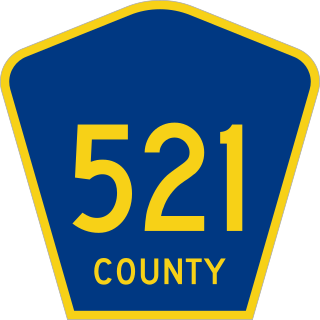
County Route 521 is a county highway in the U.S. state of New Jersey. The highway extends 43.71 miles from High Street in Hope Township to the New York state line in Montague Township.

Stokes State Forest is a state park located in Sandyston, Montague and Frankford in Sussex County, New Jersey, United States. Stokes comprises 16,447 acres (66.56 km2) of mountainous woods in the Kittatinny Mountains, extending from the southern boundary of High Point State Park southwestward to the eastern boundary of the Delaware Water Gap National Recreation Area. The park is operated and maintained by the New Jersey Division of Parks and Forestry.
National Park Route 615 is a route through the Delaware Water Gap National Recreation Area. The route consists of two parts, County Route 615, maintained by Sussex County, New Jersey, and the remainder of the route, maintained by the National Park Service.

The Minisink or Minisink Valley is a loosely defined geographic region of the Upper Delaware River valley in northwestern New Jersey, northeastern Pennsylvania and New York.

Van Campen's Inn or Isaac Van Campen Inn is a fieldstone residence that was used as a yaugh house during the American colonial era. Located in Walpack Township, Sussex County, New Jersey along the Delaware River, it is a historic site located along the Old Mine Road in the Delaware Water Gap National Recreation Area. It is operated under a memorandum of understanding between the National Park Service and the Walpack Historical Society, a local non-profit corporation.
Jonathan Hampton was an American colonial surveyor, merchant, and militia officer involved with New Jersey's frontier fortifications and defenses along the Delaware River during the French and Indian War (1755-1763).

Wallpack Ridge is a mountain located in the Ridge and Valley Appalachians physiographic province in Sussex County in northwestern New Jersey. Oriented northeast to southwest, Wallpack Ridge spans 25 miles (40 km) from Montague Township south of Port Jervis, New York to the Walpack Bend in the Delaware River near Flatbrookville in Walpack Township. It is a narrow ridge ranging between 0.67 miles (1.08 km) to 1.7 miles (2.7 km) in width, and its highest elevation reaches 928 feet (283 m) above sea level. The ridge separates the Wallpack Valley from the valley of the Delaware River, and contains the watershed of the Flat Brook and its main tributaries Big Flat Brook and Little Flat Brook.

Wallpack Valley is a valley located in Sussex County in northwestern New Jersey formed by Wallpack Ridge on the west, and Kittatinny Mountain on the east. Wallpack Ridge separates the Wallpack Valley from the valley of the Delaware River, and contains the watershed of the Flat Brook and its main tributaries Big Flat Brook and Little Flat Brook. It is a narrow valley, roughly 25 miles (40 km) in length running from Montague Township south of Port Jervis, New York to the Walpack Bend in the Delaware River near Flatbrookville in Walpack Township where the Flat Brook enters the Delaware at 300 feet above sea level.

Wallpack Center is an unincorporated community located within Walpack Township, Sussex County, New Jersey, United States. Wallpack Center is located in the Flat Brook Valley 6.7 miles (10.8 km) west of Branchville. Wallpack Center has a post office with ZIP code 07881. It is now part of the Delaware Water Gap National Recreation Area.

Flatbrookville is an unincorporated community located along Old Mine Road within Walpack Township, in Sussex County, New Jersey, United States. It is named after the Flat Brook, a tributary of the Delaware River, which flows through the community. The area is now part of the Delaware Water Gap National Recreation Area.
The Old Mine Road Historic District is a 687-acre (278 ha) historic district located along Old Mine Road in Sussex County and Warren County, New Jersey. It is part of the Delaware Water Gap National Recreation Area. The district was added to the National Register of Historic Places on December 3, 1980, for its significance in agriculture, archaeology, architecture, commerce, exploration/settlement, and transportation. It includes 24 contributing buildings and five contributing sites.

Bevans, also known as Peters Valley, is an unincorporated community located at the intersection of Bevans Road, Walpack Road, and Kuhn Road in Sandyston Township of Sussex County, New Jersey. The village is now part of the Delaware Water Gap National Recreation Area. Both the Delaware River and the Old Mine Road are nearby.