View north along CR 519 at Frenchtown Road (CR 619) in Milford
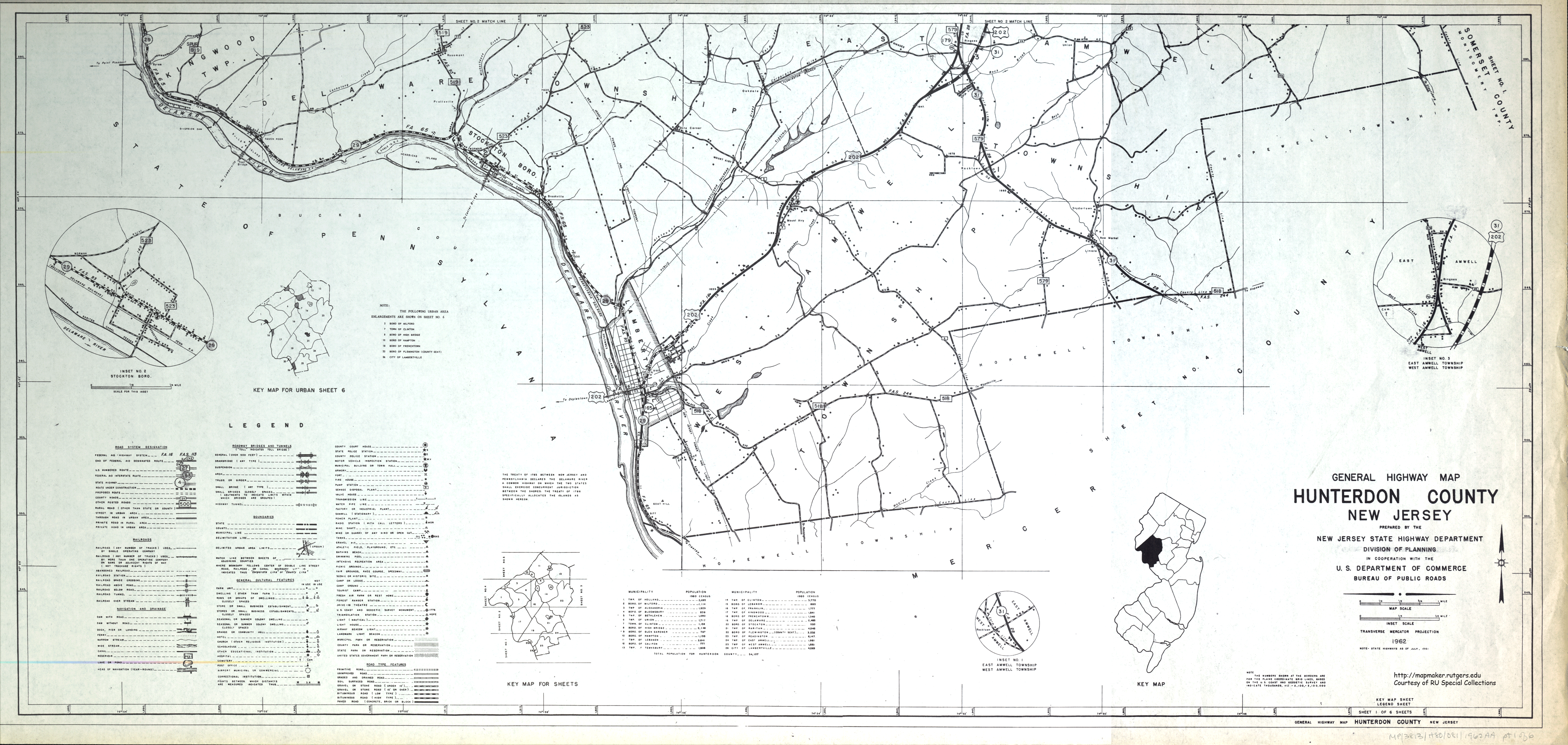
CR 519 begins at an intersection with Route 29 in Delaware Township, Hunterdon County, heading north on two-lane, undivided Kingwood-Stockton Road. The road first passes through woods before entering farm fields. The route passes through the residential community of Rosemont before continuing back into agricultural areas. CR 519 enters Kingwood Township and continues through a mix of farmland and woodland, becoming Kingwood Road at the CR 651 intersection. In Kingwood Township, the route comes to a junction with Route 12 in the community of Baptistown, where the road is lined with homes. CR 519 passes through more rural areas with a few housing developments as it continues into Alexandria Township.[1][2]
Here, the route turns northwest onto Palmyra Road at an intersection with Senator Stout Road/Hog Hollow Road and soon crosses CR 513. CR 519 forms the border between Holland Township to the west and Alexandria Township to the east as turns southwest onto Mount Pleasant Road, with CR 631 continuing north. At this point, the route is fully within Holland Township and continues through agricultural areas before entering Milford. The road makes a turn to the south before heading southwest again and passes residences. At the intersection with CR 619, CR 519 turns northwest onto Frenchtown Road and becomes Water Street at the intersection with Bridge Street/Barron Road a short distance later in the commercial center of Milford. The road passes more homes before leaving Milford for Holland Township again and becoming Milford-Warren Glen Road. In this area, the route passes a mix of farms, woods, and residential subdivisions, turning north and running through the community of Riegel Ridge. Past here, CR 519 enters woodland and turns northwest before crossing over Musconetcong Mountain.[1][2]
After crossing the Musconetcong River, CR 519 enters Pohatcong Township, Warren County and immediately turns north at the CR 627 intersection into wooded areas with some farms and homes. The route winds to the northwest and passes under I-78. After this, CR 519 becomes Springtown Road and briefly forms the border between Alpha to the west and Pohatcong Township to the east before completely entering Alpha and continuing north. The road becomes Third Avenue and passes a few businesses before crossing under Norfolk Southern's Lehigh Line and passing several homes with some commercial establishments. After crossing back into Pohatcong Township and becoming Hawk Avenue, CR 519 intersects Route 122 and turns northwest to form a concurrency with that route on New Brunswick Avenue. CR 519 splits from Route 122 by turning northeast onto Saint James Avenue and passing more homes. The road passes near commercial development as it comes to a junction with US 22. Past US 22, the route becomes Uniontown Road and enters Greenwich Township. It passes near a mix of farm fields and residential neighborhoods as it makes a curve to the north and crosses into Lopatcong Township. CR 519 briefly becomes a divided highway as it passes under Norfolk Southern's Washington Secondary before crossing Route 57.[1][2]
CR519 southbound in Alpha
Past this intersection, the route enters more rural areas of farms and woods with a few homes and businesses as it continues into Harmony Township. The road turns northeast onto Upper Belvidere Road as it runs through agricultural areas with the Delaware River a short distance to the west and Scotts Mountain to the east. CR 519 continues into White Township, where it reaches an intersection with CR 620. At this intersection, CR 620 continues north on Belvidere Road toward Belvidere while CR 519 heads northeast onto Hazen-Bridgeville Road. It passes through more rural areas as it continues to a junction with US 46, where the route passes a few residences.[1][2]
From this point, CR 519 becomes Bridgeville-Hope Road and passes through more farm areas immediately to the west of Jenny Jump State Forest, turning more to the northeast and entering Hope Township. The road passes a mix of woods and farms as it curves north and enters the residential community of Hope. Here, CR 519 becomes Union Street and makes a turn east onto High Street, with CR 521 continuing north at this point. CR 519 continues northeast out of Hope along Hope-Johnsonburg Road, passing through a mix of farmland and woodland with occasional homes. The road crosses under I-80 before coming into Frelinghuysen Township and becoming Johnsonburg Road. In this area, the surroundings become more wooded with a few fields. The road passes near a few wooded residential areas before coming to the CR 661 junction, at which point CR 519 turns northeast onto Johnsonburg-Newton Road. The route heads through more rural areas and crosses under the abandoned Lackawanna Cutoff.[1][2]
CR 519 crosses into Green Township, Sussex County and becomes Hibler Road. A short distance past the county line, the route turns north onto Wintermute Road, which makes a turn northeast into a narrow agricultural valley. Upon intersecting CR 608, CR 519 enters Fredon Township and the name changes to Ridge Road. The road continues into a mix of woodland and residential areas, with some farm fields, before entering Newton. At this point, the route becomes West End Avenue and passes several homes. CR 519 comes to an intersection with Route 94, and turns east to follow that route along High Street. Route 94 and CR 519 continue to downtown Newton and come to the Park Place square, where the road meets US 206. At this point, all three routes run concurrent north on four-lane undivided Water Street for a short distance. CR 519 splits from US 206/Route 94 by turning northwest onto four-lane undivided Mill Street. The road soon narrows to two lanes as it passes businesses and makes a turn to the north, passing by Sussex County Community College.[1][2]
CR519 northbound along its concurrency with Route23 in Wantage Township
The route crosses into Hampton Township and becomes Conrads Corner Road as it passes rural areas of residences, heading northeast. CR 519 curves north and crosses the Paulinskill Valley Trail before it enters woodland and turns northeast again. The road enters farmland and makes a sharp turn west-northwest to cross the Paulins Kill. A short distance later, the route turns north onto Branchville-Lawson Road and enters Frankford Township. CR 519 passes through forested areas with some homes prior to entering Branchville and becoming Newton Avenue. The route crosses US 206 before making a turn west onto Mill Street. The road passes a mix of residences and businesses as it reaches the center of Branchville, where CR 519 turns northeast onto Wantage Avenue. The road passes more homes before crossing back into Frankford Township, at which point it passes through a forest. The route makes a turn north onto Branchville-Lewisburg Road, with Wantage Avenue continuing to the northeast as CR 629. CR 519 passes some homes before entering a mix of woods and farms, curving northeast again.[1][2]
Upon crossing into Wantage Township, the road makes a turn to the east and passes a mix of homes and businesses as well as the Space Farms Zoo and Museum. CR 519 heads northeast into more farmland as it comes to a turn north onto Colesville-Lusscroft Road. The route runs through more rural areas with some residential development, eventually making a bend to the northeast. CR 519 continues to an intersection with Route 23, where it turns north for a concurrency with that route. The two routes pass through forested areas with some homes until CR 519 splits from Route 23 by heading north on Greenville Road. This road carries the route north, entering dense forests and crossing the Appalachian Trail before it comes to the New York border. At the state line, CR 519 ends and the road continues into Orange County, New York as CR 55.[1][2]
History
From Mill Street, starting about 250 feet northwest of its current intersection (following realignment in the 1970s from Spring Street) with Water Street at Trinity Street in Newton, to the currently-named Morris Turnpike in Hampton Township, CR 519 follows the route of the former Morris (and Sussex) Turnpike.
On June 12, 2014, a truck weighing over 40 short tons (36,000kg) attempted to cross over a 114-year-old iron pony truss bridge crossing the Lockatong Creek in Kingwood Township causing the bridge to buckle. Hunterdon County, which is responsible for maintaining the bridge, closed the bridge to await replacement.[4][5] A new truss bridge and concrete culvert opened on April 1, 2016.[6][7]
Route 12 is a state highway located in Hunterdon County, New Jersey, United States. It runs 11.69 mi (18.81 km) from the Uhlerstown–Frenchtown Bridge at the Delaware River border with Pennsylvania in Frenchtown east to an intersection with U.S. Route 202 and Route 31 at the Flemington Circle in Flemington. The route is mostly a two-lane undivided road that passes through rural areas of woodland and farmland. It intersects Route 29 and County Route 513 in Frenchtown, CR 519 in Kingwood Township, CR 579 on the border of Delaware Township and Raritan Township, and CR 523 in Raritan Township.
Route 29 is a state highway in the U.S. state of New Jersey. Signed north-south, it runs 34.76 miles (55.94 km) from an interchange with Interstate 295 (I-295) in Hamilton Township in Mercer County, where the road continues east as I-195, northwest to Route 12 in Frenchtown, Hunterdon County. Between the southern terminus and I-295 in Ewing Township, the route is a mix of expressway and boulevard that runs along the Delaware River through Trenton. This section includes a truck-restricted tunnel that was built along the river near historic houses and Riverview Cemetery. North of I-295, Route 29 turns into a scenic and mostly two-lane highway. North of the South Trenton Tunnel, it is designated the Delaware River Scenic Byway, a New Jersey Scenic Byway and National Scenic Byway, that follows the Delaware River in mostly rural sections of Mercer County and Hunterdon County. The obsolete Delaware & Raritan Canal usually stands between the river and the highway. Most sections of this portion of Route 29 are completely shaded due to the tree canopy. Route 29 also has a spur, Route 129, which connects Route 29 to U.S. Route 1 (US 1) in Trenton.
U.S. Route 206 is a 130.2-mile-long (209.5 km) north–south U.S. highway in New Jersey and Pennsylvania, United States. Only about a 1⁄2 mile (0.80 km) of its length is in Pennsylvania; the Milford–Montague Toll Bridge carries it over the Delaware River into New Jersey, where it connects to the remainder of the route. Its southern terminus is at an intersection of White Horse Pike and Bellevue Avenue in Hammonton. The highway's northern terminus is at an intersection of US 209 near Milford, Pennsylvania; some sources and signs show an overlap with US 209 to end at its parent route US 6. For much of its length, US 206 is a rural two-lane undivided road that passes through the Pine Barrens, agricultural areas, and the Appalachian Mountains of Northwestern New Jersey, with some urban and suburban areas. The route connects several cities and towns, including Bordentown, Trenton, Princeton, Somerville, Roxbury, Netcong, and Newton.
County Route 579 is a county highway in the U.S. state of New Jersey. The highway extends 37.24 miles (59.93 km) from John Fitch Parkway in Trenton to Route 173 in Greenwich Township.
County Route 555 is a county highway in the U.S. state of New Jersey. The highway extends 34.20 miles (55.04 km) from Port Norris Road in Downe Township to Black Horse Pike in Washington Township in Gloucester County.
County Route 553 is a county highway in the U.S. state of New Jersey. The highway extends 51.22 miles (82.43 km) from Hands Landing Road/Ogden Avenue in Commercial Township to Broadway in Deptford Township.
County Route 552 is a county highway in the U.S. state of New Jersey. The highway extends 27.48 miles (44.22 km) from Laurel Street in Bridgeton to Harding Highway in Hamilton Township.
County Route 551 is a county highway in the U.S. state of New Jersey. The highway extends 34.57 miles (55.64 km) from Pennsville-Salem Road in Pennsville Township to Penn Street in Camden.
County Route 543 is a county highway in the U.S. state of New Jersey. The highway extends 28.77 miles (46.30 km) from Federal Street in Camden to Wrightstown-Georgetown Road in Mansfield Township.
County Route 540 is a county highway in the U.S. state of New Jersey. The highway extends 43.16 miles (69.46 km) from the intersection of U.S. Route 130 (US 130) and Route 140 in Carneys Point Township to Harding Highway (US 40) in Buena Vista Township.
County Route 537 is a county highway in the U.S. state of New Jersey. The highway extends 66.22 miles (106.57 km) from Delaware Avenue in Camden to CR 11 in Oceanport. It is the state's fourth longest 500 series county route.
County Route 528 is a county highway in the U.S. state of New Jersey. The highway is designated 39.89 miles (64.20 km) from Farnsworth Avenue in Bordentown to Ocean Avenue in Mantoloking. The eastern end of the highway sustained extensive damage in 2012 when an inlet opened between Barnegat Bay and the Atlantic Ocean during Hurricane Sandy, scouring away the road east of the Mantoloking Bridge. The bridge and Route 35 intersection fully reopened in February 2013.
County Route 524 is a county highway in the U.S. state of New Jersey. The highway extends 39.90 miles (64.21 km) from the White Horse Circle in Hamilton Township to Route 71 in Spring Lake Heights.
County Route 523 is a county highway in the U.S. state of New Jersey. The highway extends 29.55 miles (47.56 km) from Route 29 in Stockton to U.S. Route 202 (US 202) in Bedminster Township.
County Route 521 is a county highway in the U.S. state of New Jersey. The highway extends 43.71 miles from High Street in Hope Township to the New York state line in Montague Township.
County Route 518 is a county highway in the U.S. state of New Jersey. The highway extends 20.58 miles (33.12 km) from Route 29/Route 165 in Lambertville to Lincoln Highway in Franklin Township. It is also known as the Georgetown Franklin Turnpike.
County Route 517 is a county highway in the U.S. state of New Jersey. The highway extends 53.8 miles (86.58 km) from Lamington Road / Oldwick Road in Tewksbury to the New York state line in Vernon where it continues as Orange County Route 26. It passes through mostly rural and exurban communities. Its speed limit varies from as much as 50 mph (80 km/h) to as little as 25 mph (40 km/h).
County Route 514 is a county highway in the U.S. state of New Jersey. The highway extends 42.86 miles (68.98 km) from its western terminus U.S. Route 202 (US 202) and Route 31 in East Amwell Township to its eastern terminus Edgar Road in Elizabeth. West of its western terminus, CR 514 continues as Route 179.
County Route 513 is a county highway in the U.S. state of New Jersey. The highway extends 66.83 miles (107.55 km) from Kingwood Avenue in Frenchtown to Lakeside Road in West Milford. South of Frenchtown, the road continues as Route 29. It is the third longest county route in New Jersey, following CR 519 and CR 527.
County Route 512 is a county highway in the U.S. state of New Jersey. The highway extends 32.96 miles (53.04 km) from High Bridge Road in Califon to Springfield Avenue / Route 24 in Summit.
↑ Graziano, Sallie (March 24, 2016). "Not a joke: N.J. bridge to open on April 1". NJ.com. Retrieved April 17, 2016. 'We're pushing for Thursday to open, with the target of April 1,' said county construction inspector Bryan Stem on Thursday morning.
This page is based on this Wikipedia article Text is available under the CC BY-SA 4.0 license; additional terms may apply. Images, videos and audio are available under their respective licenses.


