The geography of France consists of a terrain that is mostly flat plains or gently rolling hills in the north and west and mountainous in the south and the east.

This is a list of the extreme points of Azerbaijan, the points that are farther north, south, east or west than any other location.

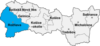
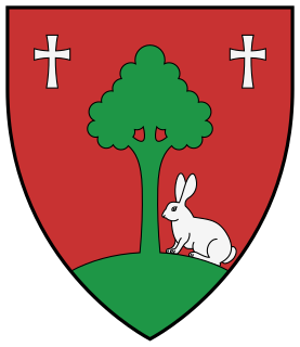
Čučma is a village and municipality in the Rožňava District in the Košice Region of eastern Slovakia.

Dány is a village in Pest county, Hungary.

Măgirești is a commune in Bacău County, Romania. It is composed of five villages: Măgirești, Prăjești, Stănești, Șesuri and Valea Arinilor.

Solonț is a commune in Bacău County, Romania. It is composed of three villages: Cucuieți, Sărata and Solonț.

The Zeppelin LZ 13 Hansa was a German civilian rigid airship first flown in 1912. It was built for DELAG to carry passengers and post and flew the first international passenger flight, visiting Denmark and Sweden in September 1912. In 1913 it was hired to the Imperial German Navy as a training craft, and at the outbreak of World War I it was requisitioned by the German military who used it for bombing, reconnaissance, and finally as a training airship.

Pieniążki is a village in the administrative district of Gmina Grajewo, within Grajewo County, Podlaskie Voivodeship, in north-eastern Poland. It lies approximately 12 kilometres (7 mi) south of Grajewo and 65 km (40 mi) north-west of the regional capital Białystok.

Nohurdüzü is a village in the Quba Rayon of Azerbaijan. The village forms part of the municipality of Yerfi.

Orta Xuç is a village in the Quba Rayon of Azerbaijan. The village forms part of the municipality of Aşağı Xuç.

Dzhibir-Kazmalary is a village in the Qusar Rayon of Azerbaijan.

Hacıqazma is a village in the Khachmaz Rayon of Azerbaijan. The village forms part of the municipality of Əhmədoba.

Düztahiroba is a village in the Khachmaz Rayon of Azerbaijan. The village forms part of the municipality of Yalama.
Fətəli xan is a municipality in the Quba Rayon of Azerbaijan. The municipality is named in honor of Azerbaijani prime minister Fatali Khan Khoyski.
Caqarqışlaq is a village and municipality in the Qusar Rayon of Azerbaijan. It has a population of 615.
Urvaoba is a village in the municipality of Urva in the Qusar Rayon of Azerbaijan.
Tornyiszentmiklós is a village in Zala County, Hungary.
Koprivlen is a village in Hadzhidimovo Municipality, in Blagoevgrad Province, Bulgaria.
Vratarite is a village in the municipality of Dobrichka, in Dobrich Province, in northeastern Bulgaria.
Vishnevka is the name of several rural localities in Russia.


