
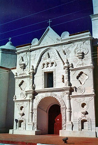
Mission San Xavier del Bac is a historic Spanish Catholic mission located about 10 miles (16 km) south of downtown Tucson, Arizona, on the Tohono O'odham Nation San Xavier Indian Reservation. The mission was founded in 1692 by Padre Eusebio Kino in the center of a centuries-old settlement of the Sobaipuri O'odham, a branch of the Akimel or River O'odham located along the banks of the Santa Cruz River. The mission was named for Francis Xavier, a Christian missionary and co-founder of the Society of Jesus in Europe. The original church was built to the north of the present Franciscan church. This northern church or churches served the mission until it was razed during an Apache raid in 1770.

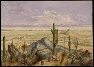
The Pimería Alta was an area of the 18th century Sonora y Sinaloa Province in the Viceroyalty of New Spain, that encompassed parts of what are today southern Arizona in the United States and northern Sonora in Mexico.
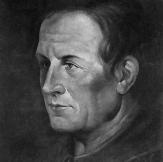
Eusebio Francisco Kino, SJ, often referred to as Father Kino, was an Italian Jesuit, missionary, geographer, explorer, cartographer, mathematician and astronomer born in the Bishopric of Trent, Holy Roman Empire.

The Spanish missions in the Sonoran Desert are a series of Jesuit Catholic religious outposts established by the Spanish Catholic Jesuits and other orders for religious conversions of the Pima and Tohono O'odham indigenous peoples residing in the Sonoran Desert. An added goal was giving Spain a colonial presence in their frontier territory of the Sonora y Sinaloa Province in the Viceroyalty of New Spain, and relocating by Indian Reductions settlements and encomiendas for agricultural, ranching, and mining labor.
Beginning in the 16th century Spain established missions throughout New Spain in order to facilitate colonization of these lands.
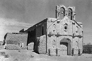
La Misión de San Gabriel de Guevavi was founded by Jesuit missionary priests Eusebio Kino and Juan María de Salvatierra in 1691. Subsequent missionaries called it San Rafael and San Miguel, resulting in the common historical name of Mission Los Santos Ángeles de Guevavi.

Magdalena de Kino is a city, part of the surrounding municipality of the same name, located in the Mexican state of Sonora covering approximately 560 square miles. According to the 2005 census, the city's population was 23,101, and the municipality's was 25,500. Magdalena de Kino is in the northern section of Sonora 50 miles from the Mexico-U.S. border. To the north the municipality abuts Nogales; to the south, the municipality of Santa Ana; to the east, Ímuris and Cucurpe; and to the west, the municipalities of Tubutama and Sáric. Its main sectors include San Ignacio, San Isidro, Tacicuri, and Sásabe. The city was named after the pioneer Roman Catholic missionary and explorer, Father Eusebio Francisco Kino, who worked in the area, as well as in the present-day US state of Arizona.

Atil is a small town in Atil Municipality in the northwest of the Mexican state of Sonora. The total area is 400.43 km² and the population of the municipality was 734 in 2005, of whom 699 lived in the municipal seat (2000). Neighboring municipalities are Tubutama, Trincheras, Oquitoa, and Altar.
Cucurpe is the municipal seat of Cucurpe Municipality in the Mexican state of Sonora.
Oquitoa is a small town surrounded by Oquitoa Municipality in the northwest of the Mexican state of Sonora.
Tubutama is a town in the north-west of the Mexican state of Sonora. It serves as the seat for the surrounding municipality of the same name.
Pima Villages, sometimes mistakenly called the Pimos Villages in the 19th century, were the Akimel O’odham (Pima) and Pee-Posh (Maricopa) villages in what is now the Gila River Indian Community in Pinal County, Arizona. First, recorded by Spanish explorers in the late 17th century as living on the south side of the Gila River, they were included in the Viceroyalty of New Spain, then in Provincias of Sonora, Ostimuri y Sinaloa or New Navarre to 1823. Then from 1824 to 1830, they were part of the Estado de Occidente of Mexico and from September 1830 they were part of the state of Sonora. These were the Pima villages encountered by American fur trappers, traders, soldiers and travelers along the middle Gila River from 1830s into the later 19th century. The Mexican Cession following the Mexican American War left them part of Mexico. The 1853 Gadsden Purchase made their lands part of the United States, Territory of New Mexico. During the American Civil War, they became part of the Territory of Arizona.
Between the years of 1539 and 1821, the Spanish Empire explored, colonized, and ruled over what is the state of Arizona in the United States.
José Antonio Garrucho (1712–1785) was a Jesuit missionary to Mexico, who served at Mission Los Santos Ángeles de Guevavi and Mission San Miguel Arcángel de Oposura. He was implicated in the events leading up to the Pima Revolt of 1751.
Luís María Gallardi was a Jesuit missionary to New Spain.
Francisco Antonio Barbastro (1735–1800) was a Franciscan missionary in New Spain.
Jacobo Sedelmayr (1702–1779) was a Jesuit missionary in New Spain, known for his explorations of the Pimería Alta.
Daniel Januske was a Jesuit missionary in New Spain.
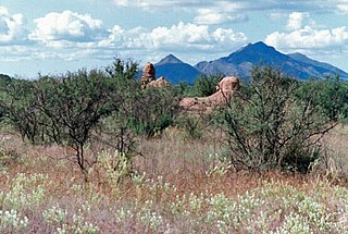
San Luis Bacoancos, also called San Luis de Babi, was a Spanish mission in the Sonoran desert.
