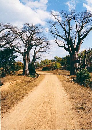
Transportation in Malawi is poorly developed. The country of almost 14 million has 39 airports, 6 with paved runways and 33 with unpaved runways. It has 797 kilometres of railways, all narrow-gauge and about 45 percent of its roads are paved. Though it is landlocked, Malawi also has 700 km (435 mi) of waterways on Lake Malawi and along the Shire River.

Mozambique, officially the Republic of Mozambique, is a country located in southeastern Africa bordered by the Indian Ocean to the east, Tanzania to the north, Malawi and Zambia to the northwest, Zimbabwe to the west, and Eswatini and South Africa to the southwest. The sovereign state is separated from the Comoros, Mayotte and Madagascar by the Mozambique Channel to the east. The capital and largest city is Maputo.

Maputo is the capital, and largest city of Mozambique. Located near the southern end of the country, it is within 120 kilometres of the borders with Eswatini and South Africa. The city has a population of 1,088,449 distributed over a land area of 347.69 km2 (134.24 sq mi). The Maputo metropolitan area includes the neighbouring city of Matola, and has a total population of 2,717,437. Maputo is a port city, with an economy centered on commerce. It is also noted for its vibrant cultural scene and distinctive, eclectic architecture. Maputo was formerly named Lourenço Marques until 1976.

Beira is the capital and largest city of Sofala Province, where the Pungwe River meets the Indian Ocean, in the central region of Mozambique. It is the fourth-largest city by population in Mozambique, after Maputo, Matola and Nampula. Beira had a population of 397,368 in 1997, which grew to 530,604 in 2019. A coastal city, it holds the regionally significant Port of Beira, which acts as a gateway for both the central interior portion of the country as well as the land-locked nations of Zimbabwe, Zambia and Malawi.

Komatipoort is a town situated at the confluence of the Crocodile and Komati Rivers in Mpumalanga province, South Africa. The town is 8 km from the Crocodile Bridge Gate into the Kruger Park, and just 5 km from the Mozambique border and 65 km from the Eswatini border.
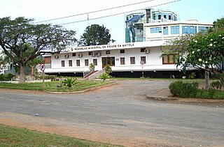
Matola is the largest suburb of the Mozambique capital, Maputo, adjacent to its westernmost side. It is the nation's second most populated city. Matola is the capital of Maputo Province and has had its own elected municipal government since 1998. It has a port and also the biggest industrial area in Mozambique. The population of Matola was, according to the 2007 census, 671,556 inhabitants, having increased to a 2017 census population of 1,032,197.
Nacala, also known as Cidade de Nacala or Nacala-Porto is a city on the northern coast of Mozambique. Located in the southwestern indentation of inner Fernao Veloso Bay, it is the deepest natural port on the east coast of Africa. Nacala serves as the terminal for the Nacala railway, a rail line to the landlocked Malawi. South of Nacala is Mozambique Island, at one time the capital of Mozambique and now a World Heritage Site.

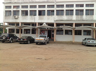
Chimoio is the capital of Manica Province in Mozambique. It is the fifth-largest city in Mozambique.
Dondo is a city and district Dondo District of Sofala Province in Mozambique.
Manica is a market town in western Mozambique, lying west of Chimoio in the province of Manica. Originally the centre of the Kingdom of Manica, it grew around the gold trade but is now best known for the Chinamapere rock paintings. The Penha Longa Mountains lie north of the town.
Moatize is the principal town and administrative center of Moatize District in western Mozambique's Tete Province. It is located on the eastern side of the Zambezi River at the confluence of the Moatize and Revuboe Rivers. After Tete, it is the second largest urban area, by population, in western Mozambique.
Chicualacuala is a town located in the province of Gaza in Mozambique. The town is better known by this unofficial name than by its official toponym Vila Eduardo Mondlane.
Chokwé, and earlier known as Vila Trigo de Morais, is a rural town and capital of Chokwe District in the province of Gaza in Mozambique. It is located about 230 kilometres (140 mi) north of the capital city of Maputo. This agricultural town is noted for its tomatoes.

Portos e Caminhos de Ferro de Moçambique is a state-owned company that oversees the railway system of Mozambique and its connected ports.
Vila de Sena or more commonly Sena is a town in Mozambique where there is a fundamental bridge over the Zambezi River. This bridge, the Dona Ana Bridge was originally a single track railway bridge, temporarily converted to road operation during the civil war.
Railway stations in Mozambique include:

Ressano Garcia is a small town in the Maputo Province, Mozambique. The town is adjacent to Komatipoort in South Africa. The town has around 11,200 people living in it.
The following is a timeline of the history of the city of Beira, Mozambique.

Sena railway, also called Shire Highlands railway, Dondo-Malawi railway and North-South Malawi railway, is a railway that connects Dondo, Mozambique, to Chipata, in Zambia. It is c. 1000 km long, in a 1067 mm gauge.

