Division No. 1, Subdivision A is an unorganized subdivision on the Avalon Peninsula in Newfoundland and Labrador, Canada. It is in Division No. 1, and lies between Trinity Bay and Placentia Bay.
Bellevue is a former provincial electoral district for the House of Assembly of Newfoundland and Labrador, Canada. As of 2003 it had 7310 eligible voters. The district was abolished in 2015 and replaced by Placentia West-Bellevue.
Monkstown is a townland and electoral ward in County Antrim, Northern Ireland. It is within the urban area of Newtownabbey and the Newtownabbey Borough Council area. The townland was previously called Ballynamanagh It is also situated in the civil parish of Carnmoney and the historic barony of Belfast Lower.

Rawlins Cross, formed by the intersection of Prescott Street, Monkstown and Military Roads, is a well known St. John's, Newfoundland and Labrador landmark. Military Road, built in 1773, was one of the first roads in this area that joined Fort William with Fort Townsend. Monkstown Road was built in the early 19th century and Prescott Street around 1840. The area where all three came together became to be known as Rawlins Cross, after grocer Patrick Rawlins.

The Burin Peninsula is a peninsula located on the south coast of the island of Newfoundland in the province of Newfoundland and Labrador.
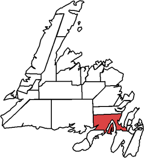
Baine Harbour is a Canadian community in the province of Newfoundland and Labrador.
Darby's Harbour is a locality and former settlement located southwest of Swift Current on Merasheen Island, Placentia Bay, Newfoundland, Canada. It had a post office in 1940. The 1935 population was 21, but by 1990 it was uninhabited.
Georgestown is a neighbourhood near the downtown of St. John's, Newfoundland and Labrador. It is bordered by Military Road, Monkstown Road, Empire Avenue, and Bonaventure Avenue. It was settled as the city's first suburb in the early 19th century. The name is an evolution of "George (Winter)'s Town", as it was known in the 19th century.
Herring Neck is a fishing community located at the northeastern extremity of New World Island, Notre Dame Bay of Newfoundland and Labrador, Canada. The community encompasses several small contiguous communities such as Merritt's Harbour, Hatchet Harbour, Salt Harbour and Sunnyside. The name has changed many times in its history; at one time the area now called Herring Neck was called Goshen’s Arm and the areas now called Pike’s Arm and Green Cove was called Herring Neck.
Route 210 is a highway that extends through the Burin Peninsula from Goobies to Marystown. The maximum speed limit is 90 km/h except through communities and settlements where the speed limit is reduced to 50 km/h. Just after exiting Swift Current, until a few kilometres north of Marystown, much of the landscape is barren, with very few trees prevalent. After entering Marystown, motorists approach a junction where they could turn right to continue their journey on Route 210 until arriving at Grand Bank, or going straight onto Route 220 towards Burin and St. Lawrence.
English Harbour East is a town in the Canadian province of Newfoundland and Labrador. It is a village located northeast of Belleoram. The Way Office was established in 1883 on July 1. The first Postmistress was Annis Hackett in 1891. The town had a population of 169 in the Canada 2006 Census. Many people moved to the area from such remote communities as Conne in the early to mid 20th Century. Its boundaries are established by the Town of English Harbour East Order under the Municipalities Act.
Little Bay East is a town in the Canadian province of Newfoundland and Labrador. The town had a population of 140 in the Canada 2006 Census.

St. Bernard's-Jacques Fontaine is a town in the Canadian province of Newfoundland and Labrador. The town had a population of 433 in the Canada 2016 Census, a drop from 470 in 2011.
Little Harbour East is a settlement located east of Belleoram. It is about 1.6 miles from Harbour Mille and is connected the Newfoundland highway network via NL-211, which branches off the main Burin highway (NL-210).
Bay de L'Eau is an abandoned community in Fortune Bay, Newfoundland and Labrador.

South Branch is a settlement in Newfoundland and Labrador, it was started as a settlement for those who took part in the construction of the Newfoundland Railway.
Middle Arm is a settlement in Newfoundland and Labrador.
Division No. 1, Subdivision B is an unorganized subdivision on the Avalon Peninsula in Newfoundland and Labrador, Canada. It is in Division 1 and contains the unorganized communities of Iona, Little Barasway, Placentia Junction, Point Verde and Ship Harbour.
Division No. 1, Subdivision C is an unorganized subdivision on the Avalon Peninsula in Newfoundland and Labrador, Canada. It is in Division 1 and contains the unincorporated communities of Cape St. Mary's, Cuslett, Gooseberry Cove, Great Barasway, Lears Cove, Patrick's Cove-Angels Cove, Ship Cove and Stoney House.
Division No. 1, Subdivision U is an unorganized subdivision on the Avalon Peninsula in Newfoundland and Labrador, Canada, in Division 1. It contains the unincorporated communities of Admiral's Cove, Bauline East, Bauline South, Burnt Cove, Devils Kitchen, Flat Rock, St. Michaels and Seal Cove.


