The pass was named after John Montagu, Colonial Secretary of the Cape in the 1840s, whose enthusiasm for good roads resulted in the first ambitious program of construction in Southern Africa. It was damaged by floods in November 1996, and was closed for most of 1997. It has been repaired and is now open. A driving time of about one hour will take one over the Outeniqua Mountains and through the village of Herold to the N9.
Construction
Watercolour of Montagu Pass in 1849, shortly after completion
In 1844, some 250 convicts started with the construction of the pass and it was opened for traffic in December 1847. The passage over the Outeniqua mountains, which used to take a full three days over the Cradock Pass, could now be accomplished within three hours. Today it takes 15 minutes by car.
Henry Fancourt White, an English-born early emigrant to then Cape Colony, was an experienced road engineer in charge of the work. His name is perpetuated in the lovely Fancourt Estate and in the village of Blanco (originally called White's Village). On the ascent, one passes the Old Tollhouse where once the toll of one penny per wheel and one penny per ox had to be paid. This historic building, declared a National Monument, is currently in a bad state having been vandalised. "Keurrivier se brug" further on has also been declared a National Monument. The original stone wall still exists all along the pass. The name boards tell interesting tales. The narrowest part of the pass with overhanging cliffs was called "Die Noute". Here wagons could not pass abreast. Further on is "Regop Trek", the steepest part of the road. Where the road passes underneath the railway bridge, is "Stinkhoutdraai" where stinkwood trees used to grow in profusion. In this way the pass continues, until reaching the hotel at North Station. The oldest part of the building dates back to 1840.
The Old Toll House
This building is built of local stone and it is a proclaimed heritage site. The toll was 2 pence per wheel and one penny for each pulling animal, 2 pence for a horse, cow, ox or mule and 1 half a penny for a sheep, goat or pig.
The first toll keeper was John Kirk Smith who was born in Nottingham, England, in 1818.
External links
Wikimedia Commons has media related to Montagu Pass.
Datchet is a village and civil parish in the Royal Borough of Windsor and Maidenhead in Berkshire, England, located on the north bank of the River Thames. Historically part of Buckinghamshire, and the Stoke Hundred, the village was eventually transferred to Berkshire, under the Local Government Act of 1972. The village developed because of its close proximity to Windsor and the ferry service which connected it to the main London Road across the River Thames. The ferry was later replaced by a road bridge at the foot of the High Street, which was rebuilt three times, a rail bridge approaching Windsor across the river, and two road bridges above and below the village.The name "Datchet" is thought to be Celtic in origin, and the last part may be related to cet ("wood"). In the Domesday Book it is called "Daceta".
The Union Canal, full name the Edinburgh and Glasgow Union Canal, is a canal in Scotland, running from Falkirk to Edinburgh, constructed to bring minerals, especially coal, to the capital. It was opened in 1822 and was initially successful, but the construction of railways, particularly the Edinburgh and Glasgow Railway, which opened in 1842, diminished its value as a transport medium. It fell into slow commercial decline and was closed to commercial traffic in 1933. It was officially closed in 1965. The canal is listed as three individual scheduled monuments by Historic Scotland according to the three former counties, Midlothian, West Lothian and Stirlingshire, through which it flows.
Whitchurch Bridge is a toll road bridge over the River Thames in England. It carries the road between the villages of Pangbourne, Berkshire, and Whitchurch-on-Thames, Oxfordshire, and crosses the river on the reach above Mapledurham Lock, just before Whitchurch Lock. The bridge has a weight limit of 7.5 tonnes and is a Grade II listed building.
The Manx pound is the currency of the Isle of Man, in parity with the pound sterling. The Manx pound is divided into 100 pence. Notes and coins, denominated in pounds and pence, are issued by the Isle of Man Government.
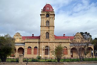
George is the second largest city in the Western Cape province of South Africa. The city is a popular holiday and conference centre, as well as the administrative and commercial hub and the capital city of the Garden Route.
Maidenhead Bridge is a Grade I listed bridge carrying the A4 road over the River Thames between Maidenhead, Berkshire and Taplow, Buckinghamshire, England. It crosses the Thames on the reach above Bray Lock, about half a mile below Boulter's Lock. The Thames Path crosses the river here.
The N12 is a national route in South Africa which runs from George through Beaufort West, Kimberley, Klerksdorp and Johannesburg to eMalahleni.
Napier is a village at the foot of the Soetmuisberg, between Caledon and Bredasdorp. A blend of century-old cottages and modern houses, surrounded by the rolling farmland which typifies the Overberg region of South Africa, give the village a rural atmosphere.
Turnpike trusts were bodies set up by individual acts of Parliament, with powers to collect road tolls for maintaining the principal roads in Britain from the 17th but especially during the 18th and 19th centuries. At the peak, in the 1830s, over 1,000 trusts administered around 30,000 miles (48,000 km) of turnpike road in England and Wales, taking tolls at almost 8,000 toll-gates and side-bars.
The CP Nel Museum is a museum in Oudtshoorn, South Africa, which houses exhibits depicting the role of the ostrich trade in the town's history, as well as the cultural history and lifestyle of the people of the Little Karoo region, as it was during the Victorian era and early 20th century.
John Montagu was a British army officer and civil servant who served as Colonial Secretary of Van Diemen's Land from 1834 to 1842, and Colonial Secretary of the Cape Colony from 1843 to 1853.
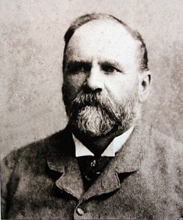
Henry Fancourt White was a British-born South African colonial assistant surveyor who played a part in construction of the Montagu Pass between George and Oudtshoorn, over the Outeniqua Mountains.
The Outeniqua Mountains, named after the Outeniqua Khoikhoi who lived there, is a mountain range that runs a parallel to the southern coast of South Africa, and forms a continuous range with the Langeberg to the west and the Tsitsikamma Mountains to the east. It was known as Serra de Estrella to the Portuguese. The mountains are part of the Garden Route of South Africa.
Sir Lowry's Pass is a mountain pass on the N2 national road in the Western Cape province of South Africa. It crosses the Hottentots-Holland mountain range between Somerset West and the Elgin valley, on the main national road between Cape Town and the Garden Route. A railway line also crosses the mountain range at this point.
Thomas Charles John Bain was a South African road engineer. As a prolific road building pioneer, Bain was responsible for the planning and construction of more than 900 km of roads and mountain passes, many of them still in use today, over a career spanning from 1848 until 1888. These passes through the mountain ranges between the thin coastal plain and the interior of the former Cape Colony in South Africa, played a major role in opening up the vast hinterland of South Africa.
Great Brak River is a coastal village in the Mossel Bay Local Municipality in the Western Cape province of South Africa. It is a historic village built around the lagoon of the Great Brak River, 17 kilometres (11 mi) north-northeast of the town of Mossel Bay.
The South African Railways Class H2 4-8-2T of 1909 was a steam locomotive from the pre-Union era in the Colony of Natal.
The South African Railways Class GEA 4-8-2+2-8-4 of 1946 was an articulated steam locomotive.
Coornhoop is a historic 17th century farmhouse. It is located at 2 Dixton Road in Observatory, Cape Town. Currently, it houses the Centre for Conflict Resolution.
In the 19th century small tollkeeper's cottages were built to house tollkeepers who collected tolls on the roads that lead into the city later known as Toronto, Ontario. Private companies were licensed to maintain the province's roads, and they were allowed to levy tolls from those traveling on the road to pay for that maintenance. Tollkeepers were provided with cottages, so they could work from home.
This page is based on this Wikipedia article Text is available under the CC BY-SA 4.0 license; additional terms may apply. Images, videos and audio are available under their respective licenses.