| Monto Bello | |
|---|---|
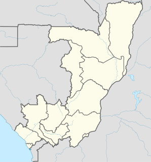
 Monto Bello Location in the Republic of the Congo | |
| Coordinates: 04°08′34″S12°54′49″E / 4.14278°S 12.91361°E | |
| Country | |
| Region | Bouenza Region |
| District | Mfouati District |
Monto Bello is a small town in the south of the Republic of Congo.
| Monto Bello | |
|---|---|
| Monto Bello Location in the Republic of the Congo | |
| Coordinates: 04°08′34″S12°54′49″E / 4.14278°S 12.91361°E | |
| Country | |
| Region | Bouenza Region |
| District | Mfouati District |
Monto Bello is a small town in the south of the Republic of Congo.
Mont Belo is also the railway junction for the branchline to Mbinda.

A branch line is a secondary railway line which branches off a more important through route, usually a main line. A very short branch line may be called a spur line. David Blyth Hanna, the first president of the Canadian National Railway, said that although most branch lines cannot pay for themselves, they are essential to make main lines pay.
Mbinda is a town in the Republic of Congo, lying on the border with Gabon. It is a transport hub and lies at the end of a railway line to Brazzaville.

Dolisie, known as Loubomo between 1975 and 1991, is a city in the western province of Niari in the Republic of the Congo. It is the country's third largest city, and an important commercial centre. The city lies on the eastern edge of the coastal rainforest, and has a population of 83,798.

Tshela is the main town of Bas-fleuve district, in Kongo Central Province in the Democratic Republic of Congo (DRC). The town was linked to the port of Boma, Congo by an isolated narrow gauge railway, the Mayumbe Line. This 610 mm gauge line lasted from 1889–1984.

Kayama Station is a railway station on the Odakyu Electric Railway’s Odakyu Odawara Line in the city of Odawara, Kanagawa Prefecture, Japan. The station is 76.2 rail kilometers from the line's terminal at Shinjuku Station.

Mayoko District is a district in the Niari Department of south-western Republic of the Congo. The capital lies at Mayoko. It has a northern border with Gabon. As of 2007, the population is 5,147.

St. Mary's is a town in the Canadian province of Newfoundland and Labrador. The town had a population of 439 in the Canada 2011 Census.
Acobamba is a district in the middle Sihuas Province in Peru.
The Orangeville Transit System provides local bus service to the Town of Orangeville in central Ontario, Canada. Approval was given by the town council, on April 28, 2008, that the current contract with First Student Canada to operate and maintain the transit buses, should be extended for another year. The Public Works Department administers the contract and is responsible for other non-operational functions. Town of Orangeville transit buses are all fully accessible.

Yiliang County is a county, under the jurisdiction of Kunming, the capital of Yunnan province, China.

The Laoshan Bicycle Moto Cross (BMX) was one of 9 temporary venues used for the 2008 Summer Olympics. It was located in Laoshan, Shijingshan District, Beijing. The venue was used for the men's and women's BMX racing events.

Haput is a village in the Quba Rayon of Azerbaijan.
Makabana is a small town in the south of the Republic of Congo.
Karaba or Karaba Kagoua is a small town and commune in the Cercle of San in the Ségou Region of Mali. In 1998 the commune had a population of 5,282.
Ōwada Station is a train station in Rumoi, Hokkaidō, Japan.

Itaju do Colônia is a municipality in the state of Bahia in the North-East region of Brazil.

Sparbanken Lidköping Arena is an indoor arena in Lidköping, Sweden. It is the home arena for the bandy team, Villa Lidköping BK. The normal capacity of the arena is 4,500 for bandy games and 12,500 for concerts, and the arena was opened on December 25, 2009. The attendance record for a bandy game is 5,400 on December 2, 2016 when Villa Lidköping BK played vs district rivals IFK Vänersborg.
Kaagvere is a village in Kastre Parish, Tartu County in eastern Estonia.

Gornje Žapsko is a village in the municipality of Vranje, Serbia. According to the 2002 census, the village has a population of 109 people.
Strešak is a village in the municipality of Vranje, Serbia. According to the 2002 census, the village has a population of 119 people.

Noordereiland is a neighborhood of Rotterdam, Netherlands.

The Roundhouse in Skierniewice was built in 1845 and used until 1991. Currently the Polish Association of Railway Enthusiasts (PSMK) runs a museum exhibition here.
Coordinates: 04°08′34″S12°54′49″E / 4.14278°S 12.91361°E

A geographic coordinate system is a coordinate system that enables every location on Earth to be specified by a set of numbers, letters or symbols. The coordinates are often chosen such that one of the numbers represents a vertical position and two or three of the numbers represent a horizontal position; alternatively, a geographic position may be expressed in a combined three-dimensional Cartesian vector. A common choice of coordinates is latitude, longitude and elevation. To specify a location on a plane requires a map projection.
| This Republic of the Congo location article is a stub. You can help Wikipedia by expanding it. |