Moors for the Future

Last updated
Example of eroded peat moorland, Bleaklow, Derbyshire Eroded peat moorland, Bleaklow, Derbyshire.JPG
Example of eroded peat moorland, Bleaklow, Derbyshire

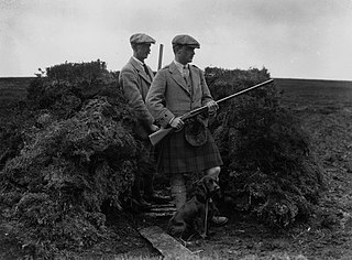
Moors for the Future is a partnership of public and private organisation to protect and promote moorland in the United Kingdom. Based in Edale in the Peak District National Park, much of the work carried out by Moors for the Future is in the National Park. The organisation works to promote the moors to the public for recreational use, as well as to raise important issues (such as ground nesting bird disturbance and moorland fires) that are associated with recreational use of the moors. [1] [2]

Moorland type of habitat found in upland areas with (sometimes marshy) poor acid soil and overgrown with low vegetation

Moorland or moor is a type of habitat found in upland areas in temperate grasslands, savannas, and shrublands and montane grasslands and shrublands biomes, characterised by low-growing vegetation on acidic soils. Moorland nowadays generally means uncultivated hill land, but includes low-lying wetlands. It is closely related to heath although experts disagree on precisely what distinguishes the types of vegetation. Generally, moor refers to highland, high rainfall zones, whereas heath refers to lowland zones which are more likely to be the result of human activity. Moorland habitats mostly occur in tropical Africa, northern and western Europe and neotropical South America. Most of the world's moorlands are very diverse ecosystems. In the extensive moorlands of the tropics biodiversity can be extremely high. Moorland also bears a relationship to tundra, appearing as the tundra and the natural tree zone. The boundary between tundra and moorland constantly shifts with climate change.

United Kingdom Country in Europe

The United Kingdom of Great Britain and Northern Ireland, commonly known as the United Kingdom (UK) or Britain, is a sovereign country located off the north-western coast of the European mainland. The United Kingdom includes the island of Great Britain, the north-eastern part of the island of Ireland, and many smaller islands. Northern Ireland is the only part of the United Kingdom that shares a land border with another sovereign state, the Republic of Ireland. Apart from this land border, the United Kingdom is surrounded by the Atlantic Ocean, with the North Sea to the east, the English Channel to the south and the Celtic Sea to the south-west, giving it the 12th-longest coastline in the world. The Irish Sea separates Great Britain and Ireland. The United Kingdom's 242,500 square kilometres (93,600 sq mi) were home to an estimated 66.0 million inhabitants in 2017.

Edale village and civil parish in High Peak, Derbyshire, England

Edale is a village and civil parish in the Peak District, Derbyshire, England, whose population was 353 at the 2011 Census. Edale, with an area of 7,030 acres (2,840 ha), is in the Borough of High Peak.

Contents

There is a team of researchers who look at the science of moorland restoration and its benefits. For example, peat is a huge store of carbon, so, if the moors degrade, the carbon could be released into the atmosphere. They also look at the effect climate change will have, and how much extra carbon can be locked up by a healthy growing peat bog.

Moors for the Future also work with land owners and others to restore areas of moorland. There are on-going efforts on Kinder Scout, Bleaklow and Black Hill. Funding of the MoorLife project (2010–15) means this will be extended to other areas of the South Pennines.

Kinder Scout Mountain in the United Kingdom

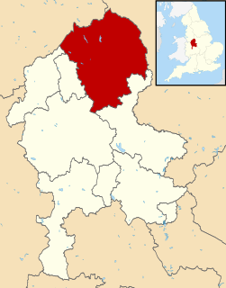
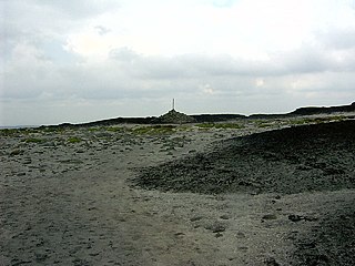
Kinder Scout is a moorland plateau and National Nature Reserve in the Dark Peak of the Derbyshire Peak District in England. Part of the moor, at 636 metres (2,087 ft) above sea level, is the highest point in the Peak District, the highest point in Derbyshire, and the highest point in the East Midlands. In excellent weather conditions the city of Manchester and the Greater Manchester conurbation can be seen, as well as Winter Hill near Bolton, and the mountains of Snowdonia in North Wales.

Bleaklow mountain

Bleaklow is a high, largely peat-covered, gritstone moorland, just north of Kinder Scout, across the Snake Pass (A57), in the Derbyshire High Peak near the town of Glossop. Much of it is nearly 2,000 feet (610 m) above sea level and the shallow bowl of Swains Greave on its eastern side is the source of the River Derwent.

Black Hill (Peak District) mountain in West Yorkshire United Kingdom

Black Hill is a hill in the Peak District, England.

Origins

Moors for the Future was launched in 2002 and is a partnership project. It is funded by the Peak District National Park Authority, the National Trust, Natural England, United Utilities, Severn Trent Water, Yorkshire Water, Environment Agency, Derbyshire County Council and Moorland Owners.

National Trust for Places of Historic Interest or Natural Beauty Conservation organisation in England, Wales and Northern Ireland

The National Trust for Places of Historic Interest or Natural Beauty, commonly known as the National Trust, is an independent charity and membership organisation for environmental and heritage conservation in England, Wales and Northern Ireland.

Natural England is a non-departmental public body in the United Kingdom sponsored by the Department for Environment, Food and Rural Affairs. It is responsible for ensuring that England's natural environment, including its land, flora and fauna, freshwater and marine environments, geology and soils, are protected and improved. It also has a responsibility to help people enjoy, understand and access the natural environment.

United Utilities British water company

United Utilities Group plc (UU), the United Kingdom's largest listed water company, was founded in 1995 as a result of the merger of North West Water and NORWEB. The group manages the regulated water and waste water network in North West England, which includes Cumbria, Cheshire, Greater Manchester, Lancashire and Merseyside, which have a combined population of nearly seven million.

Related Research Articles

The national parks of England and Wales are areas of relatively undeveloped and scenic landscape that are designated under the National Parks and Access to the Countryside Act 1949. Despite their similar name, national parks in England and Wales are quite different from national parks in many other countries, which are usually owned and managed by the government as a protected community resource, and which do not usually include permanent human communities. In England and Wales, designation as a national park may include substantial settlements and human land uses which are often integral parts of the landscape, and land within a national park remains largely in private ownership.

Peak District Upland area in England

The Peak District is an upland area in England at the southern end of the Pennines. It is mostly in northern Derbyshire, but also includes parts of Cheshire, Greater Manchester, Staffordshire, West Yorkshire and South Yorkshire. An area of great diversity, it is mostly split into the Dark Peak, where most of the moorland is found and the geology is gritstone, and the limestone area of the White Peak.

Pennines mountain range

The Pennines, also known as the Pennine Chain or Pennine Hills, are a range of mountains and hills in England separating North West England from Yorkshire and North East England.

The Campaign to Protect Rural England (CPRE) is a pressure group in England with over 40,000 members and supporters. Formed in 1926 by Sir Patrick Abercrombie to limit urban sprawl and ribbon development, the CPRE claims to be one of the longest running environmental groups. CPRE campaigns for a "sustainable future" for the English countryside. They state it is "a vital but undervalued environmental, economic and social asset to the nation." They aim to "highlight threats and promote positive solutions." They campaign using their own research to lobby the public and all levels of government.

Staffordshire Moorlands Non-metropolitan district in England

Staffordshire Moorlands is a local government district in Staffordshire, England. Its council, Staffordshire Moorlands District Council, is based in Leek and is located between the city of Stoke-on-Trent and the Peak District National Park. The 2001 census recorded the population as 94,489.

Dark Peak

The Dark Peak is the higher and wilder part of the Peak District in England, mostly forming the northern Peak District but also extends south into its eastern and western margins. It is mainly in Derbyshire and parts of Staffordshire, Cheshire, Greater Manchester, West Yorkshire and South Yorkshire.

Wetlands International is a global organisation that works to sustain and restore wetlands and their resources for people and biodiversity. It is an independent, not-for-profit, global organisation, supported by government and NGO membership from around the world.

Derwent Edge mountain in United Kingdom

Derwent Edge is a Millstone Grit escarpment that lies above the Upper Derwent Valley in the Peak District National Park in the English county of Derbyshire. An Ordnance Survey column marks the highest point of the Edge at Back Tor. North of Back Tor the edge extends into Howden Edge and enters the county of South Yorkshire.

Saddleworth Moor Moorland in northwest England

Saddleworth Moor is a moorland in North West England. Reaching more than 1,312 feet (400 m) above sea level, it is in the Dark Peak area of the Peak District National Park. It is crossed by the A635 road and the Pennine Way passes to its eastern side.

Energy Saving Trust (EST) is a British organization devoted to promoting energy efficiency, energy conservation, and the sustainable use of energy, thereby reducing carbon dioxide emissions and helping to prevent man-made climate change. It was founded in the United Kingdom as a government-sponsored initiative in 1992, following the global Earth Summit.

South Pennines

The South Pennines is a region of moorland and hill country in northern England lying towards the southern end of the Pennines. In the west it includes the Rossendale Valley and the West Pennine Moors. It is bounded by the Greater Manchester conurbation in the west and the Bowland Fells and Yorkshire Dales to the north. To the east it is fringed by the towns of West Yorkshire whilst to the south it is bounded by the Peak District. The rural South Pennine Moors constitutes both a Site of Special Scientific Interest and Special Area of Conservation.

Driven grouse shooting

Driven grouse shooting is the hunting of the red grouse, a field sport of the United Kingdom. The grouse shooting season extends from 12 August, often called the "Glorious Twelfth", to 10 December each year. Shooting takes place on grouse moors, areas of moorland in northern England and Scotland.

Pico Bonito National Park

Pico Bonito National Park is a national park in Honduras. It was established on January 1,1987 and covers an area of 564.30 km2 (217.88 sq mi). It has an altitude ranging between 60 and 2,480 metres.

Hexhamshire Moors

Hexhamshire Moors is a Site of Special Scientific Interest covering an extensive area of moorland in the Wear Valley district of north-west County Durham and the Tynedale district of south-west Northumberland, England.

Winter flooding of 2013–14 on the Somerset Levels

From December 2013 onwards the Somerset Levels suffered severe flooding as part of the wider 2013-2014 Atlantic winter storms in Europe and subsequent 2013–2014 United Kingdom winter floods. The Somerset Levels, or the Somerset Levels and Moors as they are less commonly but more correctly known, is a coastal plain and wetland area of central Somerset, in South West England, running south from the Mendip Hills to the Blackdown Hills.

Ovenden Moor Wind Farm

Ovenden Moor Wind Farm is a wind powered electricity generating site in England. Ovenden Moor is located north of Halifax and west of Bradford in West Yorkshire. The site was opened in 1993 with 23 turbines, but these were later removed in favour of larger turbines but with 14 fewer towers. This updated the output of the site from 9.2 MWh to 22.5 MWh with an expected generation lifetime of 25 years. As the turbines can be seen from some distance and the fact that they overlook the Brontë Country to the north, they have the subject of continued criticism and objections.

South Pennines Regional Park

The South Pennines Regional Park is a proposed National Park that would cover the South Pennines area in Northern England. The park would cover a large swathe of Northern England and encompass parts of Greater Manchester, Lancashire and West Yorkshire. It would also adjoin the borders of two existing national parks; the Yorkshire Dales in the north and the Peak District in the south. The area was named as a prospective national park in the 1940s when the idea of creating national parks was being carried forward, but it was never given the same status as the Peak District, North York Moors or the Yorkshire Dales.

Crowle Peatland Railway

Crowle Peatland Railway is a fledgling railway museum based on the peat moors at Crowle in North Lincolnshire, England.

References

  1. "Moors for the Future". Moors For The Future Partnership. Retrieved 15 December 2015.
  2. "Peak District gets about £12m to protect moorlands". BBC. Retrieved 15 December 2015.