This article may be expanded with text translated from the corresponding article in German. (June 2010)Click [show] for important translation instructions.
|
| Moritzberg | |
|---|---|
| Highest point | |
| Elevation | 603.5 m (1,980 ft) |
| Coordinates | 49°27′57″N11°18′44″E / 49.46585°N 11.31218°E Coordinates: 49°27′57″N11°18′44″E / 49.46585°N 11.31218°E |
| Geography | |
| Location | Bavaria, Germany |
| Parent range | Franconian Jura |
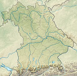
Moritzberg is a mountain of Bavaria, Germany. It is part of the Franconian Jura range.

Bavaria, officially the Free State of Bavaria, is a landlocked federal state of Germany, occupying its southeastern corner. With an area of 70,550.19 square kilometres, Bavaria is the largest German state by land area comprising roughly a fifth of the total land area of Germany. With 13 million inhabitants, it is Germany's second-most-populous state after North Rhine-Westphalia. Bavaria's main cities are Munich and Nuremberg.

Germany, officially the Federal Republic of Germany, is a country in Central and Western Europe, lying between the Baltic and North Seas to the north, and the Alps, Lake Constance and the High Rhine to the south. It borders Denmark to the north, Poland and the Czech Republic to the east, Austria and Switzerland to the south, France to the southwest, and Luxembourg, Belgium and the Netherlands to the west.

The Franconian Jura is an upland in Bavaria, Germany. Located between two rivers, the Danube in the south and the Main in the north, its peaks reach elevations of up to 600 metres (2,000 ft) and it has an area of some 7053.8 km2.
| This Bavaria location article is a stub. You can help Wikipedia by expanding it. |
